Map of Yuma
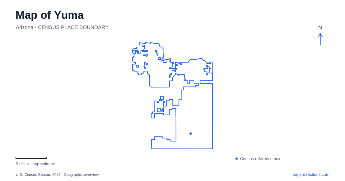
Street tiles load from OpenStreetMap when opened. The blue line shows the 2025 Census boundary.
- State
- Arizona
- Population · July 2025
- 105,227
- Land area
- 121.1 sq mi
- Water area
- 0.1 sq mi
Yuma's historic center is best understood as a place of river crossings. The Colorado River brought boats, railway engineering, military supply operations, and later highway traffic into a relatively small area. Main Street, Madison Avenue, and Gila Street each connect with a different part of that history. Along the water, parks and restored habitat now add another layer. A map that keeps the prison bluff, depot grounds, bridge structures, and wetland areas distinct reveals how the riverfront changed from a transportation and supply center into a public landscape.
Main Street and the vanished railway alignment
The townsite laid out in 1866 gave Main Street a broad right-of-way to accommodate wagon traffic and commercial activity. That width belongs to the practical requirements of an early river town, even though the street's uses changed in later decades.
Madison Avenue records another transportation era. The first railway crossing from California into Arizona in 1877 followed an alignment corresponding to that avenue. At the river, Pivot Point Interpretive Plaza preserves the support for the former swing-span rail bridge. The movable span allowed river traffic to pass, so the surviving pivot represents the meeting of two transportation systems rather than a railway structure alone.
For Yuma, this is a particularly useful piece of map reading: a present-day street points toward the location of an earlier crossing. The railway itself no longer needs to occupy the same alignment for the geography to remain legible. Madison, the river edge, and the pivot together explain why this part of downtown mattered to regional movement.
Two historic sites above the river
The territorial prison occupies a bluff at 220 Prison Hill Road. It opened in 1876 and operated for 33 years before inmates were transferred to Florence. Its elevated position is part of the site's identity, distinct from the lower riverfront recreation areas nearby.
A short distance west, Colorado River State Historic Park preserves part of the former Army quartermaster depot. Established in 1864, the depot stored and distributed supplies for military posts across the Southwest. The state park includes five early buildings within approximately ten acres, offering a different kind of historic setting from the prison's remaining structures.
These two sites give Yuma a concentrated account of territorial administration, but they served separate purposes. The prison held people under sentence; the depot supported an extensive military supply network. Their relationship on the map comes from the strategic river crossing and the high ground beside it, not from their being one institution.
The depot also interprets the river's later role in irrigation. The siphon completed in 1912 carried water beneath the Colorado in a large concrete conduit. This introduces a third use of the crossing landscape: water itself became something engineered to move under the river, rather than merely along it or over it.
Gateway between downtown and the wetlands
Gateway Park occupies the vicinity of First and Gila streets. The river-parks map places it near the Ocean-to-Ocean Bridge and the prison, with the East Wetlands continuing farther along the Colorado. This grouping gives a practical sequence of downtown street, riverside park, bridge, bluff, and restored habitat.
The name Gateway is especially useful on a Yuma map because it identifies a transition. Urban blocks approach the water here, while the riverfront landscape extends outward in both directions. The East Wetlands should be read as a broad habitat and trail area, rather than as another small downtown lawn.
West Wetlands Park lies in the other direction, with access identified at 282 North 12th Avenue. The heritage-area map locates Centennial Beach, the Stewart Vincent Wolfe Playground, garden areas, and other recreation features within this larger western landscape. Those individual landmarks give the park internal structure and help distinguish a playground outing from a walk toward the river.
The river and the park pond are different waters
West Wetlands Pond is a small community-fishing water within the park. Arizona Game and Fish lists it at 1.3 acres and prohibits swimming and wading there. That matters geographically because the pond and the Colorado River can appear within the same park view while serving different purposes and operating under different rules.
The pond is consequently best treated as a named destination of its own. It is not simply an inland extension of Centennial Beach. Park paths, ramadas, playgrounds, and the river edge combine several types of recreation within one address, but the water features retain separate identities.
Reading Yuma through these distinctions produces a coherent riverfront journey: Main Street recalls wagon-era commerce, Madison points to a railway crossing, Prison Hill and the depot explain territorial institutions, and the wetland parks show the modern public landscape. The Colorado remains the common reference, while the named streets and individual sites reveal the different histories along its banks.
Map and statistics: U.S. Census Bureau, 2025 Gazetteer, January 2025 generalized place boundaries and Vintage 2025 population estimates. Local references: City of Yuma; Arizona State Library Arizona Memory Project; Arizona State Parks; Yuma Crossing National Heritage Area; Arizona Game and Fish Department. Article prepared by Maps & Directions.