Map of Yucaipa
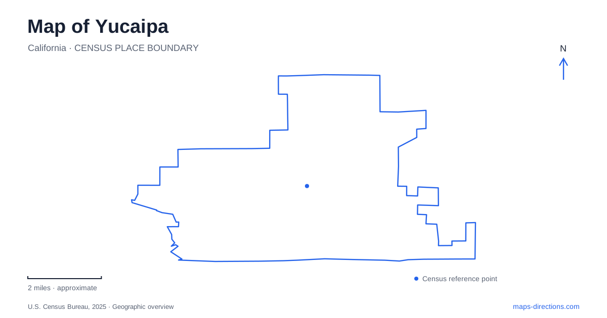
Street tiles load from OpenStreetMap when opened. The blue line shows the 2025 Census boundary.
- State
- California
- Population · July 2025
- 54,953
- Land area
- 28.3 sq mi
- Water area
- 0.0 sq mi
Yucaipa has several landscapes that deserve separate attention on a map: an older commercial center, a ranch-era historic site, developed lakeside recreation, and foothill trails. Uptown supplies the main urban gathering place, while Oak Glen Road leads to important public parks and community facilities. Kentucky Street and Canyon Drive point toward very different encounters with local history and terrain. Understanding these destinations individually makes the city more legible than treating every outing as a trip toward the mountains.
Uptown around California Street
The historic commercial district centers on the intersection of Yucaipa Boulevard and California Street. Its early twentieth-century origins distinguish it from development closer to Interstate 10. The city's specific plan emphasizes neighborhood-serving businesses and preservation of historic resources, explaining why Uptown remains a recognizable district rather than simply another stretch of roadside retail.
The performing arts center at 12062 California Street adds a modern public venue to that setting. Opened in spring 2019, it includes a multipurpose theater with retractable seating. Its position reinforces California Street as a useful reference for performances and community activity. For a first visit, locating the central intersection and then the theater gives the district a clear shape: an established commercial area with a contemporary gathering place integrated into it.
Two public destinations on Oak Glen Road
Oak Glen Road provides access to both county recreation land and municipal community facilities. The regional park is at 33900 Oak Glen Road, while the community center and community park are at 34900. These addresses refer to separate destinations along the same corridor. A family gathering at a county picnic shelter and a city recreation program therefore require different local stops.
The county park in Yucaipa contains three lakes, camping areas, picnic facilities, and a seasonal swim complex. Its map distinguishes Upper, Middle, and Lower lakes, with camping and group-use spaces distributed around them. The swimming lagoon and slides are separate facilities from the fishing lakes. Check the county's swim calendar separately from camping and fishing arrangements, since the facilities serve different activities and seasons. This makes the park a varied recreation landscape rather than a single summer pool destination.
Trails beyond the developed lakes
The regional park map also identifies Wilson Creek Trail and the Zanja Peak trailhead, placing the developed lake facilities within a broader outdoor setting. Those labels help show where a picnic outing differs from a trip directed toward surrounding trails. The map's campground, footbridge, and picnic-area symbols serve the developed park, while trailhead labels point toward a different kind of activity.
Wildwood Canyon is another distinct outdoor destination, reached at 12241 Canyon Drive. California State Parks describes grasslands and mature oak woodland in the foothills, with chaparral extending beyond the moister canyon bottom. Its recreation guide follows the Oak Tree Loop from the parking area into the woodland. This is a useful contrast with the county park: Wildwood's appeal is the trail landscape itself, with fewer developed services and restrooms concentrated near the entrance.
The adobe and a revised history
The historic adobe in Yucaipa is at 32183 Kentucky Street. The county museum explains that the site was occupied by Serrano people before European settlement and that springs supported a wet, vegetated landscape. Later ranching brought new uses to the land, but the story of the surviving house is more complicated than older accounts suggested.
Tradition attributed the building to Diego Sepulveda. Restoration and archaeological work in 1989–90 led to a revised interpretation: the surviving adobe is now believed to have been built by James Waters in 1858–59, while Sepulveda's house stood elsewhere nearby. John Dunlap purchased the ranch in 1869. These distinctions matter when comparing historic descriptions with the current site. Consult the county museum's visitor arrangements for the adobe; its Kentucky Street location establishes a historical reference rather than guaranteeing an interior tour.
Connecting the city and the foothills
A map of Yucaipa reveals several forms of public space. Uptown supports shops and performances; Oak Glen Road links community facilities with a county recreation park; Canyon Drive reaches a state-managed trail landscape; and Kentucky Street preserves the location of a historic ranch house. They share a regional setting without sharing the same purpose or visitor arrangements.
The most informative route through these places follows an interest rather than trying to combine every landmark into one circuit. Architecture and local history connect Uptown with the adobe's story, while an outdoor itinerary might compare the regional park's lakes with Wildwood's oak woodland. Keeping those geographic and historical differences visible produces a clearer understanding of a community shaped by ranching, commercial growth, and its foothill environment.
Map and statistics: U.S. Census Bureau, 2025 Gazetteer, January 2025 generalized place boundaries and Vintage 2025 population estimates. Local references: City of Yucaipa; Yucaipa Performing Arts Center; San Bernardino County Parks; California State Parks; San Bernardino County Museum. Article prepared by Maps & Directions.