Map of Yuba City
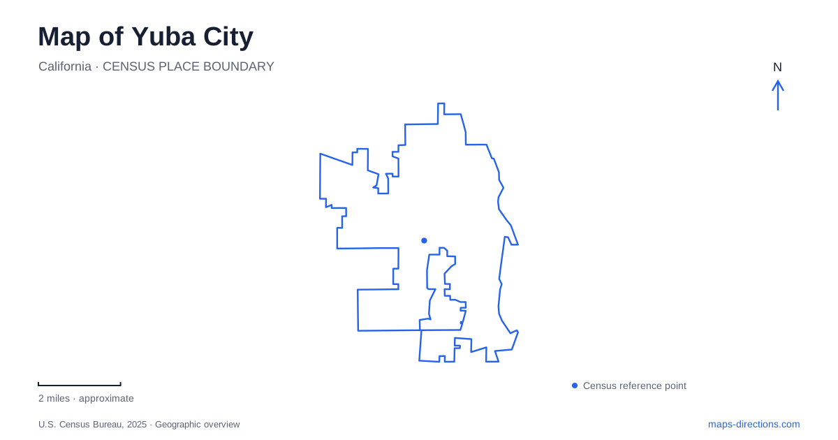
Street tiles load from OpenStreetMap when opened. The blue line shows the 2025 Census boundary.
- State
- California
- Population · July 2025
- 69,485
- Land area
- 16.6 sq mi
- Water area
- 0.1 sq mi
Yuba City faces the Feather River from its western bank, with Marysville across the water. That relationship is the first useful fact for reading the local map: the urban area operates across a river and county boundary, while individual institutions often use the broader Yuba-Sutter identity. Downtown Plumas Street, the Butte House Road museum, and riverfront paths give visitors three distinct ways to explore the community without confusing the two cities.
Plumas Street as a cultural address
Sutter Theater Center for the Arts occupies 754 Plumas Street. The building's preservation record places it at the northwest corner of Plumas and Church streets and dates the motion-picture theater and adjoining commercial storefronts to 1950. Its modern architectural form belongs to the postwar commercial landscape, rather than to a nineteenth-century Gold Rush streetscape. The surrounding storefronts are part of the building's historical context, not merely incidental neighbors.
The current arts operator uses the theater for its public programming and box office. For a cultural outing in Yuba City, Plumas and Church provide a precise and memorable intersection. They also help explain the value of the downtown street as a walking destination: the theater is embedded within a commercial corridor instead of standing in an isolated campus. Looking at the corner location makes the relationship between performance space and everyday street activity easy to see.
One arts organization, two city settings
Yuba Sutter Arts & Culture lists both the Sutter Theater and its 624 E Street address in Marysville. This is a practical example of a regional organization working on both sides of the Feather River. A name shared across the region does not establish which bank an event occupies; the venue and street are the useful pieces of information.
The distinction is more than administrative. A trip based around the Plumas Street theater can remain within the western downtown, while an E Street engagement belongs to the eastern city's street grid. The river crossing becomes part of the second itinerary. Keeping both arts addresses visible on a regional map reveals how cultural activity connects the neighboring communities while preserving their separate centers.
The county museum on Butte House Road
Sutter County Museum at 1333 Butte House Road offers a broader historical account than a single downtown landmark. Its permanent interpretation includes the Nisenan people, John Sutter, agriculture, and the region's different ethnic communities. The museum was presented to the county in 1975 after construction supported by Howard and Norma Harter, the historical society, and other donors. Later additions expanded its capacity through further private support.
The campus also includes Ettl Hall and the William Conkey Memorial Rose Garden behind the museum. These spaces connect collections and exhibitions with community gatherings and an outdoor garden. A map of Yuba City should therefore distinguish this Butte House Road campus from the Plumas Street performance setting. The two destinations complement each other: one presents the area's longer social and agricultural history, while the other demonstrates the continuing reuse of a postwar entertainment building.
Riverfront paths on different banks
Feather River Parkway follows the city's riverside. The Sacramento Area Council of Governments describes both paved and unpaved trails, with picnic tables, gazebos, benches, and interpretive signage. These details matter because the parkway is a varied river landscape rather than a single uniform pavement. A person choosing a walking or cycling outing can consider surface type as well as the line shown on a map.
Across the river, Marysville's Riverfront Trail follows the levee for about 1.6 miles between the Fifth Street Bridge and Simpson Lane overcrossing. That is a separate named trail with a clearly described pair of endpoints. The two riverfront settings can be understood together, but they occupy different sides of the water. Yuba City's riverside landscape and the eastern levee route make the Feather River both a dividing feature and the central subject of local outdoor recreation.
The Buttes require a different access assumption
The Sutter Buttes are another strong regional map feature, but the state park property there is not an ordinary walk-in recreation destination. California State Parks acquired land on the north side in 2003; that acquisition does not establish unrestricted access, and visitors must consult the agency's public-access guidance. A green state-park label therefore cannot be treated as evidence of an available trailhead or unrestricted route.
This is a useful contrast with the documented public paths along the river. One landscape provides established local recreation spaces; the other requires careful distinction between a mapped public holding and actual access. For an outing based in Yuba City, the downtown theater, museum campus, and Feather River paths provide concrete anchors, while the Buttes remain a separate regional landscape whose access conditions must be respected.
Map and statistics: U.S. Census Bureau, 2025 Gazetteer, January 2025 generalized place boundaries and Vintage 2025 population estimates. Local references: Sutter County Museum / California historic resource record; Yuba Sutter Arts and Culture; Sutter County Museum; Sacramento Area Council of Governments; City of Yuba City; California State Parks. Article prepared by Maps & Directions.