Map of Wylie
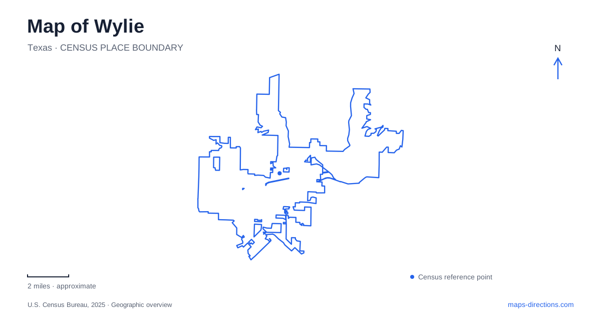
Street tiles load from OpenStreetMap when opened. The blue line shows the 2025 Census boundary.
- State
- Texas
- Population · July 2025
- 63,842
- Land area
- 21.2 sq mi
- Water area
- 9.9 sq mi
Wylie's geography connects a railroad town, a prairie landscape and a major reservoir. Ballard Avenue preserves the scale of an older commercial center, the municipal complex places civic buildings within a much larger area of open land, and Lavon Lake introduces shorelines and recreation properties outside the downtown street pattern. These settings explain why a local map needs more than a single center point. Each reveals a different stage in the community's relationship with land and transportation.
A railroad shifted the original settlement
The Texas Historical Commission records that the earlier settlement of Nickelville moved toward railroad tracks laid about half a mile to its north in 1886. The Gulf, Colorado and Santa Fe Railway brought a new focus for businesses and residents. Incorporation followed in 1887. The important geographic point is that the town's center was influenced by a transport route, rather than simply expanding evenly around its earliest settlement site.
The commission's marker stands at the southwest corner of State Highway 78 and Ballard Avenue. That intersection is therefore a useful reference for reading the older town. Its history connects the modern highway and downtown street to an earlier era when agricultural trade and rail access shaped commercial opportunity.
For Wylie, this is more than an origin story. It explains why historical accounts may locate an early institution south of the later business district. A difference between an old settlement location and today's downtown is not necessarily a mistake in either account; the community's center actually changed.
Ballard Avenue contains layers of commercial history
The local historical society's downtown guide identifies the first depot site at the northeast corner of Highway 78 and Ballard Avenue. It also records that the railroad alignment along the highway changed in 2000. The depot is consequently a historical site reference, not a promise that a visitor will find the original operating station standing there today.
Across Ballard, Olde City Park occupies land associated with earlier civic and industrial uses. The guide's account includes a jail, a machine shop, a blacksmith and an onion shed. These functions help interpret a public space that now looks very different from the working landscape shown on early fire-insurance maps.
The commercial addresses farther along Ballard tell similar stories of changing use. The guide describes 109 North Ballard as a general-store site that later became a cinema, then an automobile business before returning to entertainment use. The street provides continuity even as the purposes of individual properties change. Historical interpretation works best here by following addresses and dates together.
The civic campus opens onto prairie
The municipal complex uses the address 300 Country Club Road. Its design brings together City Hall, the public library and the recreation center within a landscape of meadows and trees. A city-hosted account of the project describes buildings whose forms respond to an onsite creek, with materials chosen to relate to the surrounding terrain.
Wylie's civic landscape deliberately preserves open ground instead of filling every space between buildings with intensive recreation. The project account describes a roughly 22-acre Blackland Prairie restoration area and a partnership with local master naturalists. Native grasses, invasive-plant removal and educational trails were part of that work. The open land is therefore an intentional part of the campus, not merely leftover space awaiting another building.
This creates a useful contrast with Ballard Avenue. The older district can be understood through closely spaced addresses and successive commercial uses. The civic campus asks the map reader to consider a larger property, several public buildings and their relationship with a creek and restored habitat.
Lavon Lake is both infrastructure and recreation
The U.S. Army Corps of Engineers describes Lavon Lake's purposes as water supply, flood control and recreation. Its water serves member cities of the North Texas Municipal Water District, while its flood-control role extends across several counties. A recreational shoreline map shows only one aspect of this much larger regional system.
Visitors from Wylie should distinguish the reservoir itself from the individual parks around it. The Corps identifies the East Fork Park gatehouse at 1901 Skyview Drive. Its park directory describes camping and day-use areas, boat ramps and an adjacent marina. A lake label covers water and shoreline; the park name identifies the particular managed property associated with an outing.
The Corps also documents the Trinity Trail between East Fork Park and Brockdale Park as an equestrian and hiking connection. This creates a land-based relationship between recreation areas that might otherwise appear simply as separate points on the shore. Trail use and a driving itinerary are different ways to read the same lake landscape.
Reading the three settings together
A map of Wylie becomes more useful when Ballard Avenue, the Country Club Road civic campus and Lavon Lake remain distinct. The first explains railroad-era commerce, the second makes prairie conservation part of public life, and the third connects local recreation with regional water management. Together they describe an actual place with several scales and histories, rather than a collection of interchangeable destination markers.
Map and statistics: U.S. Census Bureau, 2025 Gazetteer, January 2025 generalized place boundaries and Vintage 2025 population estimates. Local references: Texas Historical Commission; Wylie Historical Society and Collin County Historical Commission; City of Wylie / Texas Recreation and Park Society; City of Wylie; U.S. Army Corps of Engineers. Article prepared by Maps & Directions.