Map of Winter Springs
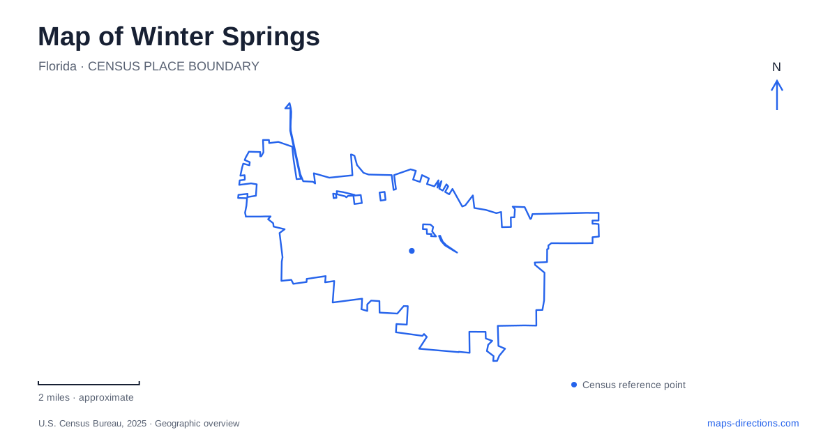
Street tiles load from OpenStreetMap when opened. The blue line shows the 2025 Census boundary.
- State
- Florida
- Population · July 2025
- 39,585
- Land area
- 14.9 sq mi
- Water area
- 0.1 sq mi
Winter Springs has a suburban landscape shaped by several different periods of settlement. The older western neighborhoods, the planned communities farther east, and the town center do not share one continuous historic downtown street pattern. State Road 434 ties important destinations together, while creeks, Lake Jesup's surrounding habitat, and a regional trail introduce routes that follow a different logic. Recognizing those layers helps explain why the city's public places are distributed among several centers.
An older name on the western side
The municipality incorporated as North Orlando in 1959. Its early residential development concentrated around the western section of State Road 434, with modest suburban lots and houses serving people working elsewhere in the region. The city changed its name in 1972, partly to remove the geographic confusion created by the original name.
Winter Springs subsequently grew strongly toward the east, where the planned development now known as Tuscawilla attracted residents. This helps explain the contrast between the original village and later neighborhoods. They were built under different development circumstances rather than laid out as successive blocks around a single courthouse square. On a map, the distinction is visible in the relationship between local streets, larger connecting roads, and separate clusters of community facilities. The earlier name remains useful in historical research, but it describes a stage in the city's development rather than a separate present-day municipality.
The lake landing predates the subdivisions
Local history reaches much farther back than municipal incorporation. Near what became Tuskawilla Landing, George Brantley and Daniel Mitchell established commercial activity associated with a wharf and store. Tuskawilla Road began as a rough wagon route connected with an attempt to build a railroad from Lake Jesup toward Orlando. The early railway effort ended before its grading was completed.
This lake-oriented geography differs from the later commuter suburb. Stores and transportation projects initially looked toward waterborne trade and the movement of agricultural products. The modern road name preserves part of that older relationship even where the surrounding landscape has changed. It is useful to distinguish the road's historical spelling from the Tuscawilla development name encountered on neighborhood maps. Similar names connect the stories, but they should not erase the difference between an early landing, a road corridor, and a much later planned community.
A deliberately planned town center
The town center of Winter Springs emerged from an effort to give the growing suburban city a shared focal point. A collaborative design process in 1998 brought together residents, officials, property owners, and planning professionals. Its objective was to combine living, shopping, civic activity, and public gathering places within a more compact pattern.
That origin matters when interpreting the area. The center represents intentional town planning rather than the survival of a nineteenth-century commercial square. The city's planning documents emphasize buildings that frame streets, public spaces, and a mix of uses. Those principles explain the intended relationship between buildings and gathering areas; they do not establish that every element shown on an early master plan was subsequently constructed. Historical proposals and the present street map should therefore be read as different kinds of evidence.
Regional trailhead or wilderness entrance?
Black Hammock Trailhead is at 1571 East State Road 434 and serves the Cross Seminole Trail. The county identifies restrooms and a water fountain there. Its role is an arrival point for a regional paved trail that connects multiple communities and forms part of the broader Coast-to-Coast Trail effort.
Black Hammock Wilderness Area is a different destination, with its main parking at the end of Howard Avenue. The county describes a 700-acre conservation property containing hardwood swamp, sand pine scrub, and pine flatwoods. The shared name can make these places appear interchangeable in a quick search, but they offer different settings and different entrances. For a visit beginning in Winter Springs, choosing between the regional trailhead and the wilderness property is a substantive decision about the outing, not merely a choice of parking lot.
Large recreation grounds and small creek paths
Central Winds Park, at 1000 Central Winds Drive, combines organized recreation with quieter outdoor space. Baseball and softball fields, soccer areas, courts, playgrounds, picnic pavilions, and a nature trail give it a broader role than a single sports venue. A map of the internal facilities is useful because an event on one field and a walk on the nature trail can begin in different parts of the same park.
Bear Creek Nature Trail offers a smaller-scale counterpoint. It follows the creek and includes two small bridges and picnic tables. Its identity comes from the watercourse rather than a large collection of athletic facilities. Together, these public places show how Winter Springs accommodates both regional movement and neighborhood recreation: a long-distance trail, a major park, and a modest creekside path each serve a distinct purpose within the residential landscape.
Map and statistics: U.S. Census Bureau, 2025 Gazetteer, January 2025 generalized place boundaries and Vintage 2025 population estimates. Local references: City of Winter Springs; Seminole County. Article prepared by Maps & Directions.