Map of Wilson
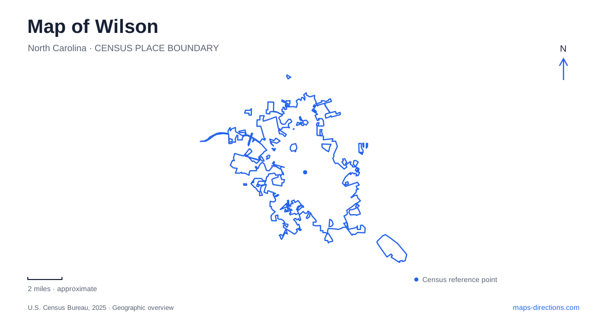
Street tiles load from OpenStreetMap when opened. The blue line shows the 2025 Census boundary.
- State
- North Carolina
- Population · July 2025
- 49,572
- Land area
- 31.8 sq mi
- Water area
- 0.9 sq mi
Wilson grew where a railway settlement and an older road community met. That history remains useful for understanding the downtown street pattern: Barnes Street, Tarboro Street and the railroad explain the original connections, while Nash Street and Goldsboro Street locate several present-day cultural destinations. Beyond those central blocks, reservoirs and neighborhood parks create a different pattern of outings, with recreation areas distributed around the city rather than gathered beside one central waterfront.
Barnes Street and two early settlements
The settlement called Hickory Grove developed around the Tarboro–Smithfield road, now represented locally by Tarboro Street. The early church site was in the area between Barnes and Kenan streets. In 1839, the railroad arrived and established Toisnot station where Barnes Street crosses the line. A road between the depot settlement and Hickory Grove became the connection between two developing communities.
Their incorporation together in 1849 produced Wilson. This sequence gives Barnes Street particular meaning: it was a connecting road before the surrounding blocks became a unified town. Reading the intersection of road and railway as the historic center of movement also explains why transportation and commerce figure so prominently in the downtown landscape. It is a more revealing starting point than treating the streets as an arbitrary grid.
Wind-powered sculpture in the commercial district
Vollis Simpson Whirligig Park occupies 301 South Goldsboro Street. The approximately two-acre site opened in 2017 and contains 30 restored kinetic sculptures. Simpson made his large wind-powered works from salvaged materials, including road signs, bicycle components and scrap metal. Their present urban setting differs substantially from the farm near Lucama where visitors first encountered them.
For Wilson, the relocation brought an established rural art attraction into the downtown street network. The sculptures' movement makes the open space itself part of the experience: this is an outdoor arrangement of objects, rather than a collection confined to a gallery wall. The park can serve as an organizing stop for nearby downtown destinations, but its pedestrian space is not a vehicle loading area. The operator's rules require motorized vehicles to remain outside the park and its sidewalks.
The surrounding tobacco-era building stock supplies another layer. The former Hi Dollar warehouse became Whirligig Station, combining apartments with commercial space. That conversion helps explain the contrast between large former warehouse structures and contemporary cultural activity around the park. The industrial buildings were not erased wholesale when the district acquired new uses.
Two museums along Nash Street
Imagination Station Science & History Museum is at 224 Nash Street SE. Its visitor information places parking behind the building on Douglas Street and identifies a front loading area beside the accessible entrance. Those two street references clarify the building's relationship to its block: the named address and the rear parking approach are on different sides. Confirm the museum's admission and entrance arrangements before planning an interior visit; a parking description alone does not establish gallery access.
Farther along East Nash Street, the Oliver Nestus Freeman Round House Museum occupies number 1202. The museum opened in 2001 and interprets African American history, art and culture. Freeman was a local stonemason, and the building's rounded form is itself part of the subject. Together, these two Nash Street institutions broaden a map of Wilson beyond the outdoor sculptures: science education and community history occupy their own buildings and approaches along the same named corridor.
Corbett Avenue and the reservoir parks
Toisnot Park, at 1500 Corbett Avenue NE, combines water recreation with sports facilities. Its shelters sit on different sides of Corbett Avenue: the city identifies the Rotary shelter with the softball-field side, while the Optimist shelter is near the skate park on the apartment side. That division is useful for a group meeting because the park name alone covers more than one activity area. Fishing, a playground and walking trails add to the field and skate facilities.
Wiggins Mill has another two-part address distinction. The municipal directory lists a viewing area at 3010 US 301 South and the reservoir at 3843 Wiggins Mill Road. These are useful separate references for locating a shoreline stop and the reservoir recreation area. They should not be collapsed into the downtown park circuit simply because they share municipal management.
A city-operated lake north of town adds a longer waterside walk, an 18-hole disc golf course and an accessible kayak launch. Its municipal fact sheet describes a roughly two-mile trail with a bridge and alternative paths beyond it. Taken together, these places show the range of Wilson's outdoor geography: compact public art downtown, a neighborhood reservoir and sports park, and larger water-oriented destinations beyond the central streets.
Map and statistics: U.S. Census Bureau, 2025 Gazetteer, January 2025 generalized place boundaries and Vintage 2025 population estimates. Local references: City of Wilson; Vollis Simpson Whirligig Park and Museum; Imagination Station; Oliver Nestus Freeman Round House Museum. Article prepared by Maps & Directions.