Map of Wilmington
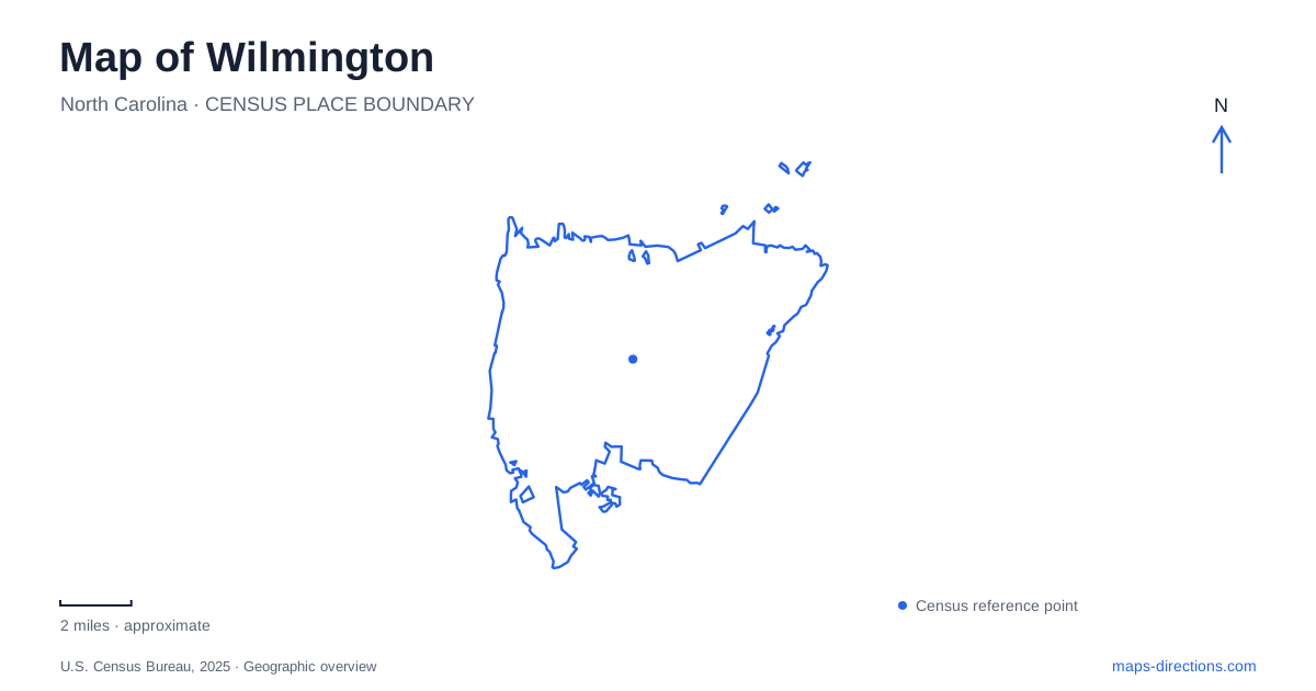
Street tiles load from OpenStreetMap when opened. The blue line shows the 2025 Census boundary.
- State
- North Carolina
- Population · July 2025
- 126,809
- Land area
- 51.4 sq mi
- Water area
- 1.6 sq mi
Wilmington is a river city with routes toward the coast, and that distinction helps explain its layout. The Cape Fear River anchors the historic downtown, while the Intracoastal Waterway forms a different destination for cross-city travel. Between them, parks, neighborhoods, and the university area give the map several useful intermediate reference points. A waterfront visit, a lake circuit, and a bicycle trip toward Wrightsville Beach are different journeys, even though all may appear in the same list of outdoor activities.
The Cape Fear River as downtown's reference
The Riverwalk follows the Cape Fear River beside the downtown district. The city identifies the walkway as approximately 1.75 miles long. Its linear shape makes it useful for understanding the waterfront: destinations along the river can be placed in sequence, rather than treated as unrelated points in the historic street grid. Views toward Battleship North Carolina also show how the river is part of the city's historic setting.
Historic Wilmington extends farther than the walkway itself. The National Register district includes more than 230 blocks, so the waterfront is one edge of a much broader collection of streets and buildings. Bellamy Mansion, the Burgwin-Wright House and Gardens, and Latimer House represent different periods within that landscape. Their presence gives a visitor reasons to move inland from the river instead of expecting the whole historic district to fit onto the waterfront path.
The riverfront also changes character along its length. The tourism authority describes the northern end as an area of modern buildings, hotels, performance facilities, and public waterfront space. This means a river walk can connect older downtown surroundings with a section characterized by larger modern buildings and public spaces. The map is more informative when it shows that change in context, rather than labeling the entire river edge simply “historic downtown.”
Neighborhood names beyond the central waterfront
The tourism office identifies several smaller districts around the central city, including Brooklyn Arts, South Front, Castle Street Arts, and Cargo. These names are useful for organizing searches because they distinguish clusters of activity that would otherwise be grouped together as downtown. South Front, for example, is associated with older buildings and warehouses adapted for restaurants and other businesses.
A map of Wilmington can therefore be read at two scales. At the broad scale, the River District establishes the central urban setting. At the neighborhood scale, a district name helps explain which collection of streets or converted buildings a destination belongs to. This is particularly helpful when comparing a riverside stop with one in a former warehouse setting. Both may be central-city experiences, but their immediate surroundings and relationship to the water differ.
Greenfield Lake and a circuit-shaped outing
Greenfield Park offers another way to organize an outdoor visit. The park covers approximately 250 acres and includes a paved walking and cycling path around Greenfield Lake. The city lists that path at 4.8 miles. Unlike the Riverwalk, whose organizing feature is a stretch of riverfront, this outing is shaped around a lake circuit.
The park includes an outdoor amphitheater, Greenfield Grind Skate Park, playgrounds, and an accessible fishing dock. Those facilities explain why the same park name appears in searches for concerts, recreation, and nature. They are parts of a larger landscape, not interchangeable descriptions of one small site. A map helps separate a destination-specific visit from a plan to follow the lake path.
Greenfield also gives Wilmington an urban wildlife and birding setting. The lake and surrounding vegetation create a different experience from the commercial frontage along the river. Recognizing that difference makes it easier to choose an outing based on the landscape itself: a circuit through parkland, a downtown waterfront walk, or a visit to a particular venue within the park.
Two routes toward the coast
The Gary Shell Cross-City Trail runs from Wade Park through Halyburton Park and Empie Park to the Heide-Trask Drawbridge at the Intracoastal Waterway. The city describes it as a fifteen-mile, off-road multiuse route. Its named parks form useful intermediate anchors. Halyburton Park is on South 17th Street, while Empie Park is on Park Avenue, allowing an outing to be organized around a section rather than the complete route.
The River to Sea Bikeway is a separate route. Municipal transportation information describes it as following the historic streetcar line from downtown toward Wrightsville Beach. The shared coastal direction should not obscure the distinction: the bikeway and the Cross-City Trail have different identities and should be followed using their own route maps. A destination near one does not automatically belong to the other.
These routes show how Wilmington connects its river-oriented center with neighborhoods and coastal approaches farther away. The Cross-City Trail's sequence of parks offers one framework, while the former streetcar corridor offers another. Together with the Riverwalk and Greenfield Lake circuit, they provide four specific geographic patterns for understanding the city: a river edge, a lake loop, a chain of parks, and a historic route toward the sea.
Map and statistics: U.S. Census Bureau, 2025 Gazetteer, January 2025 generalized place boundaries and Vintage 2025 population estimates. Local references: City of Wilmington; Wilmington and Beaches CVB. Article prepared by Maps & Directions.