Map of Whittier
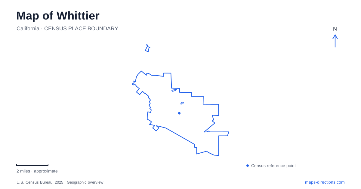
Street tiles load from OpenStreetMap when opened. The blue line shows the 2025 Census boundary.
- State
- California
- Population · July 2025
- 85,815
- Land area
- 14.8 sq mi
- Water area
- 0.0 sq mi
Whittier's local map combines a historic commercial center, a college on its eastern edge, an urban greenway and separate trailheads leading into the Puente Hills. These places form a connected picture of the city without functioning as one continuous visitor area. Greenleaf Avenue, Painter Avenue and Philadelphia Street help orient Uptown, while Pioneer Boulevard and the hillside approaches point toward different outings. The most useful map is one that preserves those changes in setting instead of flattening them into an undifferentiated list of attractions.
Find Uptown through its street intersections
The city's streetscape plan gives particular emphasis to Greenleaf Avenue and Philadelphia Street. Its Greenleaf Promenade project concerns the stretch between Wardman Street and Hadley Street. These named limits make Uptown easier to locate than a district label alone and provide a clear reference for comparing a business address with the broader commercial area.
A Whittier shopping or dining trip should still use the individual establishment's address. Streetscape plans describe the public environment, including pedestrian-oriented changes, but do not establish that a particular curb or block is always available for driving or stopping. Read current signs and the destination's arrival information for the final approach. The useful role of the district map is to explain where the visit fits, not to replace the actual parking or entrance decision.
Painter Avenue marks the college edge
The college describes its campus as lying on Uptown's eastern edge, along Painter Avenue between Philadelphia Street and Earlham Drive. Its physical address is 13406 East Philadelphia Street. The institution also identifies Weingart Hall, Mendenhall and the Ruth B. Shannon Center for the Performing Arts around the Philadelphia and Painter corner. These details help distinguish the general campus from a particular office or performance venue.
For a campus visit, carry the building name through the route-planning process. A main institutional address may lead to the correct campus edge without locating the department or auditorium involved. The college publishes separate campus, parking and accessibility maps, reflecting different arrival needs. A visitor planning a walking route across the grounds may need a more detailed view than the street map used for the initial drive.
The Greenway is an urban corridor
The Whittier Greenway Trail is identified in the city's parks plan as a commuter and recreation path extending between Pioneer Boulevard and Valley View Avenue. It differs from the hillside trails in both setting and role. Its linear form can support a trip between points in the developed area, while a hillside outing may be organized around a trailhead and a return route.
Choose the part of the corridor relevant to the trip before placing a starting pin. A long trail name is not a precise entrance. The municipal trail map labels surrounding roads and interpretive stations, which can help connect the route with recognizable neighborhood references. Use those crossing and access details to define the outing rather than assuming the entire corridor needs to be covered in one visit.
Pío Pico is a separate historical destination
California State Parks places Pío Pico State Historic Park at 6003 Pioneer Boulevard, west of Interstate 605, near the boulevard intersection associated with the city's name. The restored adobe and gardens interpret the life of the former governor of Mexican California. Its location near the Greenway entrance gives a useful relationship between the historical site and a recreation corridor without making them the same attraction.
On a map of Whittier, the freeway is an important reference for this stop. A point on the wrong side of the freeway may look close in a regional view while involving a different local approach. Search for the full historical park name and Pioneer Boulevard address. Then determine whether the intended visit concerns the adobe grounds, a nearby trail access or both, keeping each destination distinct.
Hillside access begins at named trailheads
The Puente Hills Habitat Preservation Authority identifies the Hellman Park entry on Greenleaf Avenue, leading to Peppergrass Trail. The municipal parks plan separately places Arroyo Pescadero's trailhead by Colima Road and describes Turnbull Canyon as another northern trail access. These are different starting places rather than alternate names for one entrance to the hills.
The city street map gets a visitor to the trailhead area; the preserve's trail information explains the route beyond it. A street continuing toward the hills does not establish that its end offers the appropriate parking or permitted access. Check the particular trailhead and intended trail, especially when a saved route comes from an older map. Terrain, permitted use and current access information matter beyond the first gate.
Preserve the change in scale
A useful Whittier itinerary moves deliberately between Uptown blocks, campus buildings, the Greenway corridor and hillside trail networks. Philadelphia and Painter clarify the college approach; Pioneer identifies the historic park; named trailheads clarify the hills. Keep those local anchors attached to each stop. They explain why destinations that appear near one another at city scale can require quite different final routes and map detail.
Map and statistics: U.S. Census Bureau, 2025 Gazetteer, January 2025 generalized place boundaries and Vintage 2025 population estimates. Local references: City of Whittier; Whittier College; California State Parks; Puente Hills Habitat Preservation Authority. Article prepared by Maps & Directions.