Map of Wheaton
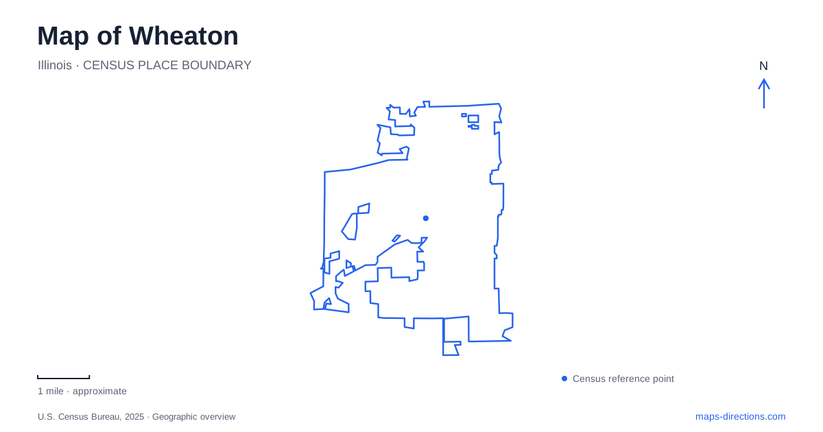
Street tiles load from OpenStreetMap when opened. The blue line shows the 2025 Census boundary.
- State
- Illinois
- Population · July 2025
- 54,065
- Land area
- 11.3 sq mi
- Water area
- 0.2 sq mi
Wheaton is best understood through the relationship between its downtown railway corridor, college campus, and surrounding green spaces. Front Street and Liberty Drive lie on opposite sides of the tracks, while the Illinois Prairie Path brings another form of travel into the central district. Farther out, Lincoln Marsh offers wetland trails and Cantigny combines gardens with historical attractions. These settings are connected by the city map, but each has a different scale: a downtown block, a campus landscape, a natural area, and a large visitor estate.
Two stations establish different starting points
Metra's Union Pacific West Line serves two local stations. The downtown stop is at 402 West Front Street, while College Avenue station is at 303 North President Street. The latter places arrivals near the college rather than in the same block as the downtown platform. On a regional rail map they are consecutive local reference points; on a walking map their separation matters to the choice of arrival.
In downtown Wheaton, the railway is also a useful organizing line. Front Street helps identify the north side, with Liberty Drive serving the improved public spaces south of the tracks. The city's completed streetscape program added a multipurpose canopy, gathering areas, and bicycle facilities along the southern side. Connections with the Prairie Path were part of that design, encouraging people traveling along the trail to enter the shopping and restaurant district.
A library building now interprets county history
The DuPage County Historical Museum stands at 102 East Wesley Street. Its building began as the Adams Memorial Library, erected in 1891 through a gift from John Quincy Adams in memory of his wife, Marilla. It became the county historical museum in 1967 after a larger library was developed elsewhere. The change of use explains why a conspicuous old public building in the downtown area now holds exhibits rather than the ordinary circulating library collection.
Charles Sumner Frost designed the building in the Richardsonian Romanesque style. Its architectural character and regional collections make it a useful historical counterpoint to the railway and newer streetscape. A visitor interested in how the county developed can begin with the exhibits, then return outside to streets that still contain evidence of earlier public investment and commercial life.
The campus landmark predates the college's name
Wheaton College opened in 1860, succeeding the Illinois Institute established on the same site in 1852. Blanchard Hall began construction in 1853 and expanded over decades, with work completed in 1927. The substantial limestone building therefore contains a longer sequence of development than its appearance as a single campus landmark might suggest.
Its stone came from Batavia, and its castle-like forms reflected architectural examples Jonathan Blanchard admired at Oxford. The hall stands at the center of campus, north of the Billy Graham Center. The building is named for Jonathan and Charles Blanchard, the institution's first two presidents. For orientation, its role as the old central building is more useful than trying to interpret the entire campus as one destination beside the railway.
Wetland trails west of the central district
Lincoln Marsh gives Wheaton an outdoor setting organized around habitats rather than streets. Its trail map identifies prairie, woodland, marsh, and grassland, with named routes including the Prairie Loop, Woodland Trail, Oak Knoll Trail, and South Marsh Trail. Limestone surfaces, boardwalks, and woodchip paths appear in the same trail system. That variety creates a landscape where a short outing can pass through several distinct environments.
The main entrance is at Harrison and Pierce avenues; the east entrance is at 1000 West Lincoln Avenue. These approaches reach different sides of the natural area. The operator specifically notes that the eastern entrance has no dedicated parking lot and limits use of nearby church parking to specified days and spaces. The entrance distinction is especially relevant for organized programs, which may identify a particular meeting location within the marsh.
Cantigny expands the historical landscape
Cantigny is a separate destination at 1S151 Winfield Road. Its visitor grounds combine gardens, the McCormick House, and the First Division Museum. Winfield Road provides the approach north from I-88, placing the estate within a wider regional road network rather than within the downtown railway blocks.
A map of Wheaton becomes more informative when these places are read together. Downtown presents a corridor of rail travel, public gathering spaces, and county history; the campus contributes a prominent nineteenth-century educational landmark; Lincoln Marsh foregrounds wetland ecology; and Cantigny adds a larger garden and museum setting. Choosing among them depends on the kind of landscape to explore, not simply on selecting the nearest cluster of attraction labels.
Map and statistics: U.S. Census Bureau, 2025 Gazetteer, January 2025 generalized place boundaries and Vintage 2025 population estimates. Local references: City of Wheaton; DuPage County Historical Museum; Wheaton College; Lincoln Marsh / Park District; Cantigny. Article prepared by Maps & Directions.