Map of Weston
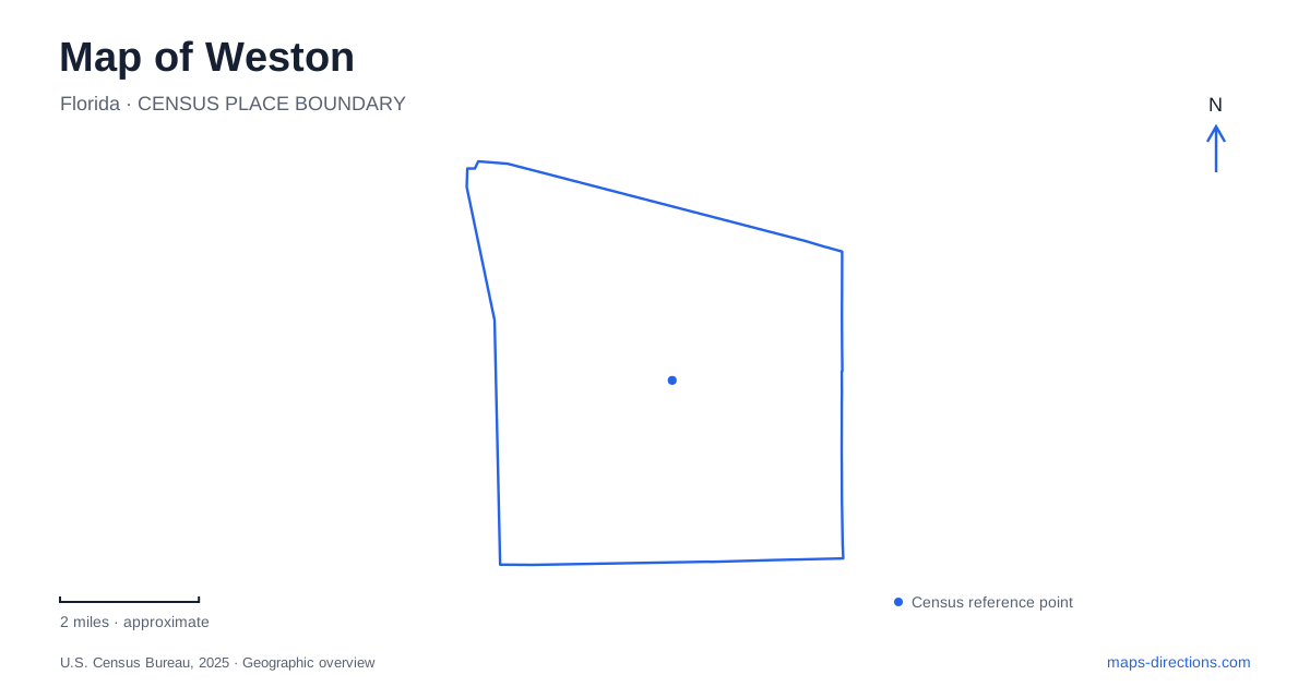
Street tiles load from OpenStreetMap when opened. The blue line shows the 2025 Census boundary.
- State
- Florida
- Population · July 2025
- 69,588
- Land area
- 24.6 sq mi
- Water area
- 1.5 sq mi
Weston presents a planned suburban landscape, but its map contains several layers that predate or complicate that first impression. Bonaventure has a separate development history, Peace Mound preserves evidence of Indigenous occupation, and public parks range from a reading garden to extensive athletic grounds. The street names Indian Trace, Bonaventure Boulevard, Saddle Club Road, and Three Village Road become more meaningful when connected to those different settings.
How two districts became one municipality
Residents of the Indian Trace Community Development District voted for incorporation in September 1996. Bonaventure residents then voted in April 1997 to join the new municipality rather than neighboring Sunrise. The municipal boundary consequently brought together communities that had not begun as one development district. The distinction survives in the separate Indian Trace and Bonaventure dependent districts that manage designated infrastructure responsibilities.
The city's historical account also records later boundary changes: conservation land west of US 27 to the L-37 levee was annexed in 1999, followed by the Interstate 75 and State Road 84 corridor in 2004. These details explain why the municipal outline includes more than residential subdivisions. Conservation ground and transportation corridors belong to the boundary story too. A map of Weston therefore benefits from displaying jurisdictional lines alongside neighborhood names, especially near its northern and western edges.
Peace Mound and the older landscape
Peace Mound Park, at 1300 Three Village Road, places archaeology within a neighborhood waterfront setting. The city identifies the site with a Tequesta burial mound and incorporates interpretation into the park's walkways. This history is not simply a decorative theme chosen for a modern recreation area; it is the reason the place has particular historical significance.
The park also contains a fishing dock, shaded playground, seating shelters, and lighted paths. Those ordinary neighborhood functions coexist with the archaeological story. A visitor can read the interpretive markers as part of a short walk rather than expecting a separate museum building. The combination makes Peace Mound useful for understanding how contemporary public space can preserve an older landscape while serving the surrounding community. The Three Village Road address is the clearest geographic anchor for that experience.
A park designed around reading
Library Park takes a different approach to interpretation. It stands beside the branch library at 4255 Bonaventure Boulevard, where the landscape designer deliberately connected the library to a circular fountain and a ring of Florida authors. Twenty bronze plaques highlight writers and playwrights associated with the state. The park thus extends a cultural institution into an outdoor setting, using paths and seating as part of the reading experience.
A separate sequence of ten bronze plaques follows a historical walk through the grounds, reaching back to Indigenous history. Gazebos and terraced seating provide spaces for groups as well as individual readers. Weston can appear primarily residential on a small-scale road map, but this library landscape supplies a more specific civic destination: a place where local history and statewide literary connections are embedded in an everyday public garden.
Athletic grounds in Weston have their own geography
The current municipal park guide identifies the regional park at 20200 Saddle Club Road as a 102-acre property. By comparison, Tequesta Trace Park at 600 Indian Trace occupies 42 acres, and Vista Park at 18800 Vista Park Boulevard covers 30 acres. Those sizes reveal a hierarchy of recreation spaces rather than a uniform series of neighborhood lawns. A field event at one of these complexes is a different kind of destination from a quiet stop at Library Park.
Indian Trace Park is smaller still: its current facility listing gives 17998 Saddle Club Road and places it beside the elementary school. The park combines a playground with basketball, ball-field space, fitness equipment, and a bicycle repair station. The school connection helps explain its neighborhood role. On a map, the repeated Indian Trace name refers to a district, a road, and different facilities; the school-adjacent park and the larger sports complex can be distinguished by their addresses and scale.
The nearby county park belongs to Sunrise
Markham Park and Target Range is a regional neighbor at 16001 West State Road 84 in Sunrise. Broward County describes a setting at the Everglades edge that combines a campground, boat ramps, mountain-bike trails, a dog park, and Fox Observatory. It belongs in a wider recreation map of the area, but its county administration and Sunrise address distinguish it from the municipal parks described above.
That regional context is useful without folding every nearby destination into Weston. The city map has its own sequence of archaeological, literary, and athletic spaces, while the adjoining county park offers a separate collection of activities. Together with the two development districts and later boundary additions, these places explain the local landscape more clearly than a single label for a planned community.
Map and statistics: U.S. Census Bureau, 2025 Gazetteer, January 2025 generalized place boundaries and Vintage 2025 population estimates. Local references: City of Weston; Calvin Giordano and Associates, park designer; Broward County. Article prepared by Maps & Directions.