Map of West Sacramento
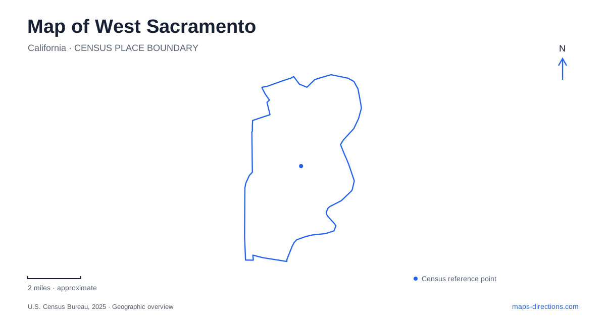
Street tiles load from OpenStreetMap when opened. The blue line shows the 2025 Census boundary.
- State
- California
- Population · July 2025
- 56,216
- Land area
- 21.5 sq mi
- Water area
- 1.3 sq mi
West Sacramento is shaped by two kinds of waterfront: the Sacramento River beside its urban districts and the engineered waterways serving its port. Tower Bridge, the I Street Bridge, and the Barge Canal each organize a different part of the map. Riverfront paths follow levees, while named streets lead inland to neighborhoods, public buildings, and industrial property. Understanding those relationships makes it easier to choose between a downtown-facing river walk, a baseball outing, and a quieter exploration of the canal landscape.
Between the river bridges
River Walk Park occupies the shore between Tower Bridge and the I Street Bridge, with its listed address at 651 Second Street. Its promenade, plazas, and grand staircase make this a structured public waterfront rather than an undeveloped riverbank. The two bridges give the park clear geographic bounds, while Second Street provides an inland reference for approaching the area.
The Washington District lies beside this stretch of river. City planning documents describe its northern limit at A Street and its western edge along portions of Sixth and Eighth streets. The district's southern boundary is the roadway older documents call Tower Bridge Gateway. Current city parking information uses Cabaldon Parkway and explicitly identifies the former name. Recognizing both labels helps reconcile older neighborhood plans with newer street references.
West Sacramento extended its northern river walk along the levee from the existing I Street Bridge to Broderick Boat Ramp. The completed project also improved connections along D Street and Second Street toward Third Street, including a crossing between D and E streets. These inland connections matter because the waterfront path is part of a neighborhood network, not simply a strip isolated beside the water. The project includes a high-water route through local streets, reflecting the practical influence of river levels on this landscape.
The ballpark and the Bridge District
South of the Tower Bridge area, the Bridge District adds another riverfront setting. Sutter Health Park's address is 400 Ballpark Drive, a useful anchor for an event-centered trip. The venue identifies both the River Cats and Athletics among its baseball uses. On a game day, the destination is the ballpark and its designated access arrangements; on another outing, the broader district's streets and river edge may be the main attraction.
The city applies special event parking rules in paid areas around the venue. Individual lots also have their own restrictions, so a general downtown parking symbol is not enough to establish whether a lot permits baseball parking. This is a local consequence of several activities sharing a relatively compact district, with residents, businesses, event visitors, and waterfront users arriving for different purposes.
The riverfront here also illustrates the connection between recreation and flood protection. A completed levee maintenance road project opened a paved recreational route into the district. The path's position along the levee is therefore functional as well as scenic: the same raised corridor supports inspection, maintenance, and public access.
Following the Barge Canal
The Barge Canal gives West Sacramento a separate outdoor corridor east of the port. The city's recreation access lies between Jefferson Boulevard and the Palmedessi Bridge on Lake Washington Boulevard. Its entrance is at Jefferson Boulevard and South River Road. These street relationships distinguish the canal outing from a return to the river walk near Tower Bridge.
A three-quarter-mile bicycle and pedestrian trail on the canal's south side was completed in 2020. Seating areas incorporate replicas of historic artifacts associated with the port's heritage. This creates an opportunity to read the waterway as infrastructure with a working history, rather than as a lake formed only for recreation. The canal's straight, engineered character and its relationship to the port are central to its identity.
Stone Lock and the larger shipping landscape
Stone Lock was constructed in 1961 to connect the Deep Water Ship Channel with the adjacent river. Over time, sediment, mechanical problems, and increasing vessel size reduced its usefulness. The Army Corps of Engineers deauthorized it in 2000. The visible water connection should consequently not be interpreted as an operating shortcut for boat travel.
The Port of West Sacramento has access to Suisun Bay through the Deep Water Ship Channel and has long served agricultural, natural resource, and construction industries. That regional role explains why substantial industrial waterways appear alongside neighborhood recreation on the city map. Stone Lock's flood-protection planning forms a separate layer: engineering proposals explain how the waterway may be managed, rather than identifying recreational access or a completed visitor facility.
A map of West Sacramento thus records both public riverfront renewal and a continuing working-water landscape. Following the bridges, neighborhood streets, levees, canal, and port in that order reveals how those functions occupy adjoining ground without reducing them to one undifferentiated waterfront.
Map and statistics: U.S. Census Bureau, 2025 Gazetteer, January 2025 generalized place boundaries and Vintage 2025 population estimates. Local references: City of West Sacramento; Sutter Health Park. Article prepared by Maps & Directions.