Map of West Jordan
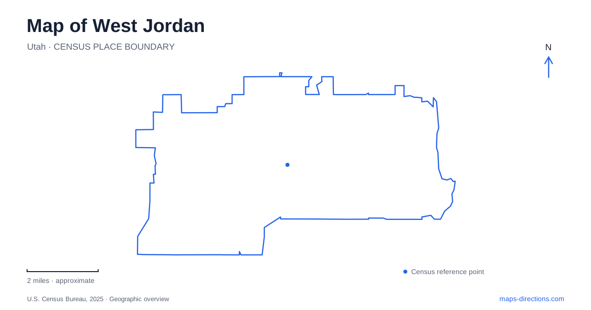
Street tiles load from OpenStreetMap when opened. The blue line shows the 2025 Census boundary.
- State
- Utah
- Population · July 2025
- 116,812
- Land area
- 32.6 sq mi
- Water area
- 0.0 sq mi
West Jordan grew from land west of the Jordan River where farming, grazing, and water-powered industry shaped settlement. Those origins remain visible around Gardner Village, but the modern map extends across a much larger network of numbered roads, parks, and rail stations. The most useful starting point is 7800 South: historic buildings, a station, and a major public park give that corridor several recognizable anchors. From there, the station addresses and the city's two Bingham highway names help organize journeys farther west.
A mill, a meeting house, and a modern village
Gardner Mill stands at 1050 West 7800 South. The flour mill was built in 1877 by Archibald Gardner and became part of the area's agricultural and industrial infrastructure. The Jordan River Commission describes a later transformation beginning in 1980, when Nancy Long purchased the property, restored the mill, and brought historic buildings from elsewhere in Utah to the site. The resulting village combines a building rooted in this location with structures preserved through relocation.
That distinction makes Gardner Village particularly interesting to read on foot. Its present arrangement is a preservation project as well as a surviving mill property. Shops and restaurants occupy historic buildings, creating a commercial setting whose visual character reflects more than one original place. The village provides a concentrated introduction to local heritage, while the surrounding road and river corridor supplies the larger geographical context.
Nearby, Pioneer Hall is listed at 1137 West 7800 South. The city's general plan identifies it as the former ward meeting house, also known as the Old Rock Church, and records municipal ownership. These two addresses place important historic buildings along the same east-west road. For a West Jordan history outing, that proximity is more useful than treating the mill and the meeting house as unrelated names scattered across the valley.
The numbered grid and the rail corridor
Historic Gardner station is at 1127 West 7800 South. The station name therefore corresponds to a specific historic cluster, while the numbers locate it on the wider valley grid. Farther west, the City Center station is at 8021 South Redwood Road. The two stations offer different reference points: one is associated with the mill area, and the other with the Redwood Road corridor.
UTA also lists the 2700 West Sugar Factory Road station at 8351 South 2700 West and Jordan Valley station at 3400 West 8600 South. Those addresses show a westward progression accompanied by a shift south. Stations at 4800 West and 5600 West use Old Bingham Highway addresses. Taken together, these named stops help explain why a rail trip through the city does not simply trace one straight east-west numbered street.
When reading a West Jordan map, retain both parts of each numbered address. The south coordinate and west coordinate work together, while a named road such as Redwood or Old Bingham adds another layer. This is especially useful when comparing an attraction near 7800 South with a station farther south and west. A familiar city name alone would hide the actual shape of that journey.
West Jordan parks spread beyond the historic cluster
Veterans Memorial Park is at 1985 West 7800 South, placing it farther west along the same corridor as Gardner Village. The city lists pavilions and baseball fields among its reservable facilities. The park adds a substantial recreation destination to a road already associated with historic buildings and transit, making the corridor useful for more than a single-purpose visit.
Ron Wood Park, by contrast, uses 5900 New Bingham Highway as its address. Its baseball facilities belong to the city's western recreation landscape. The word New matters here because the western TRAX stations use Old Bingham Highway. Keeping the full road names preserves a real distinction between places rather than shortening both to an ambiguous Bingham destination.
Water conservation brings the landscape story forward
Conservation Garden Park stands at 8275 South 1300 West. Its waterwise landscaping demonstrations connect present-day gardening with a longstanding regional concern: how to use limited water effectively. The city's historical account describes early settlers relying on Bingham Creek and seasonal streams, followed by expanding activity around the Gardner millrace. The demonstration garden addresses water from a different perspective, through plants and landscape choices rather than industrial power.
A West Jordan itinerary built around these places can follow a clear theme. Begin with the mill and the historic road corridor, add the public park or a rail journey west, and include the garden for a contemporary view of water use. The resulting route connects surviving buildings, transportation geography, and practical landscape education without assuming that all parts of the city developed around one compact downtown.
Map and statistics: U.S. Census Bureau, 2025 Gazetteer, January 2025 generalized place boundaries and Vintage 2025 population estimates. Local references: Jordan River Commission; City of West Jordan; Utah Transit Authority; Conservation Garden Park. Article prepared by Maps & Directions.