Map of West Des Moines
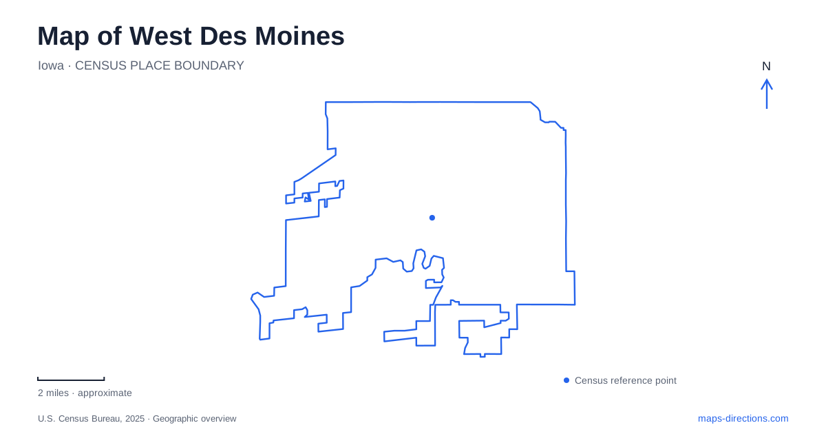
Street tiles load from OpenStreetMap when opened. The blue line shows the 2025 Census boundary.
- State
- Iowa
- Population · July 2025
- 74,224
- Land area
- 47.5 sq mi
- Water area
- 1.0 sq mi
West Des Moines, Iowa, contains an older railroad-town center, a modern civic campus, and a substantial river-and-lake recreation landscape. These places explain different stages of its development and occupy distinct settings on the map. Fifth Street in Valley Junction supplies a historic commercial reference point, Grand Avenue leads to major recreation facilities, and Mills Civic Parkway identifies a cluster of municipal and community buildings. Understanding those three anchors makes the city more legible than treating it simply as the western side of the metropolitan area.
Valley Junction's railroad geography
The community began as Valley Junction, incorporated in 1893 around the meeting of railroad routes. The name described a real transport function: lines continuing from Des Moines divided toward different destinations. The older town's later transformation did not erase that identity. The municipal name became West Des Moines in 1938, while Valley Junction remained attached to the historic district.
Today the city identifies Fifth Street as the district's central location. The Valley Junction Activity Center at 217 Fifth Street adds a community facility within those older blocks. This makes the district more than a historical name on a broad regional map. Its concentrated street pattern can be read as the surviving center of a once separate railroad settlement, with present-day activity layered onto that inherited form.
Grand Avenue and Blue Heron Lake
Raccoon River Park is reached at 2500 Grand Avenue. Within its roughly 631 acres, Blue Heron Lake occupies about 232 acres, giving the park a large open-water center. Sports fields, a playground, picnic shelters, boating facilities, and trails occupy different parts of the surrounding land. The name refers to the river landscape, but many everyday visits focus on the lake itself.
For outdoor recreation in West Des Moines, that river-versus-lake distinction is useful. A route to the boathouse leads to lake activities, while a trail toward the bridge leads into the wider river corridor. The park lists a 3.2-mile lake loop, creating an outing with a clear circuit rather than an open-ended path. Softball and soccer complexes offer a third kind of destination, with organized sports drawing visitors who may never approach the water.
The Nature Lodge occupies the northwest shore of Blue Heron Lake. Its rooms and patio support events and education, so it has a different role from the boathouse even though both share the park's Grand Avenue address. Locating the lake shoreline and the named facility together gives a more precise understanding of where an event or activity takes place.
Crossing toward Walnut Woods
The Athene pedestrian bridge spans the Raccoon River between the municipal park and Walnut Woods State Park. An observation deck near the middle provides a place to look along the water, making the crossing part of the recreation experience as well as a connection. On the state-park side, a paved trail leads to a trailhead off Southwest 52nd Avenue.
Walnut Woods preserves wooded bottomland with a substantial stand of black walnut trees. Its natural-surface paths and 1930s-era lodge create a different setting from the sports complexes across the river. The distinction is visible in the map's textures: open playing fields and lake recreation on one side, woodland trails on the other. Because the low ground is closely tied to river levels, wet or flooded paths can temporarily change the usable walking network.
A community campus on Mills Civic Parkway
The Jamie Hurd Amphitheater stands at 4100 Mills Civic Parkway on the city and school campus. City Hall, the library, and the school district's Learning Resource Center surround the nearby pond. This concentration of institutions forms another center of community life in West Des Moines, separate from Valley Junction's older commercial blocks.
The amphitheater uses lawn seating rather than fixed rows of seats. For performances, the city identifies parking at City Hall, the library, and the Learning Resource Center, with accessible spaces on the east side of the City Hall lot. These details show how the venue operates as part of a shared campus: the stage is one destination, while supporting arrival space is distributed among neighboring public facilities.
Reading the different centers together
Grand Avenue also serves the MidAmerican Energy Company RecPlex at 6500 Grand Avenue. Its address places another recreation destination on the same named road as Raccoon River Park, but well apart from the lake's 2500 address. The difference in numbers is meaningful when a sports event is described only as being along Grand Avenue.
A map of West Des Moines is most informative when it preserves these distinct centers. Valley Junction expresses the railroad-town origins, the civic campus gathers modern public institutions and performances, and the Raccoon River landscape connects developed parks with wooded habitat. The named streets and water features provide a practical framework for moving between them while keeping each place's particular character in view.
Map and statistics: U.S. Census Bureau, 2025 Gazetteer, January 2025 generalized place boundaries and Vintage 2025 population estimates. Local references: Historic Valley Junction Foundation; City of West Des Moines; Iowa Department of Natural Resources. Article prepared by Maps & Directions.