Map of West Covina
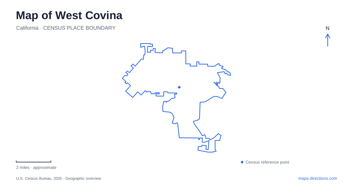
Street tiles load from OpenStreetMap when opened. The blue line shows the 2025 Census boundary.
- State
- California
- Population · July 2025
- 105,301
- Land area
- 16.0 sq mi
- Water area
- 0.0 sq mi
West Covina has a street pattern and public landscape that make more sense when its agricultural origins are kept in view. Early roads, diagonal routes, and later civic buildings did not develop around one traditional Main Street. The city's history instead describes walnut-growing land that gradually became an urban community. Today, the useful landmarks range from the civic complex on Garvey Avenue to a relocated farmhouse and hillside parks. Together they explain both the older valley-floor settlement and the different terrain found among the residential neighborhoods.
Why the roads do not tell a simple downtown story
The city's historical account identifies Service, Orange, Cameron, Vine, and Merced among roads laid out in 1908. It also explains several diagonal routes as direct horse-and-buggy connections from Glendora and Covina toward La Puente and the railroad. Those angles are traces of travel between established neighboring places, rather than mistakes in an otherwise rectangular grid.
Walnuts played a particularly important role in the western part of the settlement. More plentiful groundwater supported that crop, while nearby communities had stronger associations with citrus. Incorporation in 1923 followed growers' opposition to a proposed sewage-disposal site that they feared would affect their water supply.
That history gives West Covina a different starting point from a town built around a railway depot and shopping street. The municipality emerged partly to control land use and protect agriculture. Its road names and irregular alignments preserve relationships that predate the later residential and commercial city. The civic center should therefore be read as a later concentration of public institutions, not assumed to be the original nucleus of every surrounding street.
A civic complex with several institutions
City Hall uses 1444 West Garvey Avenue South. The city's civic-center directory identifies the county library, police department, and Los Angeles Superior Court as separate components of the same broader complex. This grouping provides a strong orientation point because several public functions are gathered in one area.
The library was founded in 1915 and has occupied the civic center since 1961. Its institutional history bridges the agricultural settlement and the growing postwar city. A library visit thus belongs to a public-service landscape that developed over time, alongside government and court facilities.
On a map of West Covina, the civic complex works best as a group of buildings rather than a single municipal symbol. Garvey Avenue South supplies the City Hall address, while the internal directory explains the neighboring institutions. This is a different urban arrangement from a courthouse standing alone on a historic town square, and it reflects the city's particular development pattern.
A farmhouse moved into a heritage landscape
Taylor House stands at Heritage Park, 3510 Cameron Avenue. The Craftsman farmhouse originally occupied land near Workman and Orange avenues. The city received the house in 1992 and moved it to its present setting, so its current location tells a preservation story as well as an agricultural one.
The parkland followed a separate path. It was used for boarding horses, then acquired by a school district for a proposed middle school. When those plans changed, the city bought the site in 1976. The house and the park therefore arrived at their shared identity through different histories.
This is a useful distinction when exploring West Covina's surviving older places. A historic building can retain its architectural significance without standing on its original parcel. Here, Cameron Avenue leads to the preserved house and landscaped grounds, while Workman and Orange belong to the account of its earlier farming setting. The relocation brought those stories together in a public place without making their geography identical.
Woodland slopes and neighborhood recreation
Galster Wilderness Park's nature center uses 1620 South Aroma Drive. The general plan describes hilly ground with native sage scrub and stands of black walnut and oak. That vegetation gives the park a different character from the maintained grass and sports fields found at several community parks.
Shadow Oak Community Center, at 2121 East Shadow Oak Drive, occupies a hilltop overlooking the San Gabriel Valley. The park includes sports and play facilities, while its later extension added walking and picnic space. The Woodside Village paseos form another layer of local open space, linking toward Shadow Oak and Gingrich parks through linear pedestrian corridors.
Cortez Park Community & Senior Center, at 2501 East Cortez Street, adds a different kind of destination, combining recreation with programs and services for older adults. These places show why West Covina's green areas should retain their individual names on a useful map. Galster emphasizes habitat and slopes, Shadow Oak combines an elevated setting with community recreation, and Cortez provides a neighborhood service hub. Their addresses reveal a distributed public landscape rather than one central park serving every purpose.
Map and statistics: U.S. Census Bureau, 2025 Gazetteer, January 2025 generalized place boundaries and Vintage 2025 population estimates. Local references: City of West Covina; Los Angeles County Library. Article prepared by Maps & Directions.