Map of Weatherford
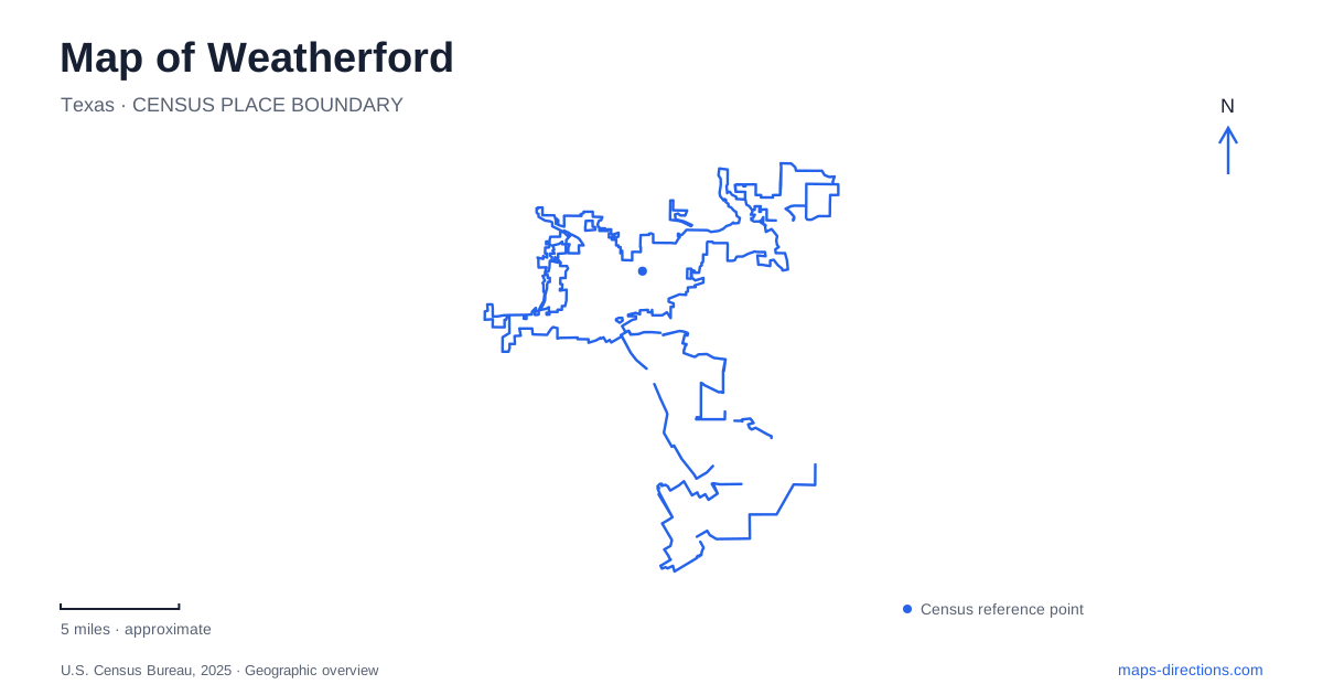
Street tiles load from OpenStreetMap when opened. The blue line shows the 2025 Census boundary.
- State
- Texas
- Population · July 2025
- 40,634
- Land area
- 29.4 sq mi
- Water area
- 1.8 sq mi
Weatherford combines a courthouse-centered historic town with several very different outdoor landscapes. Chandor Gardens turns a former rocky pasture into carefully composed garden rooms. Town Creek provides a wooded route through developed neighborhoods, while a floating boardwalk links two roads at the larger lake. Reading these destinations in relation to their streets and landforms reveals more than a simple list of attractions: it shows how civic life, designed landscapes, and water corridors shape the community.
The courthouse as a historic anchor
The Parker County Courthouse dates to 1886 and was designed by W. C. Dodson. Its restoration took place in stages, with exterior work in the early 1990s followed by a major interior restoration in 2002. The latter recovered the original arrangement and finishes after earlier modifications had changed the building substantially.
The district courtroom was returned to its original size, with decorative painting, small wooden balconies, and patterned floor coverings restored or recreated. These details make the courthouse an architectural record as well as a government landmark. The surrounding square, however, has been altered by highways and parking, according to the county's account.
That contrast matters on a historic map of Weatherford. The courthouse remains a strong central reference, but today's paved setting is not a complete survival of the nineteenth-century square. The building and its surroundings have undergone different kinds of change, so an old photograph may show a familiar landmark within a noticeably different public space.
Chandor's constructed garden landscape
Chandor Gardens occupies 711 West Lee Avenue, with its entrance gate off Lee Street. The estate began as White Shadows, the home and garden created by portrait artist Douglas Chandor and his wife, Ina. Work began in 1936 on difficult, rocky ground that had been used as pasture.
Imported topsoil, boulders, walls, and planting transformed the site into connected garden rooms. Chinese and English design influences appear in the paths, fountains, grottoes, and artificial waterfall. The result is a deliberately composed landscape: turns and enclosed spaces reveal successive views instead of presenting everything from a single open lawn.
The Bradfords purchased and restored the neglected property in 1994 before the city acquired it in 2002. This sequence is important because the garden's survival depended on both private restoration and later public ownership. Its place in Weatherford's historic district combines the story of an artist's home with the preservation of a living landscape.
A nearby trail with a different character
The half-mile Chandor Nature Trail offers a useful comparison with the cultivated gardens. The city identifies two ecological settings along it. The upper portion includes a caliche-clay escarpment, sedimentary fossils, and sandy prairie vegetation; the lower portion has woodland, loamier soil, and a seasonal riparian zone.
These changes occur within a short walk, illustrating the Western Cross Timbers mixture of oak woodland and prairie. The trail is therefore more than an extra garden path. It introduces the ground conditions and vegetation patterns that the formal estate transformed through landscaping. Viewing the two together makes the difference between designed garden rooms and a local natural corridor especially clear.
Town Creek and Holland Lake
Town Creek Hike and Bike Trail opened in 2011 and follows the creek's tree line through the city. Listed access points include the bridge at 801 Santa Fe Drive, the chamber site at 401 Fort Worth Highway, Holland Lake Park at 1419 Holland Lake Road, and the elementary-school trailhead at 100 Ikard Lane.
These multiple starting points make the trail a connector within Weatherford, not simply a loop around one park. Holland Lake Park provides one of its major recreation settings, with nature and concrete paths, a pavilion, and a softball complex opened in 2009. A visit can therefore focus on park facilities or use the park as the beginning of a longer creek-side outing.
The municipal trail map distinguishes several named sections and supplies distances between trailheads. This is useful because the full corridor and a route between two access points are different measurements. The creek provides continuity, while the street addresses determine which portion of that continuity a visitor actually uses.
Two shores of the floating boardwalk
The boardwalk at Lake Weatherford is a separate destination from Holland Lake Park. Its 4,313-foot floating route connects East Lake Drive with West Lake Drive. The city lists trailheads at 2864 East Lake Drive and 1198 West Lake Drive, while the pavilion has its own address at 2801 East Lake Drive.
Those three addresses describe two ends of a crossing and an associated facility, rather than one interchangeable arrival point. Benches and opportunities to observe birds and the water make the boardwalk an outing in itself. Together with the courthouse, garden rooms, and Town Creek, it demonstrates the range of landscapes contained within the local map.
Map and statistics: U.S. Census Bureau, 2025 Gazetteer, January 2025 generalized place boundaries and Vintage 2025 population estimates. Local references: Parker County; City of Weatherford; City of Weatherford tourism. Article prepared by Maps & Directions.