Map of Waxahachie
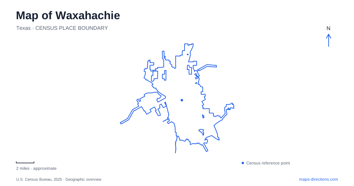
Street tiles load from OpenStreetMap when opened. The blue line shows the 2025 Census boundary.
- State
- Texas
- Population · July 2025
- 50,090
- Land area
- 49.7 sq mi
- Water area
- 1.2 sq mi
Waxahachie has a recognizable civic center, but its geography becomes more interesting south and west of the courthouse square. A creek corridor, railway structures, old commercial blocks, and a park built around public gatherings all contribute to the city plan. The large courthouse gives visitors an obvious starting point; the surrounding district explains how a county seat also functioned as a center for trade. Following the creek adds a second perspective, connecting recreation with the crossings and industrial spaces beyond the square.
Reading the courthouse and its surrounding blocks
The Ellis County Courthouse stands at 101 West Main Street. Designed by J. Riely Gordon in the Romanesque Revival style, it combines red sandstone with pink and gray granite. Arched entrances, carved details, patterned masonry, and a central tower give the building a strongly modeled exterior. Looking at it from more than one side is useful because the corner porticos and changing masses are integral to its design.
The historic district around it is broader than the immediate square. The city's survey describes commercial buildings, the old jail on North Rogers Street, and City Hall in a former post office. These structures represent several functions of the old center: government, detention, communications, and retail trade. The brick storefronts also show changes made as businesses evolved. An altered shopfront can therefore be evidence of commercial history rather than simply an interruption in an otherwise frozen period scene.
Cotton, railways, and the edge of downtown
The growth of Waxahachie in the late nineteenth and early twentieth centuries was closely connected with cotton. The city identifies cotton-related industries and prosperity as important forces behind both downtown construction and substantial residential neighborhoods. This helps explain why the architectural interest extends beyond the courthouse into streets of commercial buildings and older houses.
Railway reminders make that economic story more concrete. A restored red caboose stands near the MKT Depot, while Singleton Park contains the Wyatt Office and Calaboose across from 216 North College Street. The local preservation organization identifies the latter pair among the oldest surviving commercial buildings. These smaller structures offer a useful change of scale from the courthouse. They show how routine business, transport, and local administration occupied more modest spaces within the same town.
Crossing the creek
Historic surveys identify the Rogers Street Bridge and Elm Street Viaduct as important structures between downtown and the southern neighborhoods. Their role is geographical as well as architectural: they carry routes across the creek landscape. A map of Waxahachie should make those crossings legible, particularly when comparing a route through downtown with a walk along the water.
The municipal park inventory describes the creek trail passing Getzendaner Park, the rodeo grounds, the old city cemetery, and the Rogers Street Bridge. It identifies access points at the park, Rogers Street, the fairgrounds, and Lions Park. These connections provide a way to view several kinds of public space along one corridor. The trail follows the creek's alignment rather than simply duplicating the commercial street pattern above it, so it reveals a different ordering of the city.
Getzendaner Park and the assembly tradition
Getzendaner Park is at 400 South Grand Avenue. The park began in 1889 as West End Park and developed a strong association with Chautauqua gatherings. Its present facilities include playgrounds, pavilions, walking paths, and a pedestrian bridge, but the auditorium gives the place an unusual historical center.
The octagonal Chautauqua Auditorium was built in 1902 for educational and cultural assemblies. The organization preserving that tradition describes large summer gatherings and the building's rescue and restoration during the 1970s. Its form belongs to a period when lectures, music, and public discussion could draw audiences to a temporary encampment. For a visitor exploring Waxahachie, this is a particularly revealing contrast with the courthouse: one building expressed county authority, while the other accommodated a collective cultural event in a park setting.
A lake destination beyond the creek walk
Boat Dock Park is at 91 Lakeshore Drive on Lake Waxahachie. It offers launching access, fishing opportunities, and waterfront recreation. The state fisheries agency lists three public boat ramps around the lake and notes that there are no camping facilities there. This is a separate recreation setting from the downtown creek corridor, despite the shared association with water.
Treating the square, creek trail, assembly park, and lake as distinct parts of a visit produces a more coherent plan. Each has its own scale and purpose: close observation of masonry and storefronts downtown, movement along the creek, time around the historic auditorium, or a visit to the lakeshore. Together they show how commerce, civic life, cultural gatherings, and outdoor recreation have occupied different parts of the local landscape.
Map and statistics: U.S. Census Bureau, 2025 Gazetteer, January 2025 generalized place boundaries and Vintage 2025 population estimates. Local references: Texas Historical Commission; City of Waxahachie; Historic Waxahachie Inc.; Waxahachie Chautauqua; Texas Parks and Wildlife. Article prepared by Maps & Directions.