Map of Waukesha
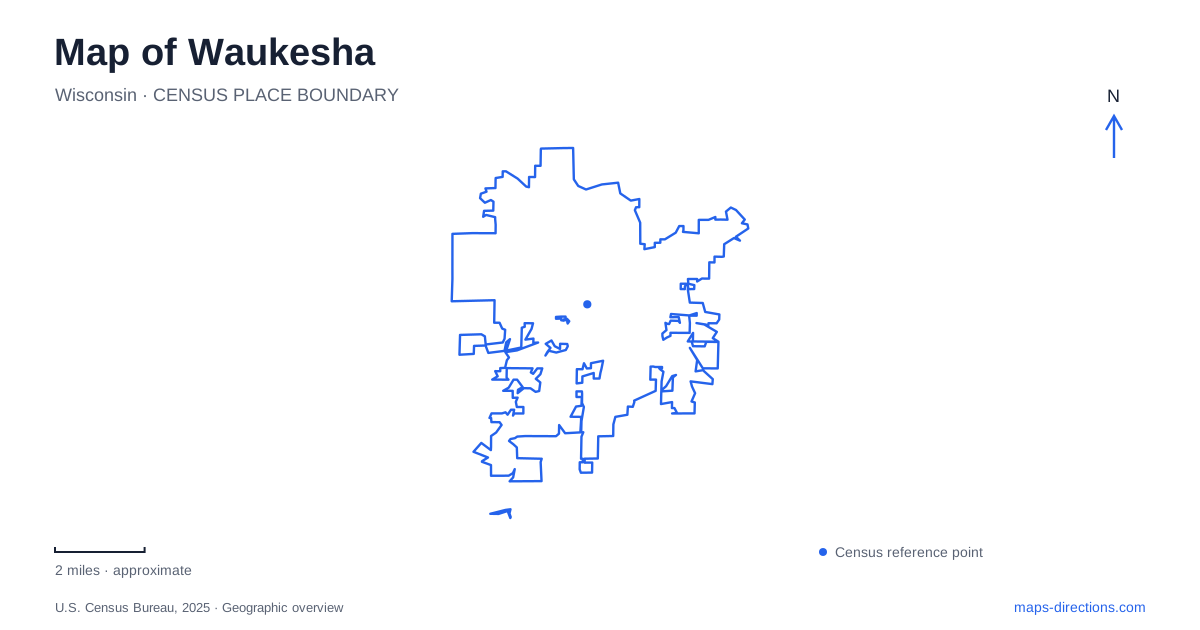
Street tiles load from OpenStreetMap when opened. The blue line shows the 2025 Census boundary.
- State
- Wisconsin
- Population · July 2025
- 70,872
- Land area
- 25.5 sq mi
- Water area
- 0.3 sq mi
Waukesha has two especially useful map patterns: the angled streets around Five Points and the Fox River's sequence of parks and trails. Downtown's geometry reflects an older commercial center, while the river organizes recreation spaces with different landscapes and purposes. Following those patterns reveals formal gardens, small urban parks, a natural-resource sanctuary, and the start of a much longer regional trail. The result is a city that can be explored through both its unusual blocks and its continuous relationship with water.
Why Five Points looks different from a grid
Main Street, Broadway, and Grand Avenue meet at the junction known as Five Points. Their angles create corners and blocks that depart from a regular rectangular grid. The National Register documentation for the Block C Historic District describes a small triangular block lined by nineteenth- and twentieth-century commercial buildings.
That street geometry influenced the shapes of the buildings themselves. The historic district record explains that nonrectangular building plans responded to the angled corners. Looking at the map before walking the area gives those facades an additional meaning: unusual footprints are a response to the streets, rather than isolated architectural curiosities.
In downtown Waukesha, this makes the junction a helpful orientation point. Following a street through Five Points is not the same visual experience as continuing through a conventional four-way crossing. The surrounding commercial blocks are best understood in relation to the meeting of the three named streets.
Frame Park on two sides of the Fox
Frame Park extends along the Fox River between Barstow Street and Moreland Boulevard. The city's walking tour describes a 1.7-mile loop and separate paved paths accommodating walkers and cyclists. The river divides the landscape into two contrasting settings: more formal planting on the east side and a more natural river edge on the west.
The Formal Gardens add a designed landscape of annuals, perennials, and roses. Their sunken garden retains fish-head waterspouts from a former water feature. These details make the park more than a convenient stretch of riverside path; it is also a place to look closely at the history and arrangement of planting.
Baxter Street provides references for the Schuetze Recreation Center and Rotary Building. The latter stands at 1150 Baxter Street, where a kayak launch also provides access to the river. A Waukesha outing based here can combine a circuit on land with attention to the water, while keeping the garden, recreation buildings, and launch in their proper places around the loop.
Smaller river spaces and a pedestrian crossing
Bethesda Spring Park at 560 Dunbar Avenue and Grede Park on Riverwalk Drive are connected by a pedestrian bridge across the Fox. Grede occupies the west bank and includes a canoe landing. Bethesda adds neighborhood park facilities and the historic Dunbar Oak.
Grede Park also contains the parade memorial, whose six ribbons form a heart in remembrance of the six people killed. This is a place for reflection within the river corridor. A route passing through should recognize that purpose rather than treating every open space solely as recreation ground.
These parks show a different scale from Frame Park. The bridge connects two smaller settings and makes the river part of a neighborhood walk. On a Waukesha map, identifying the crossing is useful because the two banks offer complementary places within a single outing.
From the sanctuary into a regional trail
The Glacial Drumlin State Trail begins its eastern section in the Fox River Sanctuary at College and Prairie Avenues. The Wisconsin Department of Natural Resources describes the full trail as a fifty-two-mile route between the city and Cottage Grove, passing through farmland, glacial terrain, and a series of small towns.
That trailhead changes the meaning of the local map. A path near the river can be the beginning of a journey extending far beyond the urban parks. The section toward Dousman is paved, while other portions have a limestone surface. Selecting a short local ride or a longer regional trip therefore involves both distance and a change in trail conditions, rather than simply following the same surface indefinitely westward.
A separate county park with a similar name
Fox River Park is another destination altogether, reached at W264 S4500 River Road. The county describes a landscape of mature woodland, wetlands, wildflowers, and paved trails, with an accessible canoe and kayak launch and a nature play area. It belongs to the county park system and requires a vehicle admission permit.
For a Waukesha visit, the distinction between this park, Frame Park, and the Fox River Sanctuary is useful. They share a river name but represent different parts of the broader landscape. The downtown blocks, formal gardens, neighborhood bridge, regional trailhead, and wooded county park each reveal a separate aspect of how the community relates to its streets and waterway.
Map and statistics: U.S. Census Bureau, 2025 Gazetteer, January 2025 generalized place boundaries and Vintage 2025 population estimates. Local references: National Park Service; City of Waukesha; City of Waukesha Downtown; Wisconsin DNR; Waukesha County. Article prepared by Maps & Directions.