Map of Waukegan
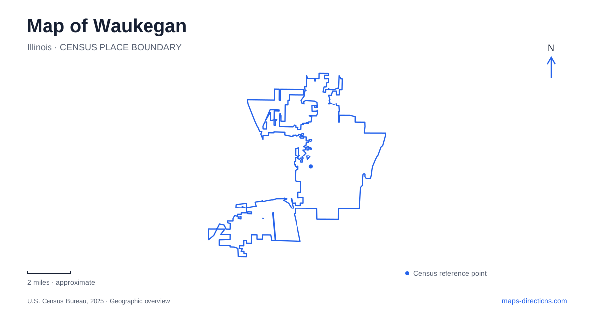
Street tiles load from OpenStreetMap when opened. The blue line shows the 2025 Census boundary.
- State
- Illinois
- Population · July 2025
- 87,940
- Land area
- 24.3 sq mi
- Water area
- 0.3 sq mi
Waukegan combines a Lake Michigan waterfront with an inland cultural landscape of theaters, historic houses and public parks. Its map rewards attention to the space between those features. The municipal beach and harbor occupy the water's edge; the Carnegie museum and Genesee Theatre help identify downtown; Bowen Park holds a separate collection of historical associations farther north. Each place reveals a different part of a city that cannot be reduced to either its shoreline or its famous former residents.
A shoreline with dunes as well as open sand
The municipal beach extends along roughly a mile of sand and includes surviving natural dunes. The city's beach-management plan treats the beach, dunes and wetlands as connected habitats, with provisions for monitoring plants and wildlife and controlling invasive species. This is a more complex environment than an empty strip between parking and the lake.
For Waukegan, the ecological value of the waterfront affects how public access is planned. Public-access plans have considered a trail, platform and boardwalk system intended to improve access while protecting sensitive habitat. Planning material explains that conservation approach, but does not establish that every illustrated feature is available to visitors. On a map, the recreational beach, dune habitat and harbor should remain distinct. They meet along the same lakefront, but a route appropriate for reaching a swimming area does not automatically describe access through a protected natural area.
The Carnegie building has a new museum role
The history museum at the Carnegie occupies the restored 1903 building at 1 North Sheridan Road. Its permanent exhibition follows local history from the last Ice Age into the twenty-first century. A separate immersive exhibition centers on Ray Bradbury and includes his private book collection and original manuscripts. The historical society's research archives are also housed here.
That downtown address matters because older references may send readers toward a different museum setting. The Carnegie is the current location for the society's larger exhibition and research program, while the Haines House remains a separate historic-house experience in Bowen Park. Both contribute to understanding Waukegan, but they should not be represented by a single interchangeable museum marker. One presents an extensive local-history collection in a former library; the other interprets a nineteenth-century domestic interior within a park.
Genesee Theatre and the entertainment district
The Genesee Theatre opened on Christmas Day in 1927 with four sold-out screenings of The Valley of the Giants. It later closed in 1989 before restoration returned it to use. Its history page identifies the marquee installed in 2004 as a reproduction of the original 1927 design, a useful example of how a historic-looking feature can be a carefully researched replacement.
This building gives downtown a different historical reference from the Carnegie. The theater represents commercial entertainment, while the former library represents civic investment in learning. Together they establish a cultural landscape composed of buildings with separate original purposes. A present-day streetscape can preserve those relationships even when the activities inside the buildings change. The theater's restoration is therefore part of the area's continuing history, rather than a reason to assume every visible element dates from its opening night.
Jack Benny's surviving childhood address
The city identifies 518 Clayton Street as the last surviving house associated with Jack Benny's childhood residences. His family rented it in 1909 and 1910. During that period, he obtained work playing violin in the orchestra pit at the Barrison Theatre, formerly at 25 South Genesee Street. The connection places his early musical employment within a specific downtown geography.
Benny's relationship with Waukegan later included major public returns, among them the 1939 premiere of Man About Town at the Genesee Theatre. These addresses make his story more precise than a general hometown association. The childhood residence, former employment site and later premiere venue represent different moments and buildings. A historical designation also does not turn a residence into a public museum; its value on the map is as a documented surviving place connected with his early life.
Bowen Park carries several generations of use
The Haines House in Bowen Park was built around 1843 and enlarged in the 1870s. Once home to John C. Haines, a former Chicago mayor, it now interprets late Victorian domestic life through researched furnishings and interior treatments. Its address is 1917 North Sheridan Road, placing it well apart from the Carnegie's downtown site.
The surrounding park also preserves the history of the Bowen Country Club, established in 1912 as a summer camp connected with Chicago's Hull-House. It served children from the settlement-house neighborhood, and the historical society records how the former Goodfellow Hall became part of the Jack Benny Center's theater setting. These layers connect domestic life, social reform and cultural activity in one landscape. Reading them alongside the downtown buildings and natural dunes gives Waukegan a map of distinct, documented places whose histories continue beyond a single famous name or lakefront view.
Map and statistics: U.S. Census Bureau, 2025 Gazetteer, January 2025 generalized place boundaries and Vintage 2025 population estimates. Local references: City of Waukegan; Waukegan Historical Society; Genesee Theatre. Article prepared by Maps & Directions.