Map of Washington DC
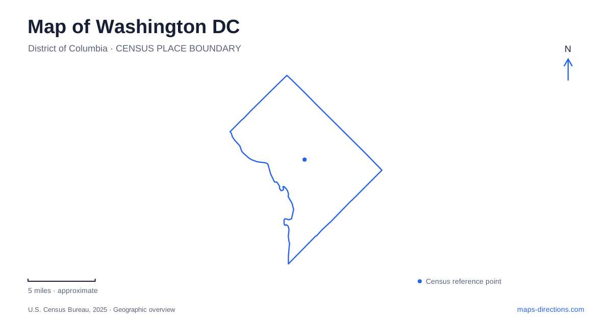
Street tiles load from OpenStreetMap when opened. The blue line shows the 2025 Census boundary.
- State
- District of Columbia
- Population · July 2025
- 693,645
- Land area
- 61.1 sq mi
- Water area
- 7.2 sq mi
Washington DC becomes easier to understand when its formal street plan and its waterways are read together. The Capitol anchors the address system, while the Potomac and Anacostia rivers shape the city's edges and connections. The National Mall provides a broad east–west reference through the monumental center. Farther north and west, Rock Creek and the Georgetown canal introduce quite different kinds of routes. These are useful geographic frameworks because a museum visit, a neighborhood address, and a wooded walk require different levels of map detail.
Begin with the quadrant, then the street
The four address quadrants extend from the United States Capitol: Northwest, Northeast, Southwest, and Southeast. Their abbreviations are part of an address, rather than optional descriptions of a neighborhood. A street number and name can recur in different quadrants. Keeping NW, NE, SW, or SE attached to a search therefore resolves an ambiguity that a citywide view cannot.
Numbered streets generally run north–south, increasing outward from the Capitol's meridian. Lettered streets run east–west. Diagonal avenues add another layer to that grid, producing triangular blocks and intersections where more than two streets meet. A route along an avenue can cross the numbered sequence obliquely, so the arrangement on the map is more informative than counting blocks alone. In Washington DC, the address system is an orientation aid, but the actual street connections still determine how a journey proceeds.
Read the Mall as a sequence of places
The Capitol, Washington Monument, and Lincoln Memorial establish the familiar east–west monumental line. The Reflecting Pool occupies the western portion of this landscape between the World War II Memorial and the Lincoln Memorial. Constitution Avenue and Independence Avenue provide major references along the broader north and south sides. This makes the Mall a useful organizing feature even for destinations that do not sit directly on its lawns.
The museum geography adds a second level of detail. The National Museum of American History and National Museum of Natural History lie on the north side of the central museum area. The Smithsonian Castle, Hirshhorn Museum, and National Air and Space Museum belong to the southern side. Those relationships help divide an itinerary into nearby groups without assuming that every building carrying a Smithsonian name is in one compact location. East of the Capitol, the Library of Congress belongs to a different cluster from the museums farther west.
Follow the water around the Tidal Basin
A map of Washington DC should distinguish the Tidal Basin from both the Potomac River and the Reflecting Pool. These bodies of water produce different walking patterns. The Reflecting Pool reinforces a straight axis toward the Lincoln Memorial; the basin creates a curved shoreline circuit with memorials distributed around it.
The Thomas Jefferson Memorial occupies the southern side of the basin, while the Franklin Delano Roosevelt Memorial and Martin Luther King, Jr. Memorial lie along its western side. The Washington Monument stands north of the basin. These positions explain why an itinerary joining all four does not follow a single straight Mall promenade. Farther south, Hains Point extends between the Potomac and Washington Channel. The elongated landform is visually close to several central landmarks, but its shoreline geometry makes it a separate piece of the larger park landscape.
Georgetown has a canal as well as a waterfront
Georgetown introduces a smaller-scale water corridor. The C&O Canal towpath begins its long journey toward Cumberland, Maryland, in this neighborhood. The Georgetown Visitor Center location is at mile 0.4, with the physical address 1057 Thomas Jefferson Street NW. That canal mileage is a linear reference along the towpath, unrelated to the city's numbered street system.
The National Park Service also identifies the Old Stone House at 3051 M Street NW as a place for information about its Georgetown sites. Putting M Street, Thomas Jefferson Street, and the canal on the same detailed map reveals a neighborhood organized around several parallel experiences: the commercial street, the canal corridor, and the Potomac waterfront. For Washington DC visitors, recognizing these as connected but distinct features gives Georgetown a clearer shape than a single neighborhood label does.
Rock Creek changes the map's organizing principle
Rock Creek Park replaces the regularity of the central grid with a valley and ridge landscape. Its two principal north–south hiking routes are the Western Ridge Trail and Valley Trail, shown in green and orange respectively on the park's trail map. East–west connector trails join them. The resulting network supports journeys along the valley, along higher ground, or between the two.
The Nature Center, Peirce Mill, and Boundary Bridge are separate starting references within this system. Choosing one makes the intended part of the park explicit. This is especially useful because a broad green shape can conceal considerable variation in route direction and terrain. The wooded corridor, the formal Mall, and the Georgetown towpath show why Washington DC benefits from more than one map scale: the citywide view establishes relationships, while a district or trail view explains the paths within them.
Map and statistics: U.S. Census Bureau, 2025 Gazetteer, January 2025 generalized place boundaries and Vintage 2025 population estimates. Local references: District of Columbia OCTO; District of Columbia DMV; National Park Service. Article prepared by Maps & Directions.