Map of Warwick
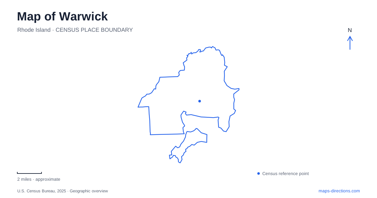
Street tiles load from OpenStreetMap when opened. The blue line shows the 2025 Census boundary.
- State
- Rhode Island
- Population · July 2025
- 84,187
- Land area
- 35.0 sq mi
- Water area
- 14.8 sq mi
Warwick is easier to understand as a collection of village centers and coastal landscapes than as a city arranged around one uniform downtown. Apponaug provides the historic civic focus, the airport creates a major transportation district, and the bay shore holds several separate park destinations. These places share a municipal name without sharing the same street pattern. A useful map should reveal how the village roads, transportation facilities and waterfront approaches fit together.
Apponaug combines civic history with a changed road system
The city's historic-district account dates Apponaug's development to a fulling mill established on Kekemewit Brook in 1696. The village became the seat of local government in 1834. Those origins give the center a relationship to water and industry that predates the modern traffic network. City Hall is a useful orientation point, but the surrounding road arrangement reflects engineering from a later period.
Rhode Island's transportation department describes the Apponaug Circulator as a five-roundabout project, substantially completed in 2017. It reorganized intersections and added a bypass segment to move through journeys away from the village center. Veterans Memorial Drive, Greenwich Avenue, Centerville Road, Post Road and West Shore Road appear in the department's project mapping. Reading this area as a conventional four-way crossroads misses that interconnected system.
On a Warwick map, enlarge the whole circulator rather than concentrating on just the final roundabout. A destination on Post Road can involve a different approach from a trip continuing through the district. The street names remain valuable, but the sequence of connections explains the route. Historical maps can illuminate the village's development while providing an incomplete picture of its present road geometry.
The airport's InterLink is a separate destination
Rhode Island T. F. Green International Airport's InterLink combines commuter rail, rental cars, commuter parking and a skywalk connection to the terminal. The airport gives its address as 700 Jefferson Boulevard. This is a specific transportation facility, not simply another name for the airline terminal's curbside arrival area.
That distinction matters for a Warwick journey involving more than one mode. Meeting a commuter train, returning a rental vehicle and collecting an arriving airline passenger involve different facilities even though the airport connects them. Start with the function of the trip, then select the corresponding destination. Jefferson Boulevard is particularly useful as a geographical clue for the InterLink; the airport name alone describes a much larger complex.
The skywalk also changes how distance should be interpreted. Connected facilities do not have to share a single roadway entrance to form one travel interchange. A road map explains vehicle approaches, while an airport layout explains movement between the terminal, rental-car area and rail facilities. Using both views makes the interchange more understandable than treating its large map label as one point.
Three waterfront parks have different approaches
The municipal parks directory places Conimicut Point Park on Point Avenue. Oakland Beach Park is on Oakland Beach Avenue. The city park in the Buttonwoods beach area has paved bicycle paths and recreational fields. These are distinct shoreline destinations, so “the beach” is an imprecise description when arranging a meeting or comparing routes.
For coastal trips in Warwick, keep each park's local approach attached to its name. Point Avenue and Oakland Beach Avenue are useful destination clues because they distinguish two waterfront outings without relying on a broad bay-side label. Buttonwoods adds another setting, with a park landscape that combines recreation and paths. A regional map shows their shared coastal location; a neighborhood map reveals the separate streets serving them.
Rocky Point is a coastal landscape with several uses
The city's community profile describes Rocky Point as a Narragansett Bay park with a shoreline walking and cycling path, hiking opportunities, a saltwater beach and a fishing pier. Those features make it a landscape to explore rather than a single monument to locate. The shore, inland paths and pier represent different parts of the same outing.
Choose the park as the overall destination, then examine which feature matters for the visit. A pier-focused outing and a longer walk through the grounds do not require the same mental map. The shoreline provides a strong orientation line, while the internal path network determines how the different areas connect. This is a useful contrast with Apponaug, where the important structure is a sequence of streets and roundabouts.
Build the route around the district's purpose
A detailed Warwick map becomes more useful when its destination labels are translated into their actual roles. Apponaug is a historic civic village inside a redesigned road network. The InterLink is a transfer facility with a Jefferson Boulevard address. Conimicut Point, Oakland Beach, Buttonwoods and Rocky Point are separate coastal settings. Select the appropriate district first, then use the street or facility detail that explains movement within it. This approach preserves the city's varied geography instead of flattening it into one generalized suburban destination.
Map and statistics: U.S. Census Bureau, 2025 Gazetteer, January 2025 generalized place boundaries and Vintage 2025 population estimates. Local references: City of Warwick; Rhode Island Department of Transportation; Rhode Island T. F. Green International Airport. Article prepared by Maps & Directions.