Map of Warner Robins
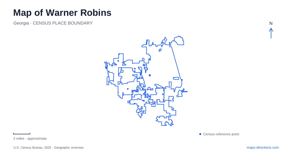
Street tiles load from OpenStreetMap when opened. The blue line shows the 2025 Census boundary.
- State
- Georgia
- Population · July 2025
- 87,761
- Land area
- 39.5 sq mi
- Water area
- 0.3 sq mi
Warner Robins grew around a major change in the purpose of a small Georgia settlement. The community once known as Wellston became the neighbor of a wartime air depot, and that decision reshaped its scale and identity. Yet the city map also contains a railway story, a creek corridor reclaimed after flooding, and a community theater that moved through several borrowed and adapted buildings. Reading these places together gives a fuller picture than treating the entire city as a label beside the air base.
Wellston and the wartime transformation
The Air Force's historical account places the selection of the depot site in June 1941. Congressman Carl Vinson notified local civic leaders that the War Department had chosen land across the road from Wellston for an Army air maintenance and supply installation. The settlement changed its name the following year in connection with Brigadier General Augustine Warner Robins, whose name was also associated with the new military facilities.
The geography of that transformation is important. A large maintenance and supply installation required a different kind of landscape from a small rural railroad community. The base and civilian town developed beside one another, with transportation serving both. The historical relationship explains the concentration of military and aviation references on the map, but it does not make every museum, depot or public building part of the same accessible campus. Their present functions and entrances are separate questions.
A railroad depot now welcomes visitors
The E.L. Greenway Welcome Center occupies the depot at 99 North Armed Forces Boulevard, across Highway 247 from the base. The city's visitor brochure dates the building to 1944, when wartime growth required a replacement for the smaller earlier wooden depot. Railroad use ended in 1970, leaving the building available for a later public role.
The older Wellston depot has a separate history: it was moved in 1944 and became part of a church property on Watson Boulevard near Davis Drive. These are distinct buildings, not two dates for the same surviving structure. That distinction helps readers locate the physical evidence of Warner Robins' growth. The current welcome center represents the larger wartime railway operation, while the earlier building's relocation records a change in use. Historic Depot Row also includes the Elberta Depot and its World War II interpretation, adding another railway association to the area.
Aviation history occupies a large museum campus
The Museum of Aviation publishes its address as 1942 Heritage Boulevard and identifies the Eagle Building as the recommended starting point. Its collection is spread across a campus of more than 50 acres, with large hangars and exhibits covering Air Force and Georgia aviation history. The Georgia Aviation Hall of Fame is in the Century of Flight Hangar, on the second-floor mezzanine.
That internal geography matters for understanding the destination. A single museum symbol on a city map does not convey the distance between exhibits or the division among buildings. The Hall of Fame and Eagle Building, for example, are parts of a larger campus rather than interchangeable names for its entrance. The museum offers public visits and self-guided resources, making it a place to explore the region's aviation story without assuming that a museum visit is a tour of the working military installation.
Bay Gall Creek explains the greenway
The Wellston Trail landscape has an origin in flood recovery. Tropical Storm Alberto caused Bay Gall Creek to overflow in 1994, damaging homes in the middle of town. The state emergency-management agency describes an extended acquisition program that removed flood-prone properties and allowed the land to become park space and a multi-use greenway.
For Warner Robins, this is a particularly revealing example of how a green corridor can preserve the memory of earlier land use. The open space did not simply survive because nobody had built there. It was created through decisions to move housing out of a vulnerable area. The city's 2024 river-cleanup announcement places Wellston Trail activity at Corder Road and identifies Bay Gall Creek as the waterway being cared for. The trail is therefore both a recreation route and part of a continuing relationship with urban drainage.
Community theater found a home in a former restaurant
The local Little Theatre began in 1962, with early performances in a converted dairy barn on Elberta Road. Rehearsals later used an upstairs room beside the old Wellston Theatre. A 1979 fire destroyed that space and its stored equipment, forcing another change. In 1980, the group bought a former restaurant at 502 South Pleasant Hill Road, renovated it and opened its new playhouse in January 1982.
Those moves trace cultural activity across Warner Robins beyond the better-known aviation sites. They also show why the history of a building's use can be as informative as its architecture. A barn, upstairs room and restaurant successively supported the same community institution. Alongside the depot conversion and floodplain greenway, the theater illustrates a city repeatedly adapting existing places to new purposes, with each adaptation leaving a different clue on the map.
Map and statistics: U.S. Census Bureau, 2025 Gazetteer, January 2025 generalized place boundaries and Vintage 2025 population estimates. Local references: Robins Air Force Base; City of Warner Robins / Explore Georgia; Georgia World War II Heritage Trail; Museum of Aviation Foundation; Georgia Emergency Management and Homeland Security Agency; City of Warner Robins; Warner Robins Little Theatre. Article prepared by Maps & Directions.