Map of Walnut Creek
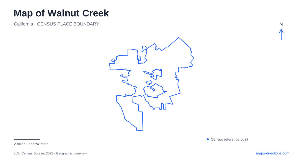
Street tiles load from OpenStreetMap when opened. The blue line shows the 2025 Census boundary.
- State
- California
- Population · July 2025
- 70,012
- Land area
- 19.8 sq mi
- Water area
- 0.0 sq mi
Walnut Creek brings several kinds of landscape into close relation: a downtown arts center, a carefully cultivated garden, and broad open-space ridges reaching toward Mount Diablo. Each is best understood at a different map scale. Civic Drive provides a precise urban reference, Bancroft Road leads to an intimate planted setting, and Shell Ridge requires attention to terrain and trail junctions. These contrasts are useful starting points for an exploration that includes both the built city and the hills around it.
Civic Drive and the arts-center corner
Bedford Gallery occupies the Lesher Center for the Arts at 1601 Civic Drive, at the corner of Locust Street. The gallery's position inside the larger arts building makes this a shared cultural destination rather than a detached museum campus. The neighboring Locust Street Garage can be entered from either Locust Street or California Boulevard.
Those street relationships give a downtown Walnut Creek visit a clear starting framework. Someone arriving for an exhibition can orient to the same building used by other arts audiences, while distinguishing the gallery from the parking structure beside it. The gallery began in 1968 as the Civic Arts Gallery and later received its present name in recognition of Peter and Kirsten Bedford. That history connects the institution to the city's long-running investment in public cultural life.
Shell Ridge and the evidence of an older sea
Shell Ridge is the city's largest open-space area, with about 1,420 acres and thirty-one miles of trails. Its parallel ridges and valleys form a broad wedge extending from near downtown toward Mount Diablo. Marine fossils left by former ocean waters explain the name.
The landform is important to understanding movement through the area. A ridge route and a creek-side route may sit close together on a small map but occupy different elevations and offer different views of the surrounding hills. Hiking, cycling, and equestrian trails make use of those varied surfaces rather than following a simple street grid.
On a Walnut Creek trail map, the ridges should be read as structure, not merely as background shading. They explain the bends, climbs, and junctions that shape an outing. The city's maps distinguish the open-space units and their trail systems, helping place Shell Ridge within a larger preserved landscape rather than treating every hill toward the mountain as one park.
Borges Ranch and Howe Homestead
Borges Ranch brings an agricultural layer to the open space. Established in 1899, the cattle-ranch complex includes barns, corrals, other ranch buildings, and the restored family home. Its preservation gives a visit a specific historical focus within the grassland and oak-woodland setting.
Howe Homestead, beside Shell Ridge, preserves another form of cultivated landscape. It was the home and orchard of Associated Press correspondent James P. Howe. The city describes fruit and nut trees, outbuildings, and community garden plots as part of the site.
These two places make a Walnut Creek open-space visit more varied than a walk through undeveloped hills alone. One reflects cattle ranching and its working structures; the other evokes an urban farm and orchard. Their relationship to the surrounding trails allows the natural and cultural histories of the landscape to be considered together.
A garden organized for close observation
The Ruth Bancroft Garden stands at 1552 Bancroft Road. The operator describes it as a living museum and provides a self-guided booklet and information on plants in bloom with admission. The garden and its retail nursery share the site, but they have different admission arrangements.
Within the grounds, the pond and the Folly reveal how the visitor sequence has changed. The garden's own history explains that these features once formed its entrance, but now lie toward the back. A walk through the more exposed planted areas therefore reaches them as a later, sheltered setting. That change is a useful reminder that even a small garden has a spatial history: paths and arrival points can alter how familiar features are experienced.
The garden is about a mile and a half from Pleasant Hill BART and three blocks from the Contra Costa Canal Trail. Those references place it within a wider transportation landscape, while its internal paths ask for much closer attention to individual plants and designed spaces.
Combining city blocks with ridge country
A Walnut Creek itinerary can move from the Civic Drive arts center to Bancroft Road's garden or toward Shell Ridge's ranch and hillside trails. The interest lies in their differences. A downtown corner concentrates cultural activity, the garden arranges a small landscape for close viewing, and the ridges expose both geology and agricultural history across a much larger area. Keeping those separate scales visible makes the map a useful guide to the character of each place.
Map and statistics: U.S. Census Bureau, 2025 Gazetteer, January 2025 generalized place boundaries and Vintage 2025 population estimates. Local references: Bedford Gallery; City of Walnut Creek; Ruth Bancroft Garden. Article prepared by Maps & Directions.