Map of Waco
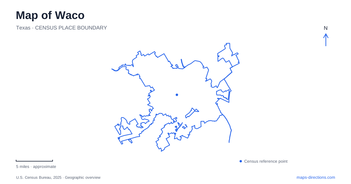
Street tiles load from OpenStreetMap when opened. The blue line shows the 2025 Census boundary.
- State
- Texas
- Population · July 2025
- 147,788
- Land area
- 91.0 sq mi
- Water area
- 12.4 sq mi
Waco's landscape can be understood through crossings, bluffs and layers of history. The Brazos River organizes the central waterfront, while Cameron Park introduces elevated overlooks and the meeting with the Bosque River. Downtown's former manufacturing buildings preserve a different story, and the mammoth excavation site reaches much farther into the past. These places are connected by the city around them, but their physical settings explain why they should remain distinct on a visitor's map.
The suspension bridge anchors the riverfront
The historic suspension bridge opened in 1870 and remains a recognizable reference across the Brazos. The city's riverfront information places Indian Spring Park on its western side and Martin Luther King Jr. Park on the opposite bank. The bridge therefore connects two identifiable public spaces rather than serving as an isolated monument in the middle of the water.
For Waco, this crossing helps explain the relationship between downtown and the eastern riverbank. A photograph of the bridge can make the two banks seem like a single setting, but a local map should preserve the park names and the streets serving each side. That information is particularly useful when an event uses one riverfront space rather than the other.
The broader riverwalk adds a route along the water. Texas Parks and Wildlife describes the connection among downtown, Cameron Park, the suspension bridge and Baylor University. This gives the central river corridor a sequence of destinations, with the bridge acting as one landmark within a larger public landscape.
Cameron Park changes the elevation of the view
Cameron Park's named places reveal terrain that a flat road map can conceal. Pecan Bottoms lies along the Brazos riverbank, while Lovers Leap occupies the cliffs above the river landscape. Circle Point provides another elevated outlook. A visit to the low river edge and a visit to a bluff overlook are therefore different experiences within the same park.
The city identifies Mouth of the Bosque as a location within the trail system with views of both rivers. The name describes an actual geographic relationship: the Bosque meets the Brazos here. Keeping both watercourse names visible makes the park easier to understand than treating the entire riverside as one continuous, uniform edge.
Waco's park geography also includes smaller settings such as Miss Nellie's Pretty Place, a wildflower preserve with a path and fountain plaza. The park is thus a collection of landforms and designed spaces. Its broad boundary does not convey whether a particular destination is a bluff, a riverbank recreation area or a garden-like landscape.
Fifth and Mary preserve a manufacturing address
The Dr Pepper Museum occupies the 1906 Artesian Manufacturing and Bottling Company building at Fifth Street and Mary Avenue. Its operator describes the location as part of a former manufacturing district and records the museum's public opening in 1991. The building's historical role explains why the attraction belongs among substantial commercial and warehouse structures rather than in a purpose-built museum park.
At 300 South Fifth Street, the museum provides a specific address for interpreting this part of downtown. A visitor can relate the present cultural use to a building originally designed around production. This is a different form of history from the bridge: one concerns a river crossing, while the other concerns manufacturing and later reuse of an industrial property.
The museum's own history also distinguishes the nonprofit institution from the beverage company that supports it. That distinction keeps the destination clear. The site presents the industry's story; it should not be mistaken for the current corporate headquarters or an operating bottling-plant tour.
The mammoth site preserves fossils where they were found
Waco Mammoth National Monument uses a separate location at 6220 Steinbeck Bend Drive. The National Park Service directs visitors to begin at the Welcome Center, from which a paved path leads to the Dig Shelter. Fossils remain in their original positions within the bone bed, so the physical site is central to the interpretation.
That arrangement differs from a conventional gallery containing specimens collected elsewhere. The path, shelter and excavation area explain how visitors encounter the discovery. The park is managed through a partnership involving the National Park Service, the city and Baylor University; university involvement does not place the monument on the main university campus.
A map of Waco can hold these histories together while showing their different settings. The river crossing, park bluffs, reused bottling building and protected excavation each tell a locally grounded story. Their addresses, water relationships and landforms provide a useful framework for choosing the part of the city that matches the purpose of a visit.
Map and statistics: U.S. Census Bureau, 2025 Gazetteer, January 2025 generalized place boundaries and Vintage 2025 population estimates. Local references: City of Waco; Texas Parks and Wildlife Department; Dr Pepper Museum; National Park Service. Article prepared by Maps & Directions.