Map of Vista
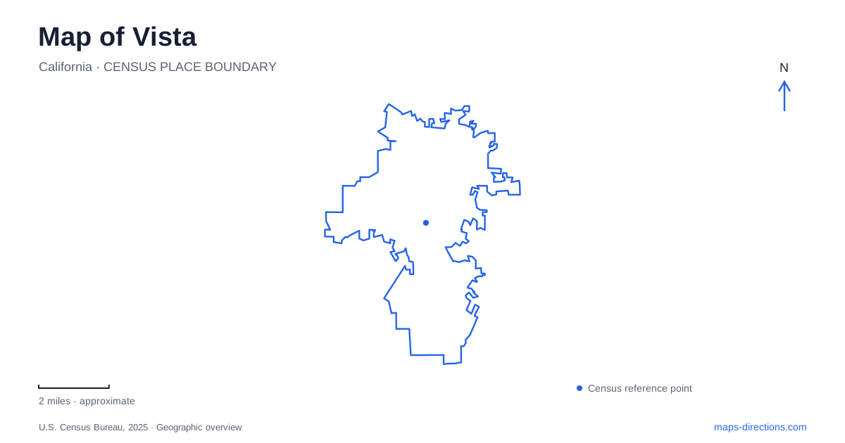
Street tiles load from OpenStreetMap when opened. The blue line shows the 2025 Census boundary.
- State
- California
- Population · July 2025
- 98,274
- Land area
- 19.0 sq mi
- Water area
- 0.0 sq mi
Vista has a cultural geography that rewards looking beyond a single downtown marker. An old movie house anchors Main Street, a large park accommodates outdoor theater and gardens, and a preserved adobe ranch house recalls the landscape before modern subdivisions. The SPRINTER railway adds a practical east–west connection through North County. Together, these features suggest several distinct outings: a downtown performance, an afternoon among park facilities, or a walk through historic ranch grounds.
The railway provides an east–west reference
The SPRINTER links Oceanside and Escondido, with local stations along the way. Vista Transit Center stands at 240 North Santa Fe Road and connects rail passengers with several BREEZE bus routes. Civic Center–Vista station is a separate stop at 810 Phillips Street. Farther along the line, Buena Creek station has an address on South Santa Fe Avenue. Those names and addresses provide more useful orientation than assuming every station serves the same part of town.
The transit center is a connecting point in a larger network, while Phillips Street identifies a different arrival area. This arrangement allows a rail trip to form the main east–west leg of an outing, followed by a local journey to a park or venue. NCTD also operates an on-demand service within a defined local zone; its existence does not mean that every destination across North County falls within that zone.
Main Street's theater has changed with the city
The AVO Playhouse at 303 Main Street began as a movie theater in 1948. After municipal purchase and restoration, it became a live-performance venue in 1995. The conversion preserved a downtown entertainment address while changing what audiences came to see. Its auditorium, stage, and backstage facilities now support theater and community uses rather than functioning as a conventional cinema.
That history gives Main Street a particularly tangible landmark. A visitor seeking an evening performance can orient around a real building with decades of entertainment history, rather than a loosely defined shopping district. The AVO also makes a useful comparison with the outdoor amphitheater elsewhere in town: both host performances, but their surroundings and arrival patterns differ substantially.
Vale Terrace Drive gathers several park destinations
Brengle Terrace Park is addressed at 1200 Vale Terrace Drive. The city's site map shows ballfields, court areas, a play area, picnic spaces, the Jim Porter Recreation Center, and the McClellan Center within the larger grounds. Moonlight Amphitheatre and Alta Vista Gardens add performance and botanical uses to that same park landscape.
The concentration of facilities explains why the park functions as more than a patch of open space. Different visitors may be attending a show, joining a recreation program, meeting at a picnic area, or spending time among planted collections. The official map distinguishes amphitheater parking from other parking areas and marks the recreation buildings individually. Reading the grounds at that level makes their organization much clearer than viewing only the outside boundary.
Vale Terrace Drive is therefore a useful organizing street for this part of an itinerary. The theater, gardens, and recreation facilities belong to one broad destination area, but each gives a different reason to spend time there. An outdoor performance can be the focus of a visit without implying that all the surrounding buildings share its event schedule.
The ranch house and its wetland setting
Rancho Guajome Adobe occupies a separate historic landscape at 2210 North Santa Fe Avenue. Built in 1852–53, the house preserves a Spanish-Mexican hacienda arrangement with inner and outer courtyards. California's historical-landmark account connects the property with the former Mission San Luis Rey lands and the families who later held the ranch.
The county describes a twenty-eight-room adobe with an arcaded veranda and a chapel. These architectural features make the building itself the central attraction, but the surrounding 112-acre park also contains wetland open space and nonmotorized trails. The setting therefore offers both architectural history and a view of vegetation and habitat beyond the house gardens.
Guajome Regional Park at 3000 Guajome Lake Road in Oceanside is a different mapped destination. Its campground and recreation facilities should not be confused with the adobe grounds on North Santa Fe Avenue. Keeping the two addresses distinct is especially useful when an itinerary simply says “Guajome.”
The resulting map of Vista has a recognizable structure: the rail corridor supplies regional movement, Main Street supplies a historic indoor stage, Vale Terrace Drive gathers a large cultural and recreation park, and North Santa Fe Avenue leads to the ranch-house landscape. Each part contributes a different chapter to the same place.
Map and statistics: U.S. Census Bureau, 2025 Gazetteer, January 2025 generalized place boundaries and Vintage 2025 population estimates. Local references: North County Transit District; City of Vista; San Diego County Parks; California State Parks. Article prepared by Maps & Directions.