Map of Virginia Beach
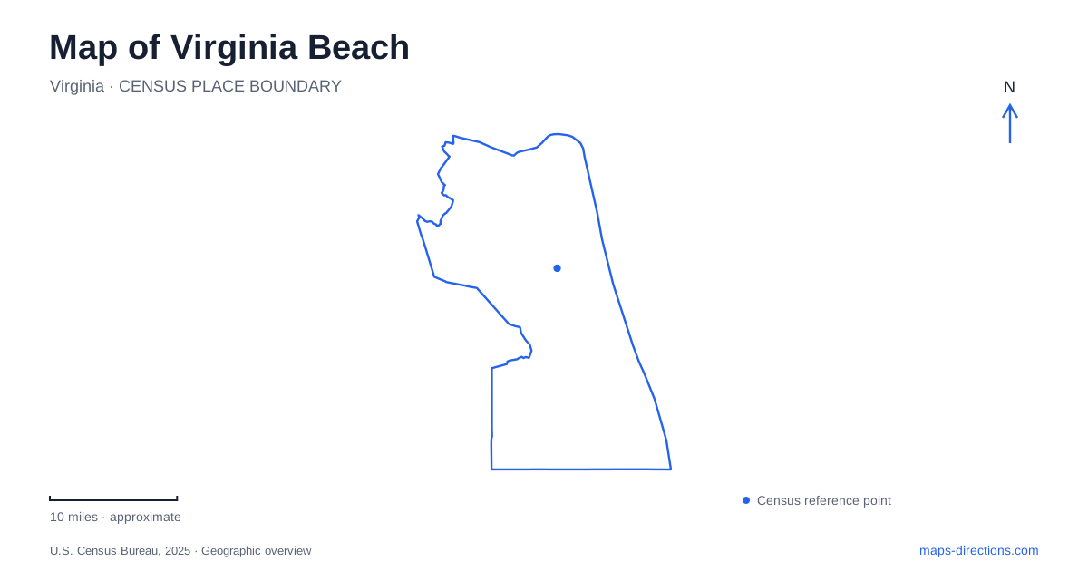
Street tiles load from OpenStreetMap when opened. The blue line shows the 2025 Census boundary.
- State
- Virginia
- Population · July 2025
- 453,737
- Land area
- 244.7 sq mi
- Water area
- 252.8 sq mi
Virginia Beach occupies several different coastal and inland settings. The Atlantic resort strip, Chesapeake Bay shoreline, Sandbridge, agricultural Pungo, and Town Center each have their own geography. A map becomes much more useful when these areas are distinguished before choosing individual stops. The most important first question is which landscape a destination belongs to: the numbered Oceanfront blocks, a bay-side park, an inland commercial district, or the long southern approach to protected coastal land.
Reading the numbered Oceanfront
The boardwalk extends three miles from 2nd to 40th streets beside the Atlantic. Atlantic and Pacific avenues, together with the intersecting streets, organize the surrounding resort district. This combination creates an understandable local pattern: the coast supplies the long edge, and numbered cross streets locate places along it.
King Neptune stands near 31st Street, making that section a recognizable northern reference within the main boardwalk area. The fishing pier lies between 14th and 15th streets. Rudee Inlet adds a boating and marina setting near the resort area's southern side. These features describe different portions of the same broader Oceanfront, so choosing a cross street is more precise than treating the whole district as one point.
The Virginia Beach boardwalk also has a separate bicycle path. That parallel arrangement matters when reading a pedestrian or cycling map: the recreational routes run together along the shore, but they are not interchangeable with the vehicle routes on the avenues. The numbered street connections help relate all three forms of movement.
Shore Drive separates two sides of First Landing
First Landing State Park faces Chesapeake Bay and contains a substantial inland trail landscape. Shore Drive, also U.S. Route 60, is a critical reference because park facilities sit on both sides. The bay-side entrance serves the Chesapeake Bay Center, camping, and park office, while the trail center and main picnic area are reached on the opposite side.
This division explains why two visitors heading to the same named park may need different approaches. One may be seeking the bay beach; another may be starting a woodland walk. The park map labels Broad Bay and White Hill Lake as well as the Chesapeake shore, revealing a more varied water landscape than a beach icon alone suggests.
The Cape Henry and Live Oak trails permit bicycles, while other named trails are for hiking. In the park's southern area, the 64th Street extension reaches the Narrows boat launch. A map of Virginia Beach should preserve these distinctions between the Shore Drive facilities, inland paths, and southern boating access. They are connected parts of one park, but they serve different activities.
Sandbridge leads toward a protected coast
South of the main resort area, Sandbridge has its own beachfront community and access roads. The approach to Back Bay National Wildlife Refuge follows Sandbridge Road into the community and then Sandpiper Road south. Little Island City Park lies along that approach before the refuge entrance at the road's end.
The refuge's visitor entrance is at 4005 Sandpiper Road. Its headquarters mailing address is on Sandbridge Road, a different location. This is a concrete case where a general address search can send a visitor to an administrative building instead of the intended public entrance.
Beyond the entrance, the landscape changes from neighborhood roads to refuge trails and beach. The East and West Dike trails have seasonal access arrangements intended to protect wintering waterfowl. Both close from November through March; during that period, beach access toward False Cape State Park remains the alternative for hikers and cyclists. Conditions and refuge rules still govern an actual outing.
The southern Virginia Beach coast therefore cannot be read as an uninterrupted extension of the resort boardwalk. The map shows public parks, a wildlife refuge, and a state park with different access arrangements. The transition is part of the place's geography, not simply a change in scenery.
Inland centers and agricultural country
Town Center supplies a contrasting inland concentration of shops, restaurants, and performance venues. Its mapped street network includes Main Street, Town Center Drive, Columbus Street, and Central Park Avenue near Independence Boulevard. The Sandler Center and Zeiders American Dream Theater help define its role as a cultural and commercial gathering area.
Pungo represents another inland setting, with farmland and produce-growing traditions near Sandbridge. It belongs in the city's geographic picture even though it does not resemble either the resort strip or Town Center's urban blocks. Keeping both areas visible prevents the shoreline from dominating every interpretation of the city.
A complete Virginia Beach map links these settings while retaining their differences. Numbered streets explain the Oceanfront, Shore Drive organizes access around First Landing, Sandpiper Road leads toward the refuge, and named inland districts reveal how much of the city lies beyond the beach.
Map and statistics: U.S. Census Bureau, 2025 Gazetteer, January 2025 generalized place boundaries and Vintage 2025 population estimates. Local references: Virginia Beach Convention & Visitors Bureau; Virginia Department of Conservation and Recreation; US Fish & Wildlife Service; Town Center. Article prepared by Maps & Directions.