Map of Victorville
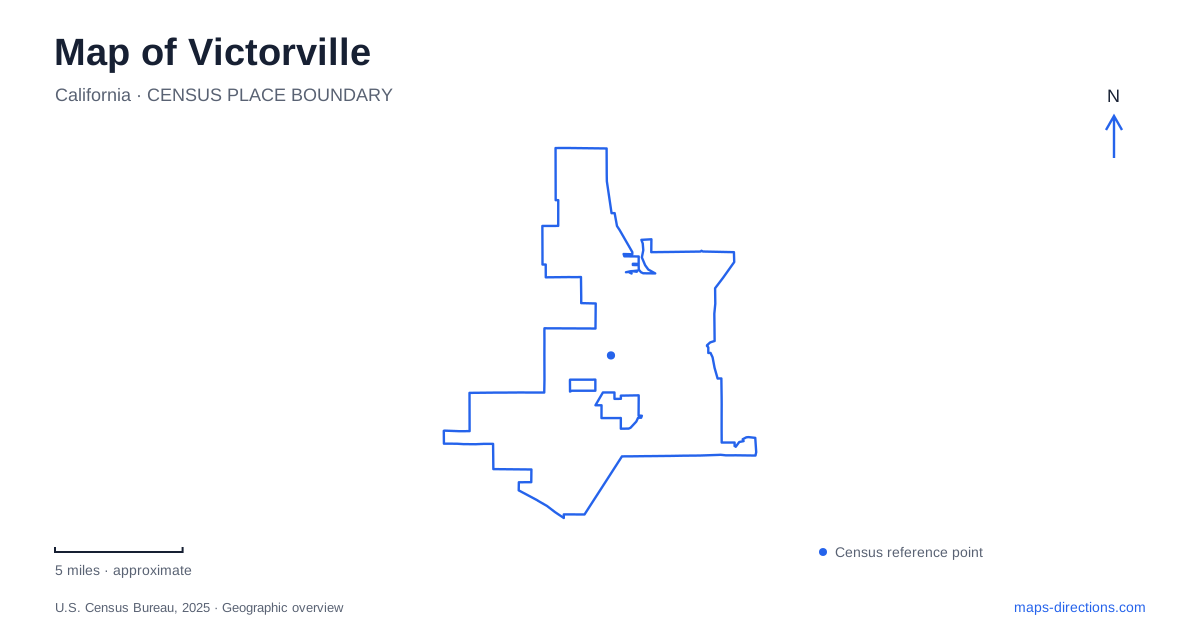
Street tiles load from OpenStreetMap when opened. The blue line shows the 2025 Census boundary.
- State
- California
- Population · July 2025
- 141,395
- Land area
- 73.7 sq mi
- Water area
- 0.3 sq mi
Victorville's geography brings together a desert river, a railroad settlement, a historic highway and an industrial airport. Each contributed a different pattern to the city. Old Town reflects an early concentration near the railway, while the former air base occupies a much larger tract in the northwest. Along the Mojave River, water and vegetation produce a landscape unlike the dry ground around it. A map becomes more revealing when these features are understood as the reasons for development, rather than simply as a collection of places to visit.
The railroad settlement came first
The community was called Victor in 1885, honoring California Southern Railroad construction superintendent Jacob Nash Victor. It grew around a station about a mile northwest of the Mojave River narrows. The postal name changed in 1901 to avoid confusion with Victor, Colorado. Municipal incorporation followed much later, in 1962.
These dates explain why Old Town's history reaches well before the official city's founding. Its origins belong to railway construction and a settlement clustered around transport infrastructure. The later arrival of Route 66 brought another kind of movement through the area, connecting roadside businesses with motorists crossing the region. When freeway travel displaced much of that traffic, Old Town's commercial role changed again.
The California Route 66 Museum at 16825 D Street provides a specific reference within this historical district. On a map of Victorville, the museum and the original settlement area help locate the older transport landscape. They also show why the history of the city cannot be reduced to its present freeway exits.
A desert river with much of its water underground
The Mojave River is unusual because much of its channel is normally dry even though water remains important to the region. The U.S. Geological Survey describes groundwater as central to the river system, with surface flow maintained in particular reaches where groundwater emerges. The Upper and Lower Narrows are among those important places.
This makes a conventional blue river line potentially misleading if it is read as a promise of continuous visible water. The channel, groundwater basin and areas of surface flow are connected parts of the system. Their appearance at ground level varies, and a dry-looking reach does not mean the river has no hydrological significance.
The narrows also give context to the settlement's original position. A constricted river corridor is a notable landscape feature in its own right, while the nearby railway and town represent human uses of the surrounding terrain. Reading the water system alongside the transport routes reveals more than either layer would show alone.
Cottonwoods, lakes and an old riverbed
Mojave Narrows Regional Park occupies an old riverbed landscape at 18000 Yates Road. County descriptions emphasize cottonwoods, willows, meadows and waterways, a striking combination within the High Desert. Horseshoe Lake and Pelican Lake organize much of the recreation setting, including camping areas beside the water.
The park also offers trails for walking and equestrian use. These routes introduce visitors to a greener local environment than the surrounding desert image might suggest. The vegetation and water are not incidental decoration around a picnic ground; they are the defining features of this former riverbed setting.
For an outdoor day near Victorville, the two lakes provide useful internal reference points. The county distinguishes tent camping along both shores from RV facilities near Horseshoe Lake. That arrangement helps explain the site's different recreation areas without assuming that all camping facilities occupy the same part of the park. The park's aquatic and riparian character is also distinct from the industrial and highway landscapes elsewhere in the city.
The northwest airfield changed its economic role
Southern California Logistics Airport occupies part of the former George Air Force Base in the northwest of Victorville. The base was officially decommissioned in December 1992, and its civilian airport successor opened in 1994. The large airfield footprint remained, but the activity associated with it changed.
The city describes the airport's present role through aircraft maintenance, testing, research, asset management and end-of-life services. Off-airport parts of the former base have developed as a logistics-oriented industrial area. This is a specialized employment and transport landscape, with land uses quite different from Old Town's smaller commercial blocks.
The airport's scale is especially apparent on an overhead map. Runways and industrial parcels organize a large area, while the historical center is shaped by individual streets and buildings. Both originated through transportation, but they represent different technologies, eras and economic functions. Together with the river corridor, they explain why modern Victorville has several strong geographical anchors rather than one compact center containing all of its defining places.
Map and statistics: U.S. Census Bureau, 2025 Gazetteer, January 2025 generalized place boundaries and Vintage 2025 population estimates. Local references: City of Victorville; California Route 66 Museum; U.S. Geological Survey; San Bernardino County Regional Parks. Article prepared by Maps & Directions.