Map of Vallejo
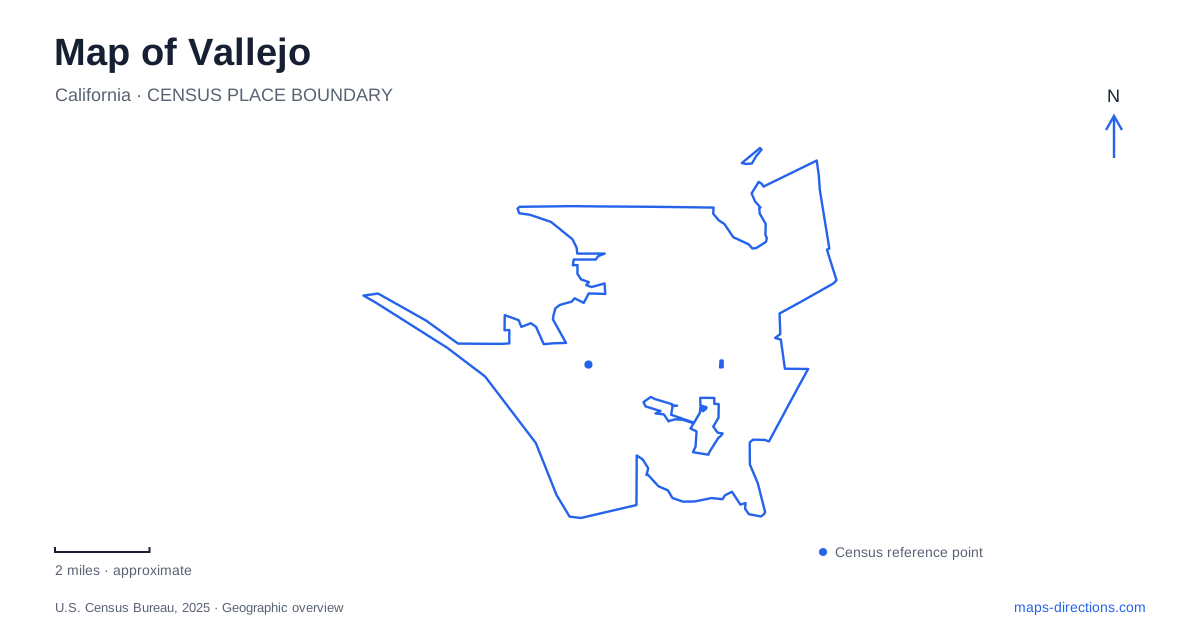
Street tiles load from OpenStreetMap when opened. The blue line shows the 2025 Census boundary.
- State
- California
- Population · July 2025
- 123,287
- Land area
- 30.4 sq mi
- Water area
- 17.9 sq mi
Vallejo's waterfront contains a naming trap that is worth resolving immediately: Mare Island Way is the address of the mainland ferry landing, while Mare Island itself has a separate ferry terminal. The water crossing, downtown streets, former naval landscape, and inland parks each provide different geographic reference points. Keeping those settings distinct makes the map useful for a ferry trip, a heritage walk, or a park visit without treating every waterfront destination as the same place.
Two ferry terminals with related names
The mainland ferry terminal is at 289 Mare Island Way. The separate Mare Island terminal is at 1050 Nimitz Avenue. The ferry operator serves the island on selected trips, so the two addresses should not be considered interchangeable departure points. The name on a ticket or schedule needs to be matched to the correct side of the water.
The mainland landing in Vallejo is associated with Georgia Street and the downtown waterfront. The local transit center is two blocks from the ferry terminal, providing another nearby but separate transport location. This arrangement can be useful for combining a ferry journey with local travel, provided the short connection between the facilities is included in the plan.
For a map of Vallejo, this is a more precise framework than a generic ferry icon. Mare Island Way identifies the mainland street, Nimitz Avenue identifies the island landing, and Georgia Street helps relate the mainland terminal to downtown. These names resolve an ambiguity that a broad waterfront label would leave unanswered.
Georgia Street and the older neighborhoods
The tourism authority identifies Georgia Street as a starting reference for the Old Town area, with older houses extending into the surrounding streets. Their proximity to downtown and the waterfront helps explain the area's historic urban character. The shoreline, commercial center, and residential neighborhoods are related parts of the city rather than isolated visitor attractions.
A heritage outing can therefore move beyond the immediate ferry frontage into the older street pattern. The map's value is in showing how those blocks relate to Georgia Street, not merely in collecting individual buildings. The relationship between houses, commercial streets, and the waterfront is part of the history visible in the area.
Farther along the mainland waterfront, the municipal marina sits near the Mare Island Causeway. Its office address is 42 Harbor Way. This distinguishes the marina from the ferry landing: one is a boating facility near the crossing, while the other is a passenger transport stop associated with downtown. Both face the same broader waterfront landscape but serve different purposes and occupy different points along it.
The causeway and the island street network
The Mare Island Causeway Bridge connects the mainland with the former naval island across the Napa River channel. The city's project information identifies G Street at the western approach. This is a useful street-level transition: after crossing, the island has its own roads and destinations rather than being an extension of the mainland promenade.
The bridge itself is part of the area's historic infrastructure, originally built in 1934. Its lift structure also reflects the need to accommodate movement on the water as well as across it. That combination helps explain why the crossing is a distinct feature of the Vallejo map, not simply another ordinary intersection.
The city has been carrying out a substantial bridge maintenance project, with traffic circulation changes documented in its project information. A static map should consequently be used to understand the connection, while current official directions establish the available movement for a particular trip. The larger geographic lesson remains stable: a mainland waterfront stop and an island destination require an actual crossing and an island street address.
Lake Chabot and the inland ridge
Dan Foley Park is at 1461 North Camino Alto and includes Lake Chabot, a cultural center, sports fields, picnic areas, and a nature trail around the lake. The district's description shows a recreation landscape with several distinct uses sharing one park. A cultural-center event and a lakeside walk can begin from the same broad destination while focusing on different parts of it.
Blue Rock Springs Park offers another inland setting. The recreation district identifies a hiking trail leading toward the ridge of Sulfur Springs Mountain, with views toward the city and Napa River. This changes the map's perspective from shoreline travel to rising terrain. The park is not simply another waterfront stop, even though the river can be part of the view from above.
Together, these inland destinations broaden the picture of Vallejo beyond its ferry identity. Lake Chabot organizes one park around water at a local scale, while the Blue Rock Springs trail relates another park to a ridge. Combined with Georgia Street, the mainland landing, and Mare Island's separate road network, they reveal a city whose useful landmarks include both crossings and changes in elevation.
Map and statistics: U.S. Census Bureau, 2025 Gazetteer, January 2025 generalized place boundaries and Vintage 2025 population estimates. Local references: San Francisco Bay Ferry; City of Vallejo; Visit Vallejo; Greater Vallejo Recreation District. Article prepared by Maps & Directions.