Map of Vacaville
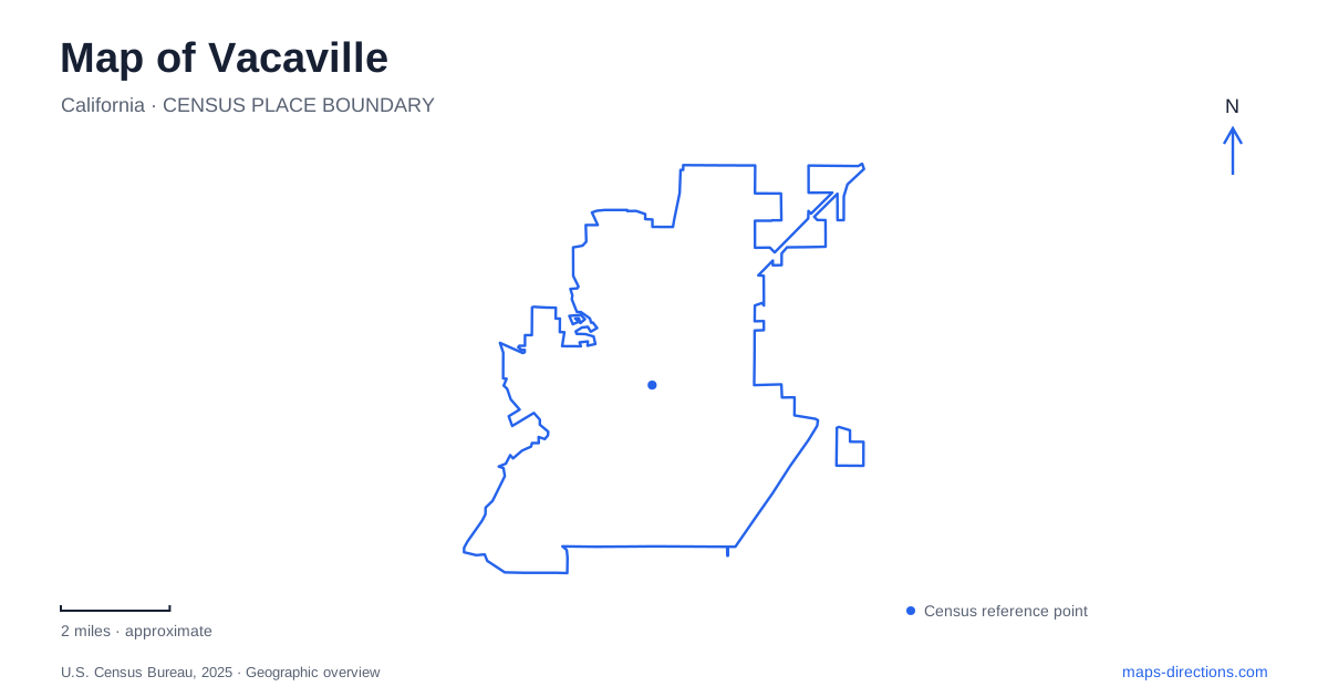
Street tiles load from OpenStreetMap when opened. The blue line shows the 2025 Census boundary.
- State
- California
- Population · July 2025
- 103,850
- Land area
- 29.9 sq mi
- Water area
- 0.2 sq mi
Vacaville has several centers of interest that reflect different stages of its development. Main Street and the nearby creek form the older downtown setting. Lagoon Valley preserves a combination of rancho history, lake recreation, and open-space trails. Nut Tree recalls the growth of roadside travel and now occupies a different kind of commercial landscape. Looking at all three gives the city a fuller identity than an Interstate 80 exit alone, with streets, parks, and historic sites explaining how agriculture and transportation shaped the places visitors encounter.
Main Street and the park across the bridge
Downtown's Main Street contains historic commercial buildings, with Town Square serving as an outdoor gathering place. At Davis and Main, a bridge leads into Andrews Park. The park extends across the creek setting and uphill toward Monte Vista Avenue, so its landscape is larger and more varied than the street frontage initially suggests.
The Creekwalk and Great Wonders Playground are individual destinations within that park. Their relationship with downtown is direct: commercial streets lead to a crossing, and the crossing opens into recreation space. That sequence makes the bridge a useful landmark for a central walk.
Vacaville's downtown also includes the former Town Hall, built in 1907. Once used for government offices and the jail, it later became home to the heritage council. The building's reuse provides another way to understand the district: older civic structures continue to serve public memory even after their original functions move elsewhere.
Buck Avenue and the town's beginnings
The museum at 213 Buck Avenue interprets Solano County history within a residential setting near downtown. Its location adds a quieter street to an outing otherwise focused on Main and the park. Buck Avenue's older houses give the area a different scale from the commercial storefronts.
The townsite itself followed William McDaniel's purchase of land from Juan Manuel Vaca. Their agreement reserved a one-square-mile area for a township, recorded in 1851. Incorporation as a city followed in 1892, after an agricultural community had already taken shape.
This history helps distinguish the compact townsite from the larger landscape around it. Vacaville grew from land transactions, ranching, and farming into a fruit-and-nut shipping center. The museum, commercial streets, and surviving rancho-era site each interpret a different part of that transition rather than repeating the same historical setting.
Lagoon Valley and the adobe grounds
Lagoon Valley Park uses 100 Pena Adobe Road, reached from the Interstate 80 park exit. The city identifies a 306-acre recreation area around Lagoon Lake, with walking paths and multiuse trails extending into adjoining open space. The lake accommodates nonmotorized boating, while the surrounding trails introduce steeper terrain and routes shared with equestrians and cyclists.
The Peña Adobe Historic Area has a separate address at 301 Pena Adobe Road. Its grounds contain the adobe house and Mowers-Goheen Museum. This smaller historic setting sits within the broader valley recreation landscape, so the shared road name should not erase the distinction between a lake outing and a visit focused on the adobe.
For Vacaville, Peña Adobe reaches back before the formal townsite. The house was erected in 1842 after the Peña and Vaca families traveled from New Mexico to California. Their Rancho Los Putos grant was formalized in 1845, and cattle ranching supplied hides and tallow for trade.
The building and surrounding valley therefore document a land-use period quite different from downtown commerce. The historical society's interpretation includes the work of Native people who made adobe bricks and built the homes. That labor is part of the site's history alongside the families whose names remain prominent on the map.
Nut Tree and the traveling public
Nut Tree began as a roadside fruit stand in 1921. Its history traces an expanding attraction that added a train and toy shop in 1952 and an airport in 1955. The original complex closed in 1996, and a mixed-use development reopened in 2006 with elements recalling the earlier destination.
Today its address is 1661 East Monte Vista Avenue. The plaza includes the No. 5 Train and a carousel alongside shopping and dining. This is a different environment from both Main Street's older blocks and Lagoon Valley's trails, even though all three reflect the city's agricultural and travel history.
Vacaville's map becomes especially legible through that contrast in settings. Davis and Main identify the creekside downtown crossing, Pena Adobe Road leads to rancho history and open space, and East Monte Vista identifies the roadside attraction's modern successor. Each location tells a distinct part of how the city developed.
Map and statistics: U.S. Census Bureau, 2025 Gazetteer, January 2025 generalized place boundaries and Vintage 2025 population estimates. Local references: Visit Vacaville; Vacaville Museum; City of Vacaville; Peña Adobe Historical Society; Nut Tree. Article prepared by Maps & Directions.