Map of Upland
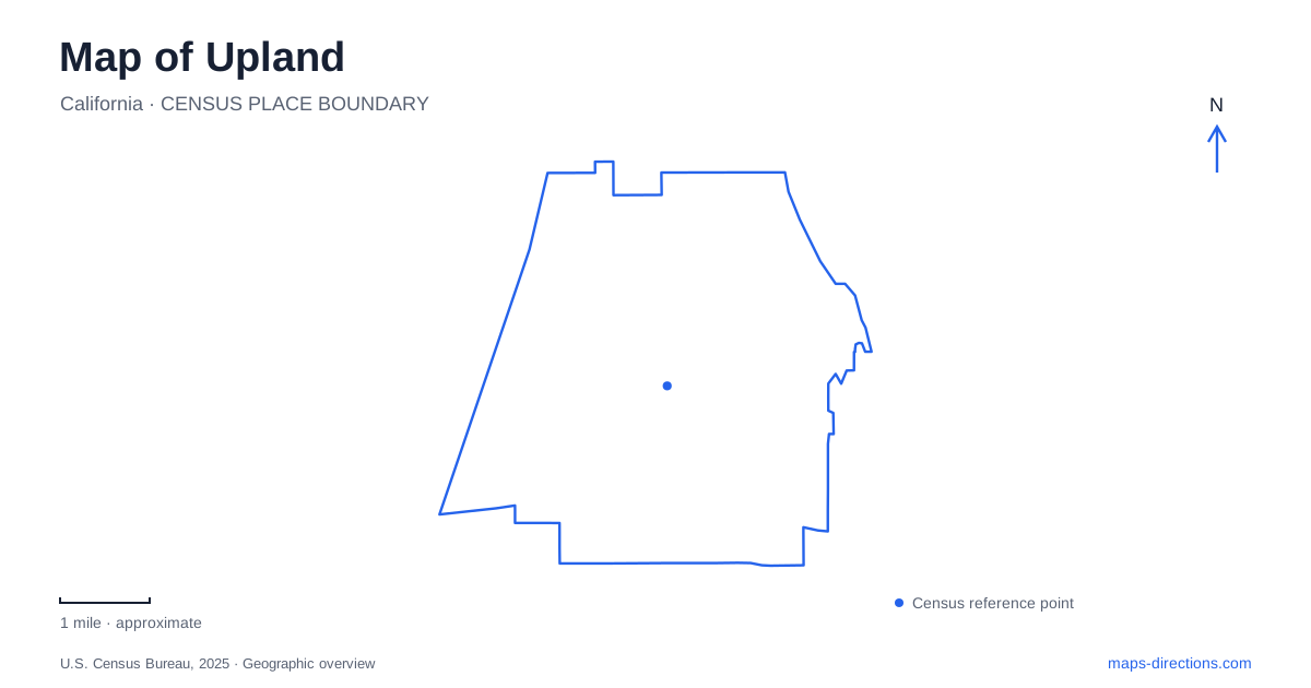
Street tiles load from OpenStreetMap when opened. The blue line shows the 2025 Census boundary.
- State
- California
- Population · July 2025
- 79,446
- Land area
- 15.6 sq mi
- Water area
- 0.0 sq mi
Upland's map is anchored by Euclid Avenue, the broad north-south boulevard laid out by the Chaffey brothers as part of their planned agricultural colony. The avenue connects the city with Ontario, while the historic downtown gathers smaller streets, shops, and the passenger rail station nearby. Farther north, parks and residential streets extend toward the San Gabriel foothills. Understanding the relationship between the broad avenue and the more compact downtown grid gives the city a clear spatial framework.
Euclid Avenue as an organizing line
At 200 feet wide, Euclid Avenue was designed on a scale that still distinguishes it from the surrounding streets. Its landscaped median and historic buildings make the corridor more than a route through town. The city's preservation records recognize the avenue itself as a historic resource, alongside individual buildings and several residential districts.
The Chaffey brothers' irrigation and land-development efforts helped establish the citrus economy that followed. The northern portion of the colony was also known as Magnolia and North Ontario before Upland incorporated in 1906. These earlier names help explain why the city's history is so closely tied to its southern neighbor and why Euclid remains such an important shared reference.
Two monuments add another historical layer along the boulevard. The Madonna of the Trail, dedicated in 1929, belongs to a nationwide series commemorating pioneer women. The local monument faces south rather than west. At Euclid and Arrow Highway, a Mission Bell recalls routes associated with the San Gabriel Mission. The two landmarks commemorate different journeys, even though both now occupy the same established urban corridor.
Downtown's rail edge and smaller blocks
The commercial downtown is organized around Second Avenue, including the blocks near A Street and Ninth Street. These intersections appear in the city's descriptions of markets and outdoor dining events, making them useful landmarks for understanding the district's pedestrian focus. Euclid provides the broad approach, while the smaller grid supports shorter movements between storefronts and gathering places.
Upland station stands at 300 East A Street on Metrolink's San Bernardino Line. Its location places regional passenger rail beside the historic center, rather than on a remote industrial fringe. The station is a practical reference for orienting the southern side of a downtown visit and understanding where the rail corridor meets the local street network.
The Cooper Regional History Museum is also on East A Street, at number 217. Its collections address the area's Indigenous history and the citrus industry. The proximity of the museum and station is fitting: railroads were essential to the shipment of lemons and oranges from the region. A map of these blocks therefore brings the contemporary rail service and the interpretation of earlier transportation history into the same small area.
Civic buildings and a second transportation corridor
The historic Carnegie Library stands at 123 East D Street, while the present public library is on North Euclid Avenue. The city's history also identifies D Street as the location of the fire station built in 1915, following a damaging downtown fire two years earlier. These civic addresses extend the historic landscape beyond the shops on Second Avenue.
The Pacific Electric Trail introduces another line through this part of Upland. City planning documents place it through the northern portion of the Euclid downtown district, with a signalized crossing of the broad avenue. The trail and the active passenger rail corridor are separate features. Seeing both on the map reveals how transportation routes from different periods continue to influence the layout of public space.
Historic districts add finer detail around these corridors. The city's register includes Old Town for its commercial fabric and such residential areas as Victorian Row, Old Magnolia, and the Arrow/Laurel Bungalow District. Their names point to different building patterns and periods, so the historic center is best understood as a collection of adjoining areas rather than one uniform architectural scene.
Foothill Boulevard and the park network
Memorial Park occupies 1100 East Foothill Boulevard between Campus and Grove avenues. Ballfields, a basketball court, playground space, and a rose garden share the grounds with the skate park and animal shelter. This mixture makes the park a substantial public destination along the east-west boulevard, with more varied activity than a simple roadside green space would suggest.
Other parks establish reference points farther across the residential map. Magnolia Park is on West 15th Street, Sierra Vista Park on East 15th Street, McCarthy Park on North San Antonio Avenue, and San Antonio Park on North Mountain Avenue. The last two names are easy to conflate, but their road locations show their distinct positions. Together with Euclid, the downtown blocks, and Foothill Boulevard, these public grounds help describe Upland at several scales: a planned regional avenue, a compact historic center, and a wider network of neighborhood destinations.
Map and statistics: U.S. Census Bureau, 2025 Gazetteer, January 2025 generalized place boundaries and Vintage 2025 population estimates. Local references: City of Upland; City of Upland Public Library; Metrolink; Cooper Regional History Museum. Article prepared by Maps & Directions.