Map of Twin Falls
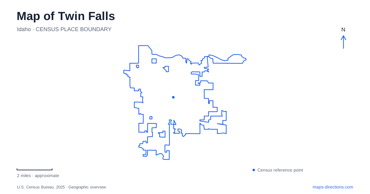
Street tiles load from OpenStreetMap when opened. The blue line shows the 2025 Census boundary.
- State
- Idaho
- Population · July 2025
- 56,216
- Land area
- 19.9 sq mi
- Water area
- 0.1 sq mi
Twin Falls sits above a landscape where height matters as much as direction. The Snake River runs through a deep canyon, while the city's northern streets and walking routes approach its rim. Perrine Bridge crosses the gap, Shoshone Falls occupies another reach of the river, and roads descend to recreation areas below. A map that shows these destinations close together can conceal the very different approaches required to reach them. Begin by identifying whether an outing stays on the rim, descends toward the river, or explores a lake within the canyon landscape.
The bridge as a northern gateway
Blue Lakes Boulevard gives Twin Falls a direct relationship with Perrine Bridge. The Idaho Transportation Department identifies the intersection with Pole Line Road as a gateway for traffic arriving from Interstate 84 across the bridge. This makes the road pair a useful first reference for understanding the city's northern approach and the transition from regional travel into the urban street network.
The present bridge opened in 1976, replacing an earlier crossing. Pedestrian walkways on both sides provide a way to experience the canyon's width and depth independently of a vehicle journey. A visitor center and parking area on the south side connect with canyon rim trails. The bridge thus serves three roles at once: a transportation crossing, a viewpoint, and a starting point for exploring the rim on foot.
East of the bridge, the south rim retains the earth ramp associated with Evel Knievel's unsuccessful 1974 canyon jump. That landmark helps orient the direction of travel along the canyon without treating every visible feature as a destination reached by the same road. The river below, the path along the edge, and the bridge deck occupy different levels of a single striking setting.
Shoshone Falls and its approach road
Shoshone Falls is the major waterfall destination associated with Twin Falls, but the city's name alone is not a sufficient navigation target for it. The municipal address is 4155 Shoshone Falls Grade Road. The grade road describes the approach into the park landscape, where viewing areas bring visitors close to the Snake River's drop through the basalt canyon.
The falls are 212 feet high, and their appearance changes with the river's flow. Snowmelt commonly makes spring the strongest viewing season. Irrigation diversions reduce summer flow, while fall can bring a much quieter scene. These changes are part of the river's agricultural and reservoir setting; a dramatic photograph taken in one season does not describe the waterfall on every visit.
The park's history also reflects a deliberate decision to preserve public access. Land donated in 1932 was to remain a public park, and an additional state donation followed the next year. Today, multiple viewing positions and the canyon rim trail allow different perspectives on the falls. The grade road may temporarily close in poor conditions, so the approach itself is an important part of planning a visit during winter weather.
Dierkes Lake beside the waterfall area
Dierkes Lake shares the general approach to Shoshone Falls, with its turnoff partway down the grade. This makes it geographically convenient to consider both places together, although the activities differ. The lake park provides picnic space, swimming facilities, and an unpaved trail around the water. The city acquired it in 1969, adding a recreation landscape to the larger canyon setting.
For Twin Falls visitors seeking a walk, the lake circuit offers a smaller-scale focus than the long rim corridor. Its 1.7-mile route follows the lake rather than simply continuing along the river's edge. Nonmotorized craft are allowed on the lake, making it a distinct paddling setting as well. A day organized around the lake can therefore include a waterfall viewpoint without making the two locations interchangeable.
Centennial Waterfront Park below the rim
Centennial Waterfront Park is reached by Canyon Springs Road. The county lists motorized and nonmotorized boat launches, natural trails, picnic shelters, and concessionaire watercraft activities there. Its position down in the canyon provides a different relationship with the river from the bridge and rim viewpoints above. The change is not merely one of scenery: water access, launch facilities, and riverside recreation become the purpose of the trip.
The county park address should be used for that outing, rather than the county parks office on Highland Avenue. Those two addresses appear together on the official information page but represent different destinations. Keeping Canyon Springs Road in the route makes the intended descent clear.
The most useful map of Twin Falls therefore separates four experiences: crossing the canyon at Perrine Bridge, viewing Shoshone Falls, circling Dierkes Lake, and reaching the river at Centennial Waterfront Park. Their shared landscape is the attraction, while their different elevations and approach roads explain how to explore it.
Map and statistics: U.S. Census Bureau, 2025 Gazetteer, January 2025 generalized place boundaries and Vintage 2025 population estimates. Local references: Idaho Transportation Department; Southern Idaho Tourism; Idaho Tourism; City of Twin Falls; Twin Falls County. Article prepared by Maps & Directions.