Map of Tustin
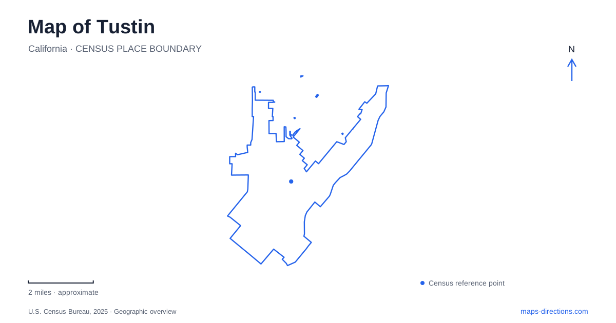
Street tiles load from OpenStreetMap when opened. The blue line shows the 2025 Census boundary.
- State
- California
- Population · July 2025
- 77,843
- Land area
- 11.1 sq mi
- Water area
- 0.0 sq mi
Tustin has several distinct landscapes within a relatively compact part of Orange County. Old Town preserves a street pattern and buildings associated with the nineteenth-century settlement. The former air station introduces a much larger scale of roads, development parcels, and military structures. Farther toward the hills, parks recall agricultural land and provide approaches to regional open space. These differences are the key to reading the map: an Old Town walk, a sports outing, and a canyon hike each belong to a different setting.
Main Street and El Camino Real
Old Town centers on Main Street and El Camino Real, where a group of historic buildings dates to the 1880s. The museum at 395 El Camino Real sits at their intersection. This is a useful place to begin understanding the older commercial community, whose businesses included a blacksmith, food shops, and feed suppliers alongside churches and schools.
The built history is more varied than one architectural period. The Stevens House dates to 1887 and uses redwood brought from Eureka, while the Leihy House is an early twentieth-century Craftsman bungalow. The Knights of Pythias Building combined social and commercial roles, with the first City Hall occupying a rear store. Such details make the streets worth reading building by building instead of treating the district as a single preserved scene.
The city's virtual walking tour identifies fourteen historic sites. A separate published tour map begins and ends at Cox Market Plaza, on the southeast corner of Main and El Camino Real. These small-scale references help reveal courtyards, older shop fronts, and surviving historical features that a broad road map leaves out. In this part of Tustin, the intersection and adjoining blocks are more informative than a route focused only on a large parking destination.
The air station's different scale
The former military airfield created a strikingly different landscape. Its two huge wooden hangars were designed and built during wartime in 1942, each extending more than 1,000 feet in length. Their dimensions explain why they became such dominant features in regional photographs and local descriptions.
Those older images now require care. The north hangar near Valencia Avenue and Armstrong Road was almost completely destroyed by fire in November 2023. It should not be presented as an intact companion to the south hangar. The surviving south structure stands near Warner Avenue and Tustin Ranch Road, and the city describes its future use as under evaluation rather than a routine public attraction.
The surrounding Legacy development is also an evolving place. The city describes current framework planning for the hangar core as a way of exploring potential uses, rather than a final development plan. On a map, this means the area's historical identity, existing public destinations, and proposed future spaces need to be read separately. A concept illustration is useful for understanding ambitions, but it does not establish that a new park or venue is already open.
Valencia Avenue's sports landscape
Veterans Sports Park at 1645 Valencia Avenue supplies a substantial existing public destination within the former air-station area. Its grounds cover more than 32 acres and combine fields, courts, a skate park, playground, walking trail, and veterans memorial features. The mix of memorial space and active recreation makes it more than simply a collection of playing fields.
The name can be confused with Tustin Sports Park at 12850 Robinson Drive, which is a separate municipal facility. The street address is especially useful when a team schedule or event notice abbreviates the venue. Valencia Avenue belongs to the Legacy setting; Robinson Drive identifies a different recreation location. Keeping that distinction clear avoids combining two unrelated park layouts into one mental picture.
An orchard park and the canyon beyond
Citrus Ranch Park at 2910 Portola Parkway introduces another kind of open space. Its 16.9 acres include a lemon-tree orchard, walking and nature trails, picnic facilities, and a hilltop gazebo. The orchard gives the grounds an agricultural character, while the climb toward the gazebo changes the viewpoint from lawn-level recreation to the surrounding landscape.
Peters Canyon Regional Park is a larger county-managed destination beyond these neighborhood parks. Its principal published address is 8548 East Canyon View Avenue in Orange. The county trail map marks both a northern entrance and a southern entrance, with routes such as Peters Canyon Trail, East Ridge View Trail, and North Loop Trail forming different ways through the terrain.
The regional park's history reaches back to Rancho Lomas de Santiago and later farming, including land leased to James Peters. Its creek, native vegetation, and trail network provide a broader landscape context for the developed neighborhoods nearby. Seen together, the Old Town blocks, air-station district, orchard park, and canyon approaches show Tustin as a place shaped by successive land uses, with each layer still influencing how people move through it.
Map and statistics: U.S. Census Bureau, 2025 Gazetteer, January 2025 generalized place boundaries and Vintage 2025 population estimates. Local references: City of Tustin; OC Parks. Article prepared by Maps & Directions.