Map of Tulare
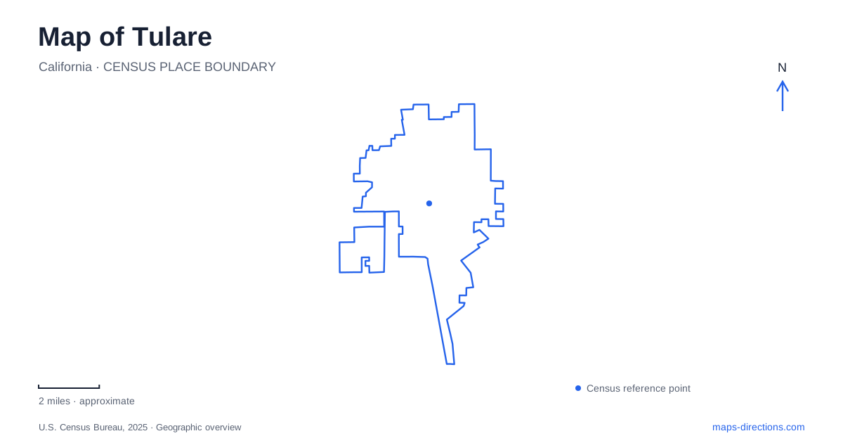
Street tiles load from OpenStreetMap when opened. The blue line shows the 2025 Census boundary.
- State
- California
- Population · July 2025
- 73,907
- Land area
- 20.7 sq mi
- Water area
- 0.1 sq mi
Tulare is a San Joaquin Valley city whose map brings together railroad history, agricultural exhibition grounds, and a surprisingly substantial cross-city recreation trail. Highway 99 provides the regional approach, while local streets lead to destinations with very different scales: a museum building, a downtown performance park, a lake-centered community park, and the expansive International Agri-Center. Understanding those differences helps explain why the city cannot be reduced to a freeway stop or to its best-known annual trade show.
History on the west side of the central avenue
The historical museum occupies 444 West Tulare Avenue, on the site of the former Central School. The reuse of that location gives the museum a connection to local education before a visitor even enters its exhibits. Inside, the subjects range from the Yokuts people to the settlement founded by the Southern Pacific Railroad. Recreated domestic and commercial interiors help show the scale of everyday life before the modern city developed around its present road network.
The collections also connect local people with much wider events. Olympic decathlon champion Bob Mathias is represented by medals and other career material, while Admiral Elmo R. Zumwalt Jr. supplies a military and public-service connection. The Heritage Art Gallery adds changing work by local artists. These are complementary reasons to visit: the building preserves historical material but also functions as a setting for contemporary community culture.
That combination makes the museum useful at the beginning of an exploration. Railroad origins and agricultural development provide context for the transportation corridors and large exhibition facilities visible elsewhere on the map, rather than remaining isolated dates in a display case.
An avenue connecting different kinds of gathering space
Zumwalt Park stands at 455 East Tulare Avenue, placing it on the east-addressed portion of the same avenue as the museum. It reopened after a full redevelopment in 2025. The Adventist Health Amphitheater is the major new feature, with a main stage and tiered seating, while the surrounding park includes play structures, a splash pad, a gazebo, and green space.
This pairing of museum and performance park makes the central avenue a useful organizing line. One site interprets the past indoors; the other accommodates public recreation and live events outdoors. The amphitheater's name can appear separately from the park name in event information, although both refer to this downtown setting. A concert visit also uses the space differently from an ordinary afternoon in the park, so the event's seating arrangement matters more than the general park outline.
The Santa Fe corridor across town
The Santa Fe Trail gives Tulare a long linear recreation feature rather than another enclosed park. The city describes a five-mile lighted route extending from Prosperity Avenue at the eastern end to Inyo Avenue at the western end. Benches, drinking fountains, and a horse trail are among the listed features.
A linear route changes the way distance should be read. A short outing can cover only one section, while traversing the full corridor is a separate undertaking. Prosperity and Inyo identify the broad ends; they are more useful for understanding its extent than treating the municipal listing at North M Street as the entire destination. The trail's sweep across town also offers a different view of the street pattern from the north-south regional journey on Highway 99.
Laspina Street: recreation and agricultural enterprise
Del Lago Community Park sits at 1700 North Laspina Street. Its lake, walking paths, picnic shelters, basketball facilities, and lighted tennis courts make it a multipurpose neighborhood gathering place. The city lists 1.35 miles of lighted walking paths, a much more contained walking setting than the cross-city trail. Here, the lake and recreation areas supply the focus of an outing within one park.
South Laspina Street leads to a very different destination: the International Agri-Center at number 4500. This is the home of World Ag Expo, a large agricultural trade exhibition with equipment displays and educational programming. Its proximity to Highway 99 places it in the regional farming and business network connecting Fresno and Bakersfield. The contrast along the street name is instructive: a community park and an agricultural exhibition campus share Laspina as an address reference but occupy different parts of town and serve different purposes.
Keeping the county landscape in perspective
Mooney Grove Park belongs to the wider area, at the south end of neighboring Visalia. The county-operated grounds include a pond, historic resources, and museum collections, providing another way to explore the valley's agricultural and social history. It should be understood as a separate regional excursion rather than folded into the downtown cluster.
A useful map of Tulare therefore holds several scales together: central civic destinations, a long urban trail, local recreation around Del Lago, and agricultural activity beside the freeway. Choosing among those settings gives an outing a clear purpose while retaining the relationships that make this particular valley city distinctive.
Map and statistics: U.S. Census Bureau, 2025 Gazetteer, January 2025 generalized place boundaries and Vintage 2025 population estimates. Local references: Tulare Historical Museum; City of Tulare; World Ag Expo; Tulare County Parks. Article prepared by Maps & Directions.