Map of Topeka
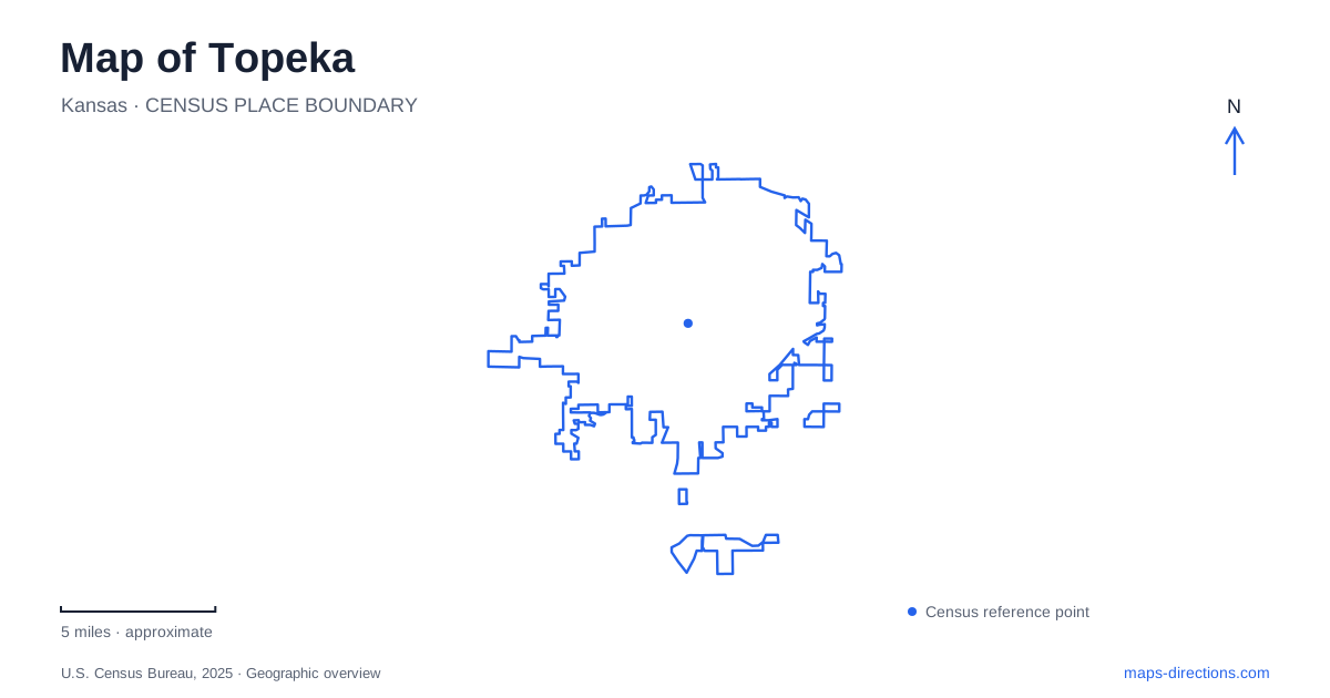
Street tiles load from OpenStreetMap when opened. The blue line shows the 2025 Census boundary.
- State
- Kansas
- Population · July 2025
- 125,795
- Land area
- 61.9 sq mi
- Water area
- 1.3 sq mi
Topeka has a civic center, a river-linked arts district, and substantial park landscapes that each require a different map scale. The Capitol can be located by a specific downtown approach street; NOTO is understood through several historic commercial blocks; Lake Shawnee is a much larger landscape with destinations distributed around the shore. The Kansas River helps explain how the northern district developed, while Kansas Avenue provides a recurring street reference on both sides of that history.
The Capitol approach and Kansas Avenue
The Kansas State Capitol visitor entrance is on Eighth Avenue, at the ground level of the north wing. The Kansas Historical Society identifies this as the entrance for all visitors. That is more useful for arrival than the building's dome or the center of its grounds. The underground garage is also associated with Eighth Avenue, between Harrison and Van Buren streets, reinforcing the importance of the north side of the complex.
South Kansas Avenue is another downtown reference. The city's welcome center is at 719 South Kansas Avenue, placing visitor information within the commercial street network. A central Topeka outing can therefore use two distinct anchors: the Capitol's Eighth Avenue approach and the Kansas Avenue corridor. One relates to a government building and its grounds, while the other helps orient a visit among downtown businesses.
The street names are worth preserving in a written plan. Eighth Avenue, Harrison, Van Buren, and South Kansas Avenue describe a small, understandable part of the downtown grid. They provide more actionable geography than a general label such as “Capitol area,” particularly when deciding how a building visit fits with other stops in the center.
NOTO and the history of a shifted crossing
The 800 and 900 blocks of North Kansas Avenue formed a substantial retail and service center during the 1940s and early 1950s. The district organization recounts how the 1951 Kansas River flood damaged businesses, followed by the 1965 collapse of the Kansas Avenue bridge. A replacement bridge was built one block east, changing the relationship between the old commercial street and cross-river travel.
That history helps explain the geography of NOTO today. The arts district occupies older commercial buildings that have been adapted for galleries, studios, restaurants, and shops. Its historic street frontage is a destination in its own right, rather than simply a continuation of a major bridge approach. This is a useful distinction when following North Kansas Avenue on a map.
Public space also works at a small scale here. Breezeway Park connects Veterans Park with Kansas Avenue around the middle of the 800 block. Murals, sculptures, and other artwork turn a passage into part of the district's experience. For a map of Topeka, NOTO adds a lesson in how changing transportation connections and reused buildings can shape a neighborhood long after the original commercial pattern was established.
Gage Park as a shared destination landscape
Gage Park brings several major attractions into one 160-acre setting. The county identifies a two-mile fitness loop, the zoo, the Kansas Children's Discovery Center, Helen Hocker Theater, and the Reinisch Rose Garden among its features. A miniature train and carousel add further reasons the park appears in family itineraries.
The shared park setting matters because these are individually named destinations within a larger public landscape. A theater visit is not the same activity as following the loop or visiting the rose garden, even though all belong to Gage Park. Reading the park's internal features allows a visitor to group compatible stops without losing the identity of the particular attraction.
Gage Park gives Topeka a concentrated recreation setting that differs from the street-based arts district. The relationship among lawns, paths, gardens, and institutions is more useful here than the commercial-block framework used in NOTO. Both are coherent districts for an outing, but they are organized in different ways.
Lake Shawnee and the west-shore gardens
Lake Shawnee was constructed as a Works Progress Administration project, beginning in 1935 and opening in 1939. Its recreation landscape includes sports facilities, camping, boating, gardens, and a trail around the lake. The county describes that trail as 6.8 miles long, connecting amenities within the approximately 1,100-acre park.
Ted Ensley Gardens occupies the west side of the lake, with its address on Southeast West Edge Road. The garden landscape includes paved walking paths, an arboretum, and designed spaces such as water and rock gardens. The shore relationship is the most useful map fact: this is a particular garden destination within the larger lake park, not an alternative name for the entire recreation area.
Lake Shawnee expands a map of Topeka beyond a collection of downtown landmarks. Its shore creates a circuit, while the gardens and sports facilities form distinct stops around that circuit. Understanding that arrangement helps a visitor choose between a garden walk, a longer trail outing, and an activity at a specific facility, each grounded in the same lake landscape.
Map and statistics: U.S. Census Bureau, 2025 Gazetteer, January 2025 generalized place boundaries and Vintage 2025 population estimates. Local references: Kansas Historical Society; Visit Topeka; NOTO Arts and Entertainment District; Shawnee County Parks and Recreation. Article prepared by Maps & Directions.