Map of Tooele
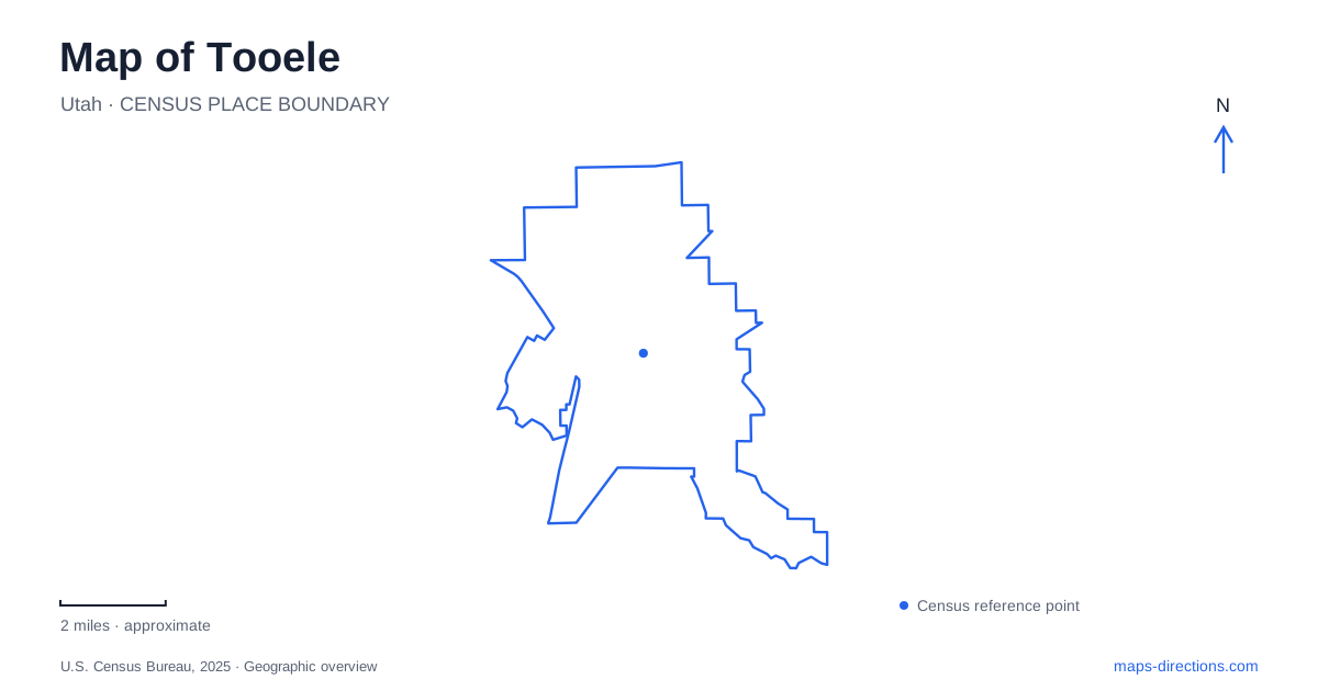
Street tiles load from OpenStreetMap when opened. The blue line shows the 2025 Census boundary.
- State
- Utah
- Population · July 2025
- 42,270
- Land area
- 24.2 sq mi
- Water area
- 0.0 sq mi
Tooele stands on the western side of the Oquirrh Mountains, where the valley floor, mountain canyons and industrial history meet. A map can make the street grid look straightforward, yet the surrounding slopes explain much of the city's development. Canyon water supported settlement, a railway connected town with a smelter, and Broadway became the commercial street of an immigrant neighborhood. These relationships offer a more revealing introduction than treating the city as simply a stop on the way to the wider desert county.
Reading the slope beneath the streets
Utah Geological Survey describes the city's ground as a gently sloping surface formed from adjoining alluvial fans. Ancient Lake Bonneville later modified the lower land through deposition and erosion. Its former shoreline creates a noticeable change in slope along the southern side of town. The landscape therefore contains evidence of both material carried out of the mountains and a much larger prehistoric lake.
Middle Canyon Creek cuts into the older surface on its way toward that shoreline. Settlement Canyon Creek follows the foothills before reaching the valley and passing through the southeastern part of the city. In Tooele, these are useful distinctions between two canyon systems that can appear close together on a regional map. Each has its own drainage path and relationship with the urban edge, rather than being interchangeable entrances into the same mountain landscape.
Vine Street once carried trains
The preserved railway museum at 35 North Broadway occupies the former valley railway station. The city identifies Engine 11 as a locomotive that carried people and ore along Vine Street in connection with the International Smelting and Refining Company. For decades, rail movement was part of the street itself, tying the residential and commercial town to a larger industrial operation.
That history changes how Vine Street reads today. The route was not only a local east-west connection; it carried the movement of materials and workers associated with smelting. The surviving station and locomotive provide tangible evidence of that relationship after the wider railway operation disappeared. They help explain why a museum collection in Tooele belongs within an ordinary street setting rather than at a distant industrial site.
The city's own historical interpretation emphasizes the immigrants and migrants whose different backgrounds contributed to this community. The machinery is therefore an entry into the history of people and neighborhoods, as well as a record of how freight moved through the valley.
Broadway and the older civic corner
New Town developed to house workers arriving for the smelter during the early twentieth century. Broadway became its commercial center, with businesses such as grocers, bakeries, hotels and barbershops. Greek, Italian and Croatian were among the languages heard in the neighborhood. The area's identity records the arrival of an industrial workforce within a place that had previously been strongly agricultural.
Main and Vine streets mark another historical focus. Pioneer Plaza occupies the northeastern corner and includes the old city hall and Carnegie library, later joined by an annex. The red-sandstone civic building dates to 1867 and served both county and city government. The library opened in 1911. Comparing this civic cluster with Broadway gives Tooele two complementary historical centers: institutions associated with the older town and a neighborhood shaped by industrial migration.
Canyon water and public responsibility
Water history also connects the mountain setting with the street grid. The Utah State Archives preserves records of the city's water company from 1890 to 1915, including agreements involving the Settlement Canyon and Oquirrh Canyon irrigation companies. The collection documents the transfer of the water company's property to municipal ownership in 1915.
These records show why canyon names recur in local infrastructure history. The mountain drainages were sources whose use, distribution and ownership required organized arrangements. A map that follows only roads misses those less visible connections between upland water and town development. The canyon landscape supported everyday urban life as well as providing the scenery visible beyond the buildings.
Settlement Canyon as recreation and remembrance
The county manages camping and day use in Settlement Canyon, while Middle Canyon has a separate seasonal opening dependent on road conditions. Those management differences reinforce the fact that the canyons are distinct destinations. The transition from city streets to canyon recreation is also a transition into a more seasonal setting.
At the mouth of Settlement Canyon, Pioneer Memorial Gardens commemorates early graves that had been moved away from State Route 36 after repeated disturbance by construction. A new monument was dedicated in July 2000 through a community preservation effort. Including this small site beside the canyon and downtown institutions gives a map of Tooele a fuller story: physical geography, industrial movement, water supply and the deliberate preservation of memory all shaped the places that remain visible today.
Map and statistics: U.S. Census Bureau, 2025 Gazetteer, January 2025 generalized place boundaries and Vintage 2025 population estimates. Local references: Utah Geological Survey; Tooele City; Tooele Valley Museum; Utah Division of Archives; Tooele County Parks and Recreation; Tooele County Tourism. Article prepared by Maps & Directions.