Map of Toledo
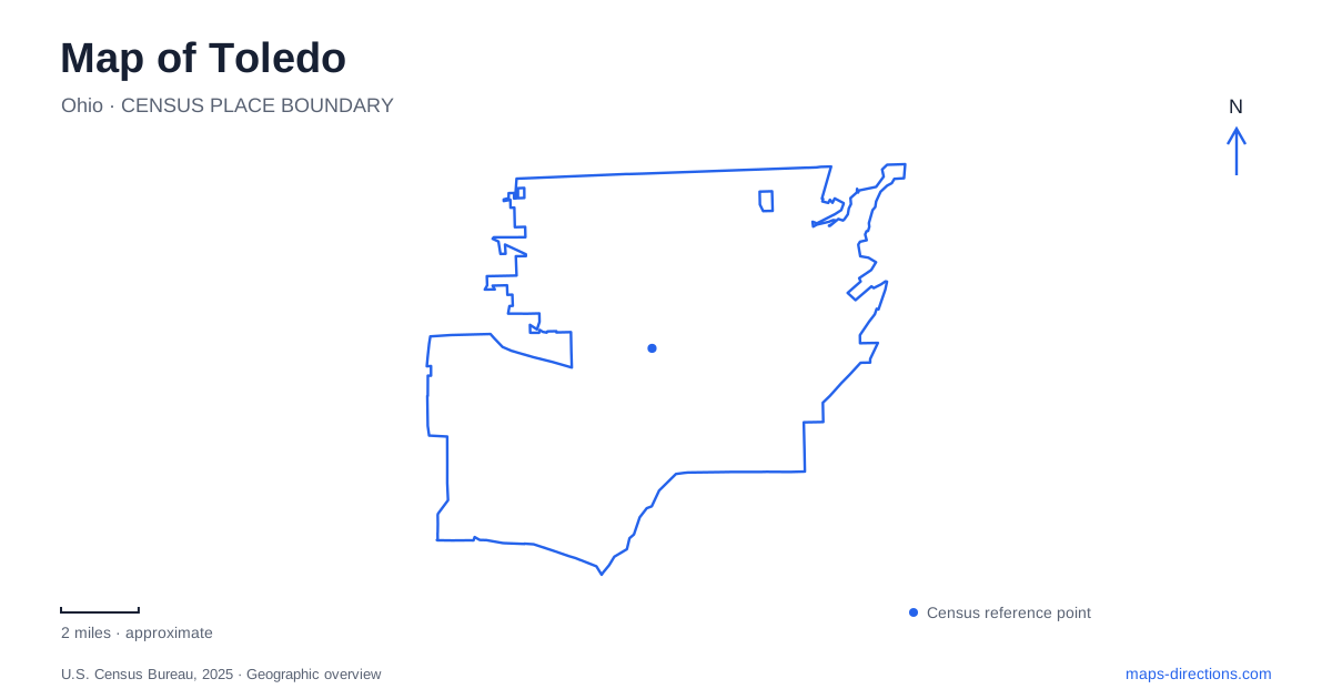
Street tiles load from OpenStreetMap when opened. The blue line shows the 2025 Census boundary.
- State
- Ohio
- Population · July 2025
- 263,423
- Land area
- 80.5 sq mi
- Water area
- 3.3 sq mi
Toledo's central landscape follows the Maumee River, where downtown buildings, bridges, former industrial sites and museum ships share the same broad waterway. The river gives the map both a dividing line and a common focus. A park facing the skyline may be across the water from downtown, while another riverfront destination sits beneath a bridge approach on the downtown side. Farther inland, Monroe Street leads to an art campus whose glass architecture supplies a different expression of the city's industrial and cultural identity.
Two banks, several kinds of waterfront
The Glass City Riverwalk plans give the riverfront of Toledo a framework extending along both banks. Metroparks describes an overall ambition of 300 acres of green space. That project boundary explains a long-term vision rather than serving as a complete walking itinerary. Use the park system's visitor maps to identify available paths, entrances and crossings within the larger riverfront landscape.
Glass City Metropark and Middlegrounds are two established anchors in that larger picture. The former faces downtown from the Front Street side, while the latter occupies reclaimed land along the downtown bank. Their locations encourage a view of the Maumee as a shared public landscape, though moving between banks still depends on the bridges. The Martin Luther King Bridge on Cherry Street and the high-level Anthony Wayne Bridge illustrate the wider loop formed by the crossings; Metroparks has used those links for walks between the two parks.
Front Street and the former steelworks
Glass City Metropark has several named arrivals along Front Street. The enrichment center is at 815, the pavilion entrance at 1001, and the Market Hall entrance at 1505. Around Market Hall are The Ribbon, marina and play areas, including the Mini-Maumee water feature. These addresses reflect a park stretched along the river rather than a single compact square.
Its industrial past remains visible in objects recovered from the site. Large slag ladles from the nineteenth-century Maumee Rolling Mills have become a sculptural planting feature. The Beacon Tower also refers to the area's industrial structures through its steel frame, while colored elements evoke trees, sunlight, sky and water. This makes the park a useful place to understand how Toledo has reused working waterfront land: recreational spaces occupy the same geographic corridor once shaped by manufacturing.
Mini-Maumee is a seasonal water-play facility with its own operating arrangements. Its presence on the map describes a facility, not a guarantee that water is running throughout the year.
Middlegrounds and the land below the bridge
Middlegrounds occupies 28 acres with about half a mile of river frontage. Its Ottawa Street entrance is at the base of the Anthony Wayne Bridge. A walking and cycling path, kayak cove and river overlooks fit into a site whose shape is strongly influenced by the water and bridge infrastructure.
The reclamation required removal of thousands of tons of debris. A stormwater system now collects runoff from the adjacent bridge and filters it through planted channels before it reaches the river. The green spaces therefore do environmental work as well as providing places to sit or walk. Near the southern end, old stone remains were adapted into an overlook, retaining a physical trace of earlier riverfront activity. The roundhouse-shaped shelter offers another reminder of the transportation history associated with the property.
Maritime history beside an active river
The National Museum of the Great Lakes stands at 1701 Front Street on the same general bank as Glass City Metropark. Its indoor exhibits interpret the freshwater shipping system, while the Col. James M. Schoonmaker museum ship and Museum Tug Ohio add full-size examples outside. The vessels have a seasonal visiting schedule, separate from the indoor museum's year-round role.
This location places maritime history directly beside the Maumee rather than in an isolated exhibition setting. For a map of Toledo, the museum provides a concrete connection between local waterfront geography and the much larger Great Lakes network. Front Street serves both park recreation and historical interpretation, making the east-bank corridor more varied than its park labels alone suggest.
Monroe Street's architectural campus
The Toledo Museum of Art is at 2445 Monroe Street, with its Glass Pavilion across the road at 2444. The main Green Building dates to 1912, the Peristyle concert hall opened in 1933, and the SANAA-designed Glass Pavilion opened in 2006. The campus thus places buildings from several periods within one walkable setting.
The pavilion houses glass art and working studio activity, linking displays with the process of making the material. Current museum renovations affect some galleries while other spaces, including the pavilion and sculpture garden, remain available. Monroe Street is the organizing feature for this visit: the cultural campus extends across it, and the architectural contrast between its buildings is part of the experience as much as the collections inside.
Map and statistics: U.S. Census Bureau, 2025 Gazetteer, January 2025 generalized place boundaries and Vintage 2025 population estimates. Local references: Metroparks Toledo; National Museum of the Great Lakes; Toledo Museum of Art. Article prepared by Maps & Directions.