Map of Titusville
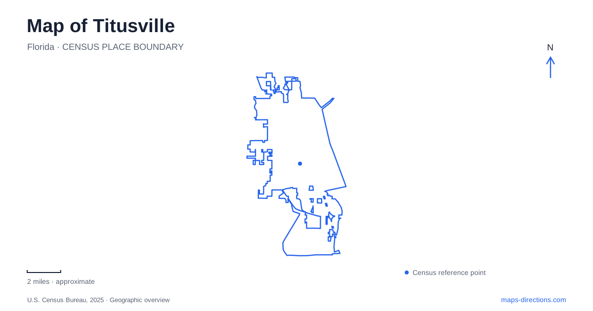
Street tiles load from OpenStreetMap when opened. The blue line shows the 2025 Census boundary.
- State
- Florida
- Population · July 2025
- 49,800
- Land area
- 29.2 sq mi
- Water area
- 5.0 sq mi
Titusville faces the Indian River Lagoon, with downtown streets and parks on the mainland and a much broader landscape of refuge, space facilities, and barrier coast to the east. That distinction is the starting point for reading the area. The downtown waterfront is not the Atlantic beach, and a view toward a launch site is different from a road journey to a visitor facility. Washington Avenue, Garden Street, and the A. Max Brewer crossing provide practical reference points for moving between these settings.
Washington Avenue connects several local stories
The 1891 Pritchard House stands at 424 South Washington Avenue. Its preservation and appointment-based tours offer a way to examine domestic history within the downtown area. This is a different historical scale from the space program: a particular house, its architecture, and the lives associated with it. The address also helps locate the southern part of a downtown visit.
Farther north, Sand Point Park is at 101 North Washington Avenue. The sequence along Washington therefore connects an older residential landmark with a substantial lagoon-front public park. In between, the downtown street network includes Main, Julia, and South streets. These short blocks provide a local framework that remains useful even when the larger purpose of a trip to Titusville is a launch, a refuge drive, or a beach outing.
Space View Park also manages stormwater
Space View Park occupies the downtown area between Washington Avenue and Indian River Avenue. Its space memorials honor astronauts and the people who worked behind the scenes, connecting the waterfront view with the human history of space exploration. Mission insignia and astronaut handprints make the commemorative landscape more detailed than a simple viewing lawn.
The park also performs an environmental function. The city explains that its detention pond receives runoff from surrounding commercial property, allowing sediment and floating debris to be captured before water reaches the lagoon. Aeration and treatment help improve the water before discharge. Reading the pond as part of this system adds another layer to the map: a public landscape can combine memorial space, recreation, and urban water management in the same location.
Sand Point's shoreline and memorial plaza
Sand Point Park offers a broader recreation setting, with a paved bicycle route, exercise trail, playground, picnic areas, and a boat ramp. Its Astronaut Memorial Plaza stands near the southern part of the park and commemorates the Apollo, Challenger, and Columbia crews. The memorial and the everyday recreation facilities share the same shoreline landscape.
The lagoon is the unifying feature of this part of Titusville. A walk through the park can remain a local activity even when the view stretches toward the space coast's larger facilities. The boat ramp and shoreline fishing areas also show that this waterfront supports uses beyond launch viewing. Treating the park as a complete community space makes a visit less dependent on one scheduled event.
Crossing toward the wildlife refuge
The A. Max Brewer Memorial Parkway carries the eastward route toward Merritt Island National Wildlife Refuge. Federal refuge documentation places the headquarters area about five miles east of town along the State Road 406 and 402 approach. The visitor center's listed address is 1963 Refuge Headquarters Road, a more useful destination for orientation than the name of the entire refuge.
Black Point Wildlife Drive is another distinct destination. The refuge describes a seven-mile, one-way route through saltwater and freshwater marshes, with numbered stops explaining natural history and management. It is designed for slow observation rather than a direct shortcut across the area. A map of Titusville and its surroundings should therefore distinguish the main access roads, the visitor-center turn, and this separate wildlife circuit.
Continuing to the Atlantic coast
Playalinda Beach is the southern access district of Canaveral National Seashore. The National Park Service directs visitors from Interstate 95 exit 220 east along the Garden Street approach toward the park. The seashore's Apollo access is much farther north at New Smyrna Beach, while its administrative mailing address is downtown on South Washington Avenue. Those locations serve different purposes and should not be substituted for one another.
The national seashore protects a barrier-island landscape of dunes, coastal hammocks, and Mosquito Lagoon. That setting contrasts with the developed mainland frontage. Launch operations can also affect access to the Playalinda district, as park notices demonstrate. Planning the beach as a separate excursion makes room for those operational differences. Taken together, the historic streets, lagoon parks, marsh drive, and Atlantic shore explain Titusville as a gateway between several landscapes, each with its own roads, institutions, and ways of experiencing the water.
Map and statistics: U.S. Census Bureau, 2025 Gazetteer, January 2025 generalized place boundaries and Vintage 2025 population estimates. Local references: North Brevard Heritage Foundation; City of Titusville; Brevard County; US Fish and Wildlife Service; National Park Service. Article prepared by Maps & Directions.