Map of Tigard
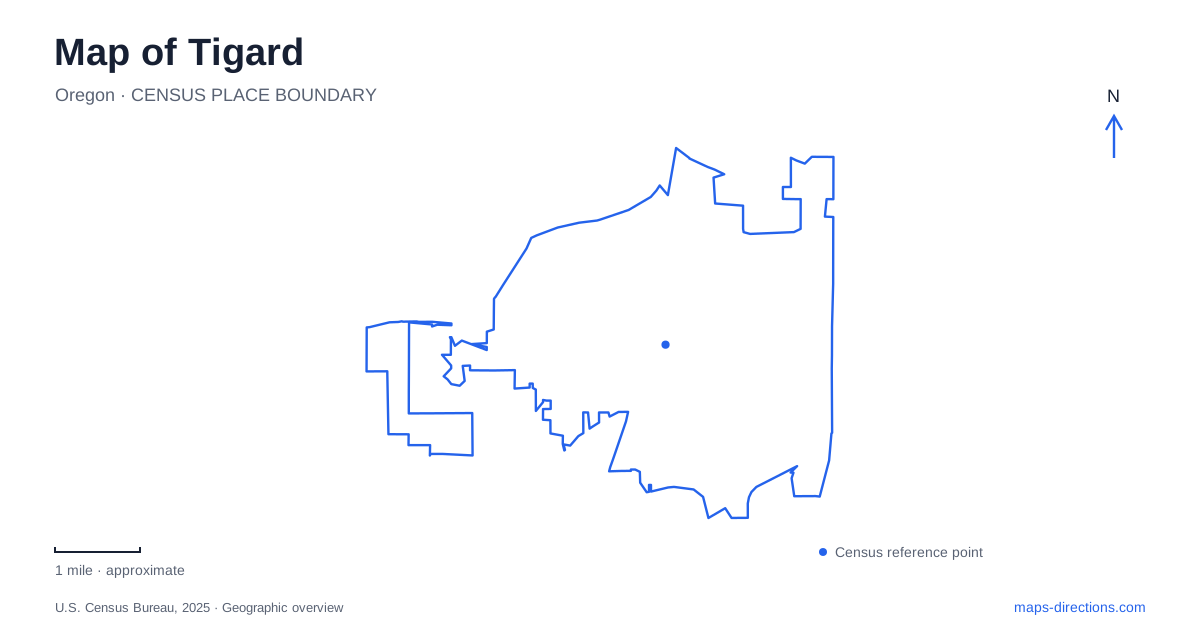
Street tiles load from OpenStreetMap when opened. The blue line shows the 2025 Census boundary.
- State
- Oregon
- Population · July 2025
- 57,929
- Land area
- 12.8 sq mi
- Water area
- 0.0 sq mi
Tigard has a downtown shaped by a creek, a railroad and a main street rather than a broad rectangular business grid. Main Street supplies the familiar storefront setting, while Fanno Creek threads through green space close to the commercial center. Southwest Commercial Street brings buses and commuter rail into this compact area. These three lines explain much of the central city's arrangement: shopping follows the street, regional travel follows the tracks, and walking routes follow the water through land that buildings have largely left open.
Main Street and the Burnham Street gathering place
Historic Main Street is a useful starting point for exploring Tigard because it concentrates shops and places to eat beside access to the local trail system. The city highlights decorative glass baskets incorporated into two gateway sculptures along the street. Such details give this commercial strip an identity different from a highway shopping corridor: the interest is in a sequence of individual storefronts and small public spaces, rather than a single enclosed shopping destination.
Universal Plaza adds a larger gathering space at 9100 Burnham Street. Its combination of food carts, picnic space, a splash pad and a nature trail puts several kinds of activity around one address. A family can use the plaza as a pause between the more enclosed storefront environment and the creekside landscape. The water play feature is one part of the plaza, so a map search for the splash pad and one for the plaza may describe the same outing from different perspectives.
Burnham Street also matters because the Fanno Creek route has connections toward it through Ash Avenue and the City Hall area. This gives the downtown more than one pedestrian approach to its green space. A walk need not consist only of going up Main Street and retracing the same blocks; the relationship between the plaza, side streets and creek is worth examining before choosing a circuit.
Following the creek through the center
The Fanno Creek Trail reveals a different side of Tigard. Between Tiedeman Avenue and Grant Avenue, the route passes through Woodard Park, where Fanno Creek and Derry Dell Creek share a landscape of trees and open ground. The continuation toward Main Street uses an underpass beneath Pacific Highway. That crossing is especially important geographically: the busy road and the stream corridor intersect, but trail users have a route beneath the roadway.
From Main Street toward Hall Boulevard, Fanno Creek Park provides grassy areas, wooded wetlands, bridges and boardwalks. The library area lies along this sequence, and the Hall Boulevard crossing uses a flashing pedestrian beacon. These features make the corridor a chain of different spaces rather than an uninterrupted strip of identical parkland. Open lawns, enclosed vegetation and street crossings each form a distinct part of the walk.
The regional trail remains a developing network. In particular, the city identifies a future connection between Bonita Road and Durham Road. A regional trail label therefore should not be read as a promise that every proposed segment already joins the next.
Forest and tributaries at Dirksen
Dirksen Nature Park gives Tigard a substantial natural landscape away from the storefronts. The city lists the park at 11130 SW Tiedeman Avenue, with Fowler Middle School along its southern side. Fanno Creek and Summer Creek both pass through the property. Their presence explains the mixture of wetlands, mature forest and open ground more clearly than the park's acreage alone.
The nature play areas draw on that setting. Log climbers, a rock cave and a living willow tunnel provide a different experience from conventional metal play equipment. A smaller area uses beaver habitat as its theme, including poles for building a lodge. The education center and wildlife viewing opportunities extend the same idea: the landscape itself supplies much of the activity.
The city acquired the property in 2010 and named it for former mayor Craig Dirksen, who supported acquiring parkland and open space. That relatively recent public history sits beside a much older creek environment. It also helps explain why a developed recreational area and habitat conservation occupy the same site.
A downtown rail connection
The Tigard Transit Center stands at 8960 SW Commercial Street, south of Main Street. TriMet's WES commuter trains connect this stop with Beaverton, Tualatin and Wilsonville. At Beaverton, passengers can transfer to MAX, which makes the downtown station part of a wider regional journey rather than an isolated local rail stop.
WES is a weekday commuter service concentrated in morning and afternoon periods. Its presence on the map should therefore be paired with a timetable when planning a leisure visit. The center also has bus connections and bicycle parking. For an arrival by transit, Main Street, Burnham Street and the creek corridor provide a much more useful first set of landmarks than the full spread of the surrounding suburbs.
Map and statistics: U.S. Census Bureau, 2025 Gazetteer, January 2025 generalized place boundaries and Vintage 2025 population estimates. Local references: City of Tigard; TriMet. Article prepared by Maps & Directions.