Map of Terre Haute
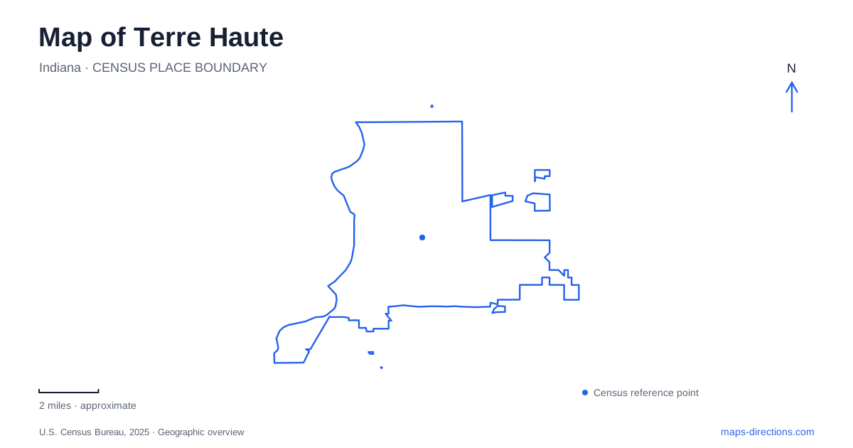
Street tiles load from OpenStreetMap when opened. The blue line shows the 2025 Census boundary.
- State
- Indiana
- Population · July 2025
- 58,764
- Land area
- 34.8 sq mi
- Water area
- 0.4 sq mi
Terre Haute has two strong geographic reference lines: Wabash Avenue through downtown and the Wabash River along the city's western side. Their shared name can make them sound interchangeable, but they describe different experiences. The avenue gathers commercial architecture, public art, and museums. The river opens onto parkland, water access, and a wider wetland landscape. Examining the streets between them reveals how the urban center relates to its natural setting.
Wabash Avenue and the downtown cross streets
Crossroads of America Plaza, at 643 Wabash Avenue, is a useful downtown starting point. The visitor bureau's walking tour identifies the Crossroads sign, a transportation-history marker, the Wabash Valley Musicians Mural, and a brick piano honoring the area's musicians. Together, these features give a small public space several layers of local meaning.
From the plaza, the tour follows Wabash east to Seventh Street before turning south. That simple change of direction introduces a downtown organized around intersecting corridors rather than one continuous pedestrian precinct. The numbered street becomes a route through older commercial buildings and cultural destinations, while Wabash remains the broader east-west reference.
The historic downtown tour also identifies the twelve-story Sycamore Building, completed in 1921. Its height distinguishes it within the surrounding streetscape. For someone learning Terre Haute, this kind of visible landmark can be more memorable than a series of turn instructions: it helps connect the map's blocks with the skyline seen from the sidewalk.
American art on South Seventh Street
The Swope Art Museum is at 25 South Seventh Street. Its downtown placement makes art part of the same street experience as the older commercial architecture, rather than a separate campus on the city's outskirts. The museum's visitor information describes public programs, studio activities, and opportunities to use the collection for learning.
A museum visit also changes the pace of a downtown outing. The plaza and street architecture are experienced while moving between blocks; galleries invite a longer pause. Because the Swope sits on the Seventh Street corridor, visitors can organize a walk around that pause instead of repeatedly returning to a vehicle between nearby stops.
The relationship is especially useful when reading Terre Haute at neighborhood scale. Wabash Avenue establishes the starting axis, Seventh Street carries the route south, and the museum supplies a specific destination within that sequence. This is a compact arrangement of public space, commerce, and culture, with individual building addresses doing more explanatory work than a broad downtown label.
Fairbanks Park follows the riverbank
Fairbanks Park lies south of downtown along the Wabash. The city's park map shows Dresser Drive serving the grounds, with First Street and Oak Street providing additional references. Within the park, the River Walk Trail follows the waterfront rather than the pattern of the downtown blocks.
The mapped features include an amphitheater, fishing pier, boat docks, picnic shelters, and the Chauncey Rose Memorial Plaza. The Paul Dresser Memorial Birthplace adds another connection to local cultural history. These facilities make the riverfront a civic landscape as well as a place to look at the water.
On a map of Terre Haute, Fairbanks Park therefore forms a distinct western edge to an urban visit. The transition from Seventh Street to the river changes both the scale of open space and the orientation of movement. Downtown encourages movement along streets and through buildings; the park draws attention along the bank, toward views, gathering spaces, and water access.
The park map is also helpful for interpreting the many names within the grounds. Dresser Drive is a road reference, the River Walk is a pedestrian route, and the memorial birthplace is a building destination. Together they describe a layered public place whose activities extend beyond a single river overlook.
Wabashiki expands the view beyond the city
Across the river, Dewey Point provides access to Wabashiki Fish & Wildlife Area from 110 East National Avenue in West Terre Haute. The Indiana Department of Natural Resources describes a landscape of bottomland forest, wetlands, and some upland habitat. Its seven-mile Dewey Point-Wabashiki Trail passes through the floodplain environments associated with the Wabash.
Dewey Point includes an observatory, shelter, restrooms, bicycle rack, and kayak launch. A separate connector walkway offers elevated views over the wetlands, giving visitors another way to understand the broad low ground beyond the riverbank. These are different perspectives from the structured lawns and civic features of Fairbanks Park.
The wider setting completes the geographic story without requiring every outing to cover all of it. A short visit may concentrate on Wabash Avenue and Seventh Street; another may follow the riverfront or explore the wetland edge. Keeping the commercial corridor, city park, and conservation landscape visible together explains why the Wabash is both a downtown reference and a much larger natural system.
Map and statistics: U.S. Census Bureau, 2025 Gazetteer, January 2025 generalized place boundaries and Vintage 2025 population estimates. Local references: Terre Haute Convention and Visitors Bureau; Swope Art Museum; City of Terre Haute; Indiana Department of Natural Resources; Visit Indiana. Article prepared by Maps & Directions.