Map of Temple
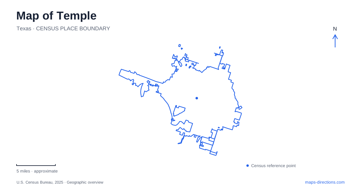
Street tiles load from OpenStreetMap when opened. The blue line shows the 2025 Census boundary.
- State
- Texas
- Population · July 2025
- 98,412
- Land area
- 74.2 sq mi
- Water area
- 4.8 sq mi
Temple grew around the railroad, and the clearest introduction to its geography still begins at the depot. Tracks, a passenger platform, museum exhibits, and the downtown street network occupy the same setting, making the railway a visible part of daily life. Farther out, neighborhood parks and the rocky country around Belton Dam introduce a very different landscape. A useful map connects these places without treating the station district, recreation fields, lake shore, and river below the dam as one continuous destination.
A working station inside a historic district
The depot at 315 West Avenue B was completed in 1911 for the Santa Fe railway. Its red brick and stucco exterior combines Prairie and Beaux-Arts influences, while cross-and-circle brickwork recalls the railroad's emblem. The building once served as headquarters for the Gulf, Colorado and Santa Fe Railway's Southern Division. That administrative role helps explain why the station is more substantial than a simple passenger shelter.
The city purchased the property in 1995, restoration followed, and the railroad museum opened in 2000. Today, the Texas Eagle uses the station, while the Temple Railroad and Heritage Museum interprets the wider story of the community and its rail connections. The building therefore has two overlapping identities: a transportation facility and a place to investigate the transportation system that shaped the surrounding streets.
West Avenue B provides the street address for this district. Downtown businesses lie within walking reach of the station, and Santa Fe Plaza adds public space to the rail setting. The nearby attraction called Whistle Stop Playground carries the theme into a children's play area overlooking the train yard. Here, passing equipment and railway infrastructure help explain the district as clearly as a historical display.
Three museums, three different subjects
Museum visits in Temple need not repeat the same story. The railroad collection concentrates on transport and local development. The Czech Heritage Museum and Genealogy Center at 119 West French Avenue examines a much longer cultural history, including the Czech lands and immigration to Texas. Family research forms another part of its work, giving it a purpose beyond a quick exhibition visit.
The Children's Museum at 11 North Fourth Street offers an interactive experience aimed at younger visitors. Its address also places it on a different street from the depot and the heritage center. Plotting all three reveals how the downtown area contains several destinations rather than one museum complex. A family can choose according to interests and ages, while a visitor researching ancestry may give the heritage center considerably more attention.
These institutions also supply useful orientation points: West Avenue B identifies the railway setting, West French Avenue the cultural-history stop, and North Fourth Street the children's destination. Keeping those street names alongside the museum names makes the small-scale downtown map easier to read.
Lions Park and an open recreation landscape
Lions Park gives Temple a recreation setting with a different character from the station district. Its origins date to a 1975 partnership between the city and the Founder Lions Club. The city rebuilt the playground in 2026 with a safari theme and accessible play features, continuing a long history of community recreation at the site.
The park also contains an eighteen-hole disc golf course. Official visitor information describes that course as lightly wooded with relatively little elevation change. Those details matter when comparing it with the rocky trails nearer the dam: an open park activity and a bluff-side nature outing involve different terrain, even though both appear as green areas on a regional map.
Below the dam is a different landscape
West of Temple, Miller Springs Nature Center occupies the country below Belton Dam. The Army Corps of Engineers identifies roughly 260 acres and about ten miles of hiking and mountain-bike trails. FM 2271 provides the important road reference, while the Leon River and limestone bluffs explain the landscape itself.
This is the eastern edge of the Edwards Plateau, where rocky grassland, Ashe juniper, and changing habitats create an ecological transition. A particularly striking feature is the gorge associated with the 1992 spillway flood. Sustained water flow cut through ancient limestone, leaving a landscape whose shape records the force of the overflow.
Belton Lake lies above the dam; the nature center lies below it. That distinction gives a regional map its final organizing principle. Downtown begins with rails and urban blocks, Lions Park opens into recreational grounds, and the dam divides a reservoir landscape from a river-and-bluff landscape. Reading those changes produces a much clearer picture than following a single destination label across the whole area.
Map and statistics: U.S. Census Bureau, 2025 Gazetteer, January 2025 generalized place boundaries and Vintage 2025 population estimates. Local references: Amtrak; City of Temple; US Army Corps of Engineers; Texas Parks and Wildlife; Belton Convention and Visitors Bureau. Article prepared by Maps & Directions.