Map of Temecula
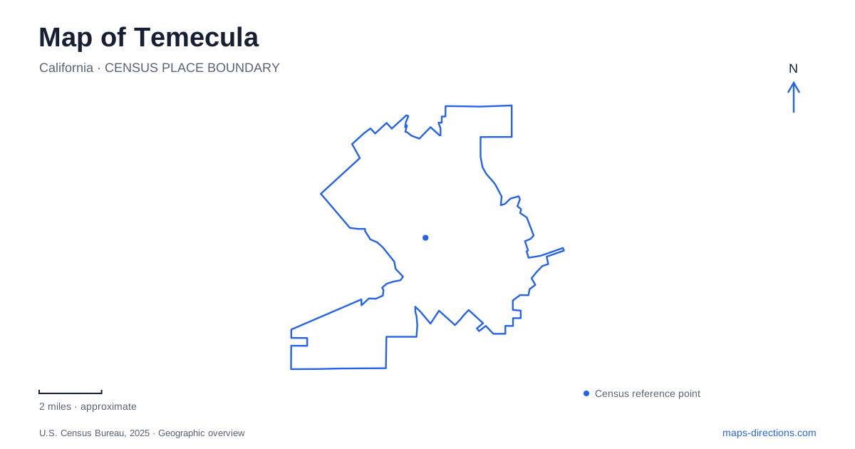
Street tiles load from OpenStreetMap when opened. The blue line shows the 2025 Census boundary.
- State
- California
- Population · July 2025
- 114,865
- Land area
- 37.2 sq mi
- Water area
- 0.0 sq mi
Temecula's map contains several historical centers rather than one place that has always served the same purpose. The city's own history describes an early Indigenous village near the creek confluence, another settlement farther upstream, and the railway-era town that became today's Old Town. Beyond that district, modern neighborhoods and the eastern wine-growing landscape spread across a much wider area. Understanding those changes makes the map more useful than simply choosing the most prominent tourism label and assuming it describes the whole valley.
Old Town grew around a new railway connection
The railway reached the area in 1882. Businesses moved closer to the depot to serve travelers, producing the district then called New Town. That settlement is now Old Town, a reversal in naming that makes sense once the transportation history is understood. The earlier settlement upstream near the present Redhawk bridge belonged to a different geographical phase.
The railway's connection through the canyon toward the coast was vulnerable to flooding. Tracks laid near the riverbed suffered washouts, illustrating how terrain and seasonal water shaped the usefulness of a transportation route. This history adds substance to a walk through the commercial district: the buildings and streets developed around a connection whose operation depended on conditions well beyond the town itself.
For Temecula visitors, Old Town offers a concentrated setting of historic buildings, shops, restaurants, and public institutions. It is suited to a visit on foot because several different interests can be pursued within the district. Its historical significance, however, comes from its railway-era development and the older communities that preceded it, rather than from an unbroken claim to being the valley's only center.
The museum and monument park form a historical starting point
The valley museum stands at 28314 Mercedes Street, within the setting of Sam Hicks Monument Park. The park is also identified by its 41970 Moreno Road address. These two street references describe neighboring parts of the same cultural setting, with the museum offering indoor interpretation and the park supplying outdoor public space.
The museum organizes walking tours that begin at the museum and end at Main Street, interpreting historic buildings along the way. Even when planning an independent outing, that sequence suggests a useful relationship between the collection and the town outside. Start with historical context, then examine the buildings and streets as evidence of the community's development. The museum's research and archival programs also show that local history extends beyond the visible commercial façades.
A Temecula history itinerary can therefore be compact without being shallow. The museum, park, and Main Street create a focused route through one chapter of the valley's past. The city's account of earlier Indigenous settlement adds an essential reminder that the railway town was a later development in a landscape already inhabited and named.
Rancho California, Calle Contento, and De Portola
Most wineries in the regional visitor map cluster east of I-15 around Rancho California Road and De Portola Road, with another group along Calle Contento. These roads provide a more useful organizing structure than a single wine-country destination. Rancho California is the main introductory corridor for many arrivals, while Calle Contento branches into another collection of properties.
De Portola lies south of Rancho California and passes through an equestrian landscape near the foothills. That setting matters when planning a drive: vineyards, horse properties, and rural roads form a different environment from Old Town's commercial blocks. The regional tourism organization specifically asks drivers to watch for riders and slow when horses are present.
For a Temecula valley outing, grouping stops along one road or a connected pair of roads keeps the geographical story clear. The wine trails are collections of establishments distributed through a rural landscape, not walking circuits enclosed within a single property. Looking at their relationship to I-15, the foothills, and one another helps visitors choose a manageable area to explore without assigning the same character to every winery location.
A large sports park serves another side of daily life
Ronald Reagan Sports Park is at 30875 Rancho Vista Road. Formerly called Rancho California Sports Park, the 128-acre site includes the Community Recreation Center, ball fields, football and soccer facilities, playground space, and picnic areas. Its scale and purpose make it a significant destination in its own right, particularly for families attending organized activities.
The park's name commemorates a presidential reference to the community's fundraising and volunteer effort in creating local sports facilities. This history presents a different form of place-making from the railway depot or the vineyard roads. Temecula can be explored through all three: a commercial center reshaped by transportation, a rural district organized around agriculture and hospitality, and a public recreation landscape built through community effort. Each occupies a distinct setting that deserves its own place in the itinerary.
Map and statistics: U.S. Census Bureau, 2025 Gazetteer, January 2025 generalized place boundaries and Vintage 2025 population estimates. Local references: City of Temecula; Visit Temecula Valley. Article prepared by Maps & Directions.