Map of Taunton
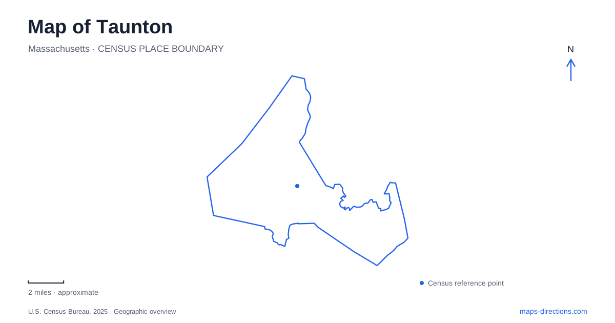
Street tiles load from OpenStreetMap when opened. The blue line shows the 2025 Census boundary.
- State
- Massachusetts
- Population · July 2025
- 62,522
- Land area
- 46.7 sq mi
- Water area
- 1.7 sq mi
Taunton is not organized around a single riverfront or one compact village. Its civic center, historic mill neighborhoods and large recreation areas occupy different settings. The Green helps identify the downtown core, while the Mill River and Three Mile River explain other neighborhood relationships. Farther from the center, state-park addresses lead to pond and woodland landscapes. A map becomes more useful when these names are read as clues to the city's development, rather than treated as interchangeable labels for the same destination.
The Green identifies the civic core
The municipal master plan describes downtown around the Green, courthouse and blocks of multi-story commercial and mixed-use buildings. This is a different pattern from a large park or a rural village center. A central destination should be matched to its building and street, with the Green serving as the area reference rather than the endpoint of every route.
For a visit to central Taunton, keep the actual appointment address visible as you zoom toward the civic area. The city's downtown parking study maps several types of parking alongside streets and development sites. That is a reason to distinguish a destination from the place where a car journey ends. A building's nearest visible lot is not automatically public parking, and a planning-study symbol should not substitute for current signs on arrival.
Historic neighborhood names follow water and industry
The city's account of its neighborhoods associates Whittenton with the Mill River and identifies the Weir as another major area outside downtown. It also relates Oakland and Westville to industrial development along the Three Mile River. Those relationships help explain why familiar local names may not correspond to a simple north, south, east or west quadrant.
When an address or invitation uses one of these neighborhood names, use it to orient the search but retain the street address. A watercourse can connect several places without offering a continuous public path between them. The older industrial geography is especially useful for understanding why a neighborhood center exists where it does; it is less useful as a substitute for a specific crossing, entrance or present-day business location.
The Weir waterfront is a named public destination
The open-space plan describes Weir Village Riverfront Park West on the former F. B. Rogers Silver Factory site. The city records its transformation into a public park with a boat launch, waterfront walkway, benches and rain gardens. This is a concrete place to locate on a map, rather than an assumption that every former industrial waterfront has become publicly accessible.
A Taunton river outing should distinguish that named park from the broader Weir neighborhood. If the plan is to launch a small craft, confirm the actual launch arrangement and current conditions with the operator. If the purpose is a walk, locate the public walkway rather than a nearby industrial parcel. The site's change in use is part of its interest, but the public facility boundary still determines where the visit takes place.
Watson Pond and Massasoit require separate approaches
The state Department of Conservation and Recreation lists Watson Pond State Park at 1644 Bay Street. Its published description emphasizes beachfront picnic space, a playground, a pavilion and seasonal operation. Massasoit State Park has a different address, 1361 Middleboro Avenue, and a larger woodland setting with trails, ponds, cranberry bogs and camping.
The two parks should remain separate entries in any Taunton itinerary. A search for a pond or a state park alone could lead to the wrong approach. Bay Street is the useful street reference for Watson Pond, while Middleboro Avenue identifies the published Massasoit arrival. Neither broad park label provides the internal route to every activity, so use the relevant park map after the correct road destination has been selected.
The large park extends beyond a city label
Massasoit's resource-management plan places the park in Lakeville, Middleboro and this city. It names Lake Rico, Big Bearhole Pond, Little Bearhole Pond and Middle Pond among its features. That wider geography explains why a municipal boundary view cannot show the full recreational landscape or settle which pond a visitor intends to reach.
A useful map of Taunton keeps the Green, river neighborhoods, Weir public waterfront and two state parks at distinct scales. Begin with the part of the city that matches the outing, then select the building, park entrance or named water feature. This approach respects the city's several centers and prevents a regional recreation area, an industrial-era neighborhood and a downtown address from being reduced to the same generic destination.
Map and statistics: U.S. Census Bureau, 2025 Gazetteer, January 2025 generalized place boundaries and Vintage 2025 population estimates. Local references: City of Taunton; Massachusetts Department of Conservation and Recreation. Article prepared by Maps & Directions.