Map of Tampa
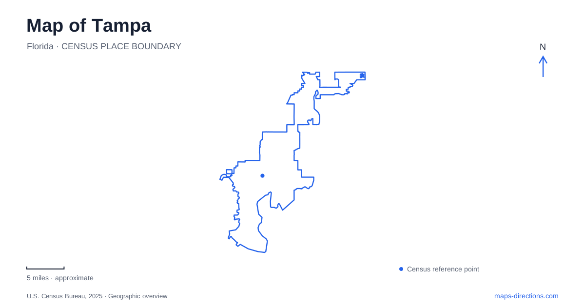
Street tiles load from OpenStreetMap when opened. The blue line shows the 2025 Census boundary.
- State
- Florida
- Population · July 2025
- 413,554
- Land area
- 114.5 sq mi
- Water area
- 63.6 sq mi
Tampa has a central waterfront that bends around downtown rather than following one straight coast. The Hillsborough River, Garrison Channel, and the streets leading toward Ybor City create distinct but connected settings. River paths explain one set of connections, while the streetcar explains another. Reading both on the same map helps distinguish a waterside walk from a trip through the historic commercial districts.
Follow the river's bend through downtown
The Riverwalk extends about 2.6 miles along the Hillsborough River toward Garrison Channel. Its route links parks, cultural destinations, and waterfront public spaces. Water Works Park, Curtis Hixon Waterfront Park, and the southern channel-side attractions occupy different portions of this corridor.
At Water Works Park, North Highland Avenue provides a street reference near the restored Ulele spring. Farther along, Curtis Hixon's open grounds sit beside cultural buildings and the river. These places are connected by the walk, but their relationship is easier to understand by following the water than by assuming they all lie on the same street.
Near the Channel District, the Florida Aquarium is at 701 Channelside Drive, with the American Victory ship at 705 Channelside Drive. Their neighboring addresses reveal a close grouping of maritime destinations. The shift from the river corridor to channel-side streets is a useful turning point when reading a downtown Tampa map.
The opposite bank has its own public landscape
Julian B. Lane Riverfront Park lies on the west bank, across from the Straz Center and north of the university campus. Its grounds combine sports facilities, play areas, event space, and river access. The Bob Buckhorn River Center and its ground-floor boathouse reinforce the park's connection with rowing and other water activity.
The park also contains public art that recalls Roberts City, the neighborhood associated with this part of the riverfront. The Ripple Effect mural beneath the Fortune Taylor Bridge connects the park's northern and southern portions. That artwork makes the bridge more than a crossing on a road map: it is also a landmark within the park landscape.
Farther along the campus waterfront, Plant Park originated as a botanical setting for Henry Plant's hotel, now Plant Hall. Its grounds and walkway add another layer to the river's urban history. The two banks therefore contain different institutions and stories, even where they face one another across a short stretch of water.
Streetcar stops connect the channel with Ybor
The TECO Line is a 2.7-mile heritage streetcar route linking downtown, the Channel District, and Ybor City. It serves eleven stations and is fare-free. Its line is useful on a map because it connects areas that are related economically and historically but do not share one compact pedestrian center.
Channelside Drive carries several station references. The aquarium station is at Cumberland Avenue, while other stops serve York Street and McKay Street. In Ybor, the line reaches named stations along Seventh and Eighth avenues, including Centro Ybor at 16th Street and Eighth Avenue.
The streetcar does not represent a citywide rail network. For a Tampa itinerary, it is most useful as a clearly defined connection among these central districts. Matching a destination to the appropriate station also shows whether a final walk leads along the channel, through commercial blocks, or toward a museum.
Ybor's numbered blocks preserve industrial history
Ybor City Museum State Park occupies the former Ferlita Bakery at 1818 East Ninth Avenue, near 19th Street. Its setting is an urban block with a museum, garden, and restored cigar workers' houses, rather than a large landscape park outside the city.
The district grew around cigar manufacturing beginning in the 1880s. The museum interprets the lives of Cuban, Spanish, Italian, and other immigrant communities who shaped that economy. The surviving bakery and small houses help connect the larger industrial story to ordinary workplaces and homes.
This local scale distinguishes Ybor from Tampa's taller downtown waterfront. Seventh Avenue, streetcar stops on nearby blocks, and the Ninth Avenue museum form related but separate references. A detailed neighborhood map reveals those relationships without treating the entire historic district as one attraction.
Bayshore provides another kind of waterfront route
Bayshore Boulevard has its own linear park trail and an on-road bicycle lane along the northbound side between Rome Avenue and Gandy Boulevard. Bronze markers embedded in the sidewalk identify measured distances along the route.
That setting differs from the Riverwalk's sequence of downtown parks and channel-side destinations. A complete map of Tampa keeps both visible while identifying their different street relationships. The river bend, west-bank grounds, streetcar corridor, historic Ybor blocks, and Bayshore route together explain how the central city is organized around water without being limited to a single waterfront.
Map and statistics: U.S. Census Bureau, 2025 Gazetteer, January 2025 generalized place boundaries and Vintage 2025 population estimates. Local references: Visit Tampa Bay; City of Tampa; University of Tampa; HART TECO Line; Florida State Parks. Article prepared by Maps & Directions.