Map of Tamarac
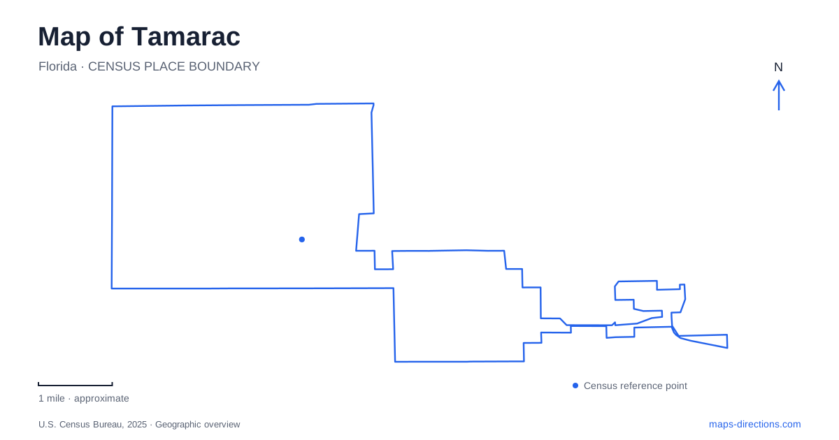
Street tiles load from OpenStreetMap when opened. The blue line shows the 2025 Census boundary.
- State
- Florida
- Population · July 2025
- 74,134
- Land area
- 11.6 sq mi
- Water area
- 0.5 sq mi
Tamarac, Florida, has an irregular municipal outline that reflects how it developed. Founder Kenneth E. Behring began with a neighborhood of small single-family homes organized around shared social and maintenance services. As more land became available, additional neighborhoods followed. The result is a city better understood through several local centers than through one old downtown square. Parks, community buildings, and major roads provide the clearest reference points for seeing how its different sections fit together.
Neighborhood development and the city's shape
The city incorporated in 1963, initially serving an active-retirement market. The first neighborhood, Tamarac Lakes, was on the eastern side. Mainlands and Woodlands followed as the developer acquired additional land, a sequence the municipal history explicitly connects to the unusual boundary shape. The original idea combined the privacy of a house with shared services and a clubhouse-based social life.
This background explains why neighborhood names are useful map labels. They identify phases of development rather than simply subdivisions within a uniform street plan. It also cautions against treating the founding retirement concept as a description of every resident today. The city has become more varied, and its recreation facilities support many ages and activities. The historical pattern remains visible, but the uses of that landscape have broadened.
Two different Caporella destinations
Caporella Park is at 5200 Prospect Road, north of Commercial Boulevard. Its renovated recreation setting includes a splash pad, shaded playground, and amphitheater. The city uses the park for outdoor performances and community events, giving the Prospect Road location a role beyond ordinary neighborhood play.
The Caporella Aquatic Center is a separate destination at 9300 Northwest 58th Street. Developed on land donated by the Caporella family, it opened in 2007 and includes a swimming pool and fitness facilities. The shared name can obscure the distinction in Tamarac: an event at the park on Prospect Road and a swimming session at the aquatic center lead to different parts of the city. The road name resolves the ambiguity more effectively than the family name alone.
Nearby Swim Central Annex Park is listed at 5800 Northwest 94th Avenue. This adds another named outdoor facility to the aquatic-center area, illustrating how several related recreation destinations can cluster without becoming one site. Numbered avenues and streets are especially useful here because they preserve the difference between neighboring addresses.
Mainlands Park's quieter landscape
Mainlands Park, at 4500 Monterey Drive, combines a multi-use trail with a nature kiosk, exercise stations, picnic tables, and a fishing pier that also functions as an observation platform. The emphasis differs from a pool complex or an amphitheater: movement around the grounds and time beside the water are central parts of the experience.
For interpreting the residential landscape of Tamarac, this park makes the Mainlands name tangible. Its paths and waterside facilities supply shared outdoor space within a named neighborhood setting. The fishing and observation platform also shows why a small water feature matters on a local map. It is a place people use, not merely a blue shape between houses, and the surrounding walking route helps explain that use.
A sequence of parks on Southgate Boulevard
Southgate Boulevard links several distinct public spaces. Tephford Park at 10003 Southgate lies west of Nob Hill Road and was formerly called Southgate Linear Park. Its name honors Broward sheriff's deputy Brian Tephford. Farther along the same boulevard, Gary B. Jones Park for People and Pups is at 8101, while Veterans' Memorial Park occupies 7825.
The memorial park includes public art such as the Eternal Flame and an Honor Wall. These names and addresses reveal a corridor serving recreation, dog exercise, and remembrance rather than one large continuous park. Keeping the separate sites visible is useful when arranging a meeting or selecting an outing: a common boulevard supplies orientation, but each location has its own purpose and identity.
Community facilities on the main roads
The Community Center at 8601 West Commercial Boulevard and the Recreation Center at 7501 North University Drive provide two additional civic anchors. Their distinct addresses show how services are distributed across the road network. A class or gathering described only as taking place at a community facility needs the building name as well as the city.
Together, these places give Tamarac a readable structure: neighborhood origins explain the irregular boundary, Prospect Road and Northwest 58th Street distinguish two Caporella facilities, Monterey Drive identifies a walking-and-water setting, and Southgate Boulevard organizes a sequence of parks. The map becomes a record of how a planned residential community developed shared places for recreation and civic life across its different neighborhoods.
Map and statistics: U.S. Census Bureau, 2025 Gazetteer, January 2025 generalized place boundaries and Vintage 2025 population estimates. Local references: City of Tamarac. Article prepared by Maps & Directions.