Map of Tallahassee
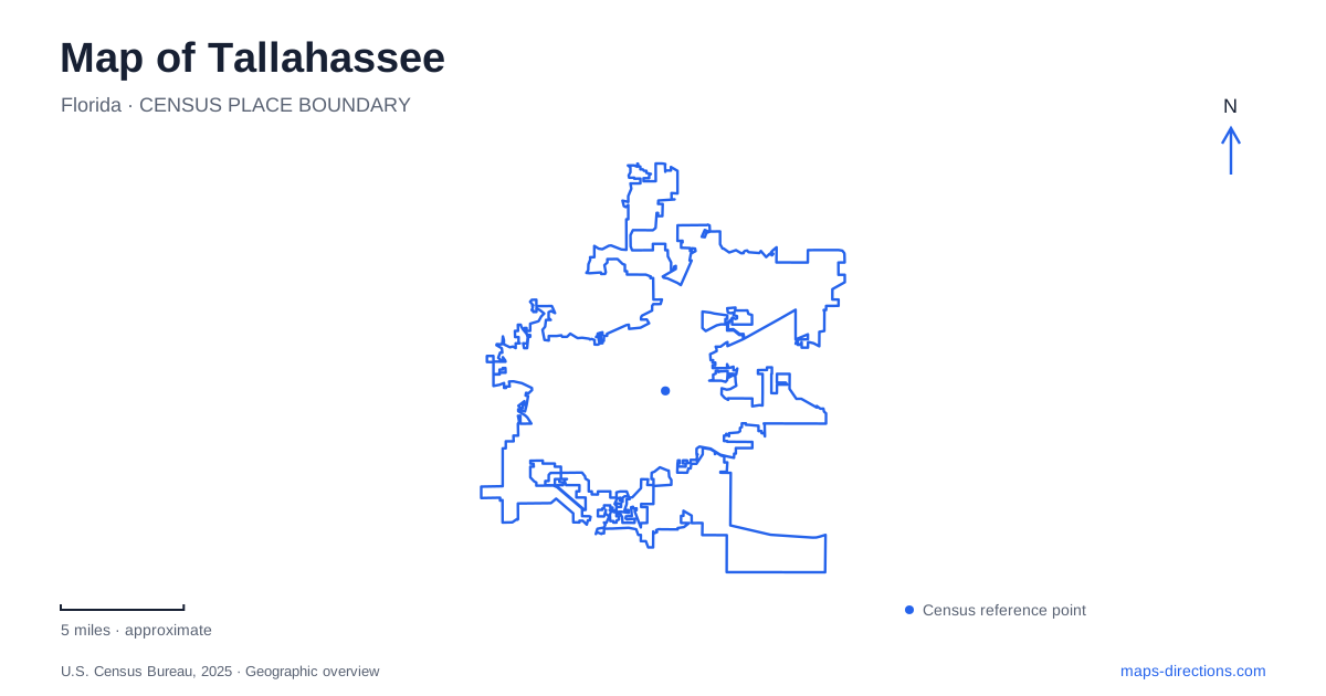
Street tiles load from OpenStreetMap when opened. The blue line shows the 2025 Census boundary.
- State
- Florida
- Population · July 2025
- 204,902
- Land area
- 102.6 sq mi
- Water area
- 2.9 sq mi
A map of Tallahassee connects several different landscapes of public memory. The Capitol complex records the growth of state government, Cascades Park combines recreation with drainage infrastructure, and Mission San Luis interprets a much earlier Apalachee and Spanish settlement. Northward, the formal gardens and wooded lakes at Maclay create another kind of destination. Roads such as Monroe Street, Tennessee Street and Thomasville Road help organize those places, but their histories explain why they occupy such different settings.
Two capitols, two periods of government
The Historic Capitol and the modern Capitol stand together, making the government center unusually easy to read across time. The older building served state government from the nineteenth century into the 1970s. The modern Capitol was declared complete in August 1977, while the historic building was subsequently restored to its 1902 appearance.
That restoration began in 1978 and finished in 1982. Choosing the 1902 form meant removing later additions, so the building seen today is a deliberate presentation of one period rather than an untouched structure that never changed. The proximity of the two capitols makes that decision visible: the historic building retains an earlier scale beside the later government complex.
For a Tallahassee visit, the distinction also clarifies the purpose of each stop. The Historic Capitol Museum interprets political history, while the modern complex remains associated with the operation of state government. Their neighboring locations do not make their visitor functions identical.
Cascades Park as infrastructure and remembrance
Cascades Park lies at 1001 South Gadsden Street, between South Monroe Street, East Lafayette Street and the railroad tracks. Its position just beyond the central government area makes it part of the downtown landscape, although its ponds and paths create a different atmosphere from the civic streets.
The park is also a stormwater management system. Underground channels, open streams and retention ponds help control flooding and treat urban runoff. Water features here therefore have a practical role in the city's drainage network, not simply an ornamental one. The trails follow a landscape whose form is partly determined by that function.
Smokey Hollow adds another layer. The commemoration remembers an African American neighborhood established after the Civil War and destroyed in the 1960s. Much of the former community occupied land now associated with the park. Understanding that history changes the meaning of the open space: it contains the memory of homes and neighborhood relationships that no longer appear in the street pattern.
A survey marker in Prime Meridian Plaza recalls the starting point of Florida's land-survey system, first established in 1824. Within Tallahassee, few places bring together drainage engineering, neighborhood displacement and the measurement of land so directly. These are distinct stories, but all help explain how the landscape was organized and reorganized.
Mission San Luis and the western hilltop
Mission San Luis occupied its present site from 1656 to 1704. It served as a center of Apalachee leadership and the western capital of Spanish Florida. The site interprets the interaction of those communities through reconstructed buildings, archaeology and demonstrations, rather than presenting the structures as surviving seventeenth-century originals.
The history includes cooperation, colonial pressure and eventual abandonment. The mission system collapsed in 1704, and surviving Apalachee people dispersed, with some moving toward French territory around Mobile. This is a deeper historical layer than the state-capital story that dominates many first impressions of Tallahassee.
The Mission Road address and Tennessee Street side identify different relationships between the property and surrounding roads. Consult the site's arrival guidance for the operating entrance, rather than assuming an older map establishes the correct approach. The 64-acre property has more than one street edge, so a saved destination should identify the visitor entry as well as the broad historic-site name.
Formal gardens and two different lakes
Alfred B. Maclay Gardens State Park is at 3540 Thomasville Road. Alfred and Louise Maclay began planting the ornamental gardens in 1923 as part of their winter home. The design includes brick paths, a walled garden, a reflection pool, camellias and azaleas. Louise and the family donated the gardens to the state in 1953.
The planting was intended to flower during winter and early spring, when the family was in residence. That seasonal logic remains important to understanding the garden's design. It is a cultivated historical landscape, not simply a sample of the surrounding woodland.
Lake Hall supports recreation, including a designated swimming area and canoe or kayak access. Lake Overstreet has a different role: visitors use the surrounding trails for scenery, while the lake itself is reserved for wildlife. A park map makes that distinction clear and separates the formal garden from the larger trail landscape. Together with the Capitol, Cascades and Mission San Luis, these northern lakes reveal the range of places contained within a Tallahassee map.
Map and statistics: U.S. Census Bureau, 2025 Gazetteer, January 2025 generalized place boundaries and Vintage 2025 population estimates. Local references: Florida Historic Capitol Museum; Florida Department of Management Services; City of Tallahassee; Mission San Luis; Florida State Parks. Article prepared by Maps & Directions.