Map of Tacoma
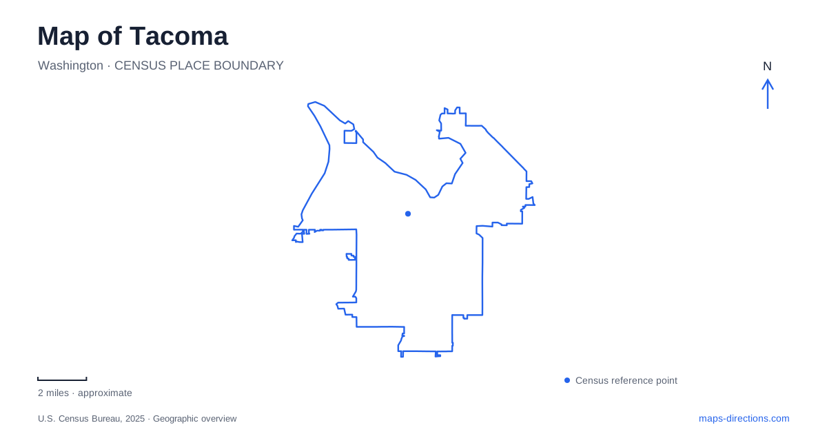
Street tiles load from OpenStreetMap when opened. The blue line shows the 2025 Census boundary.
- State
- Washington
- Population · July 2025
- 229,816
- Land area
- 49.8 sq mi
- Water area
- 12.7 sq mi
Tacoma rises beside Commencement Bay, with a waterfront that changes character from working port waterways to museum promenades, neighborhood parks and the wooded peninsula of Point Defiance. Hills separate some downtown streets from the shore, while bridges and transit routes connect places that appear close on a flat map. The useful starting point is the bay itself: its shape explains why the city's major waterfront destinations form a long sequence rather than gathering along one straight downtown beach.
The downtown waterway and glass bridge
The Thea Foss Waterway is part of the city's industrial shoreline history and its later environmental restoration. Municipal cleanup work addressed contamination in this waterway and the adjoining Wheeler-Osgood Waterway. That history matters when reading today's waterfront: public spaces and cultural destinations occupy a landscape that required substantial repair, rather than an untouched shore developed solely for recreation.
The Museum of Glass provides a conspicuous landmark along this urban edge. Its tilted metal-clad cone was inspired by the wood burners associated with regional sawmills, connecting the building's contemporary form with older industrial structures. This makes the architecture part of the waterfront story as well as a container for exhibitions.
The 500-foot Chihuly Bridge of Glass links the museum with downtown's cultural corridor. Opened with the museum in 2002, the pedestrian overpass makes a practical connection between different levels and parts of the district. Its role as both artwork and crossing is especially relevant on a map of Tacoma: following a street grid alone does not explain all the pedestrian connections between the higher downtown side and the museum plaza.
Ruston Way as a chain of parks
Ruston Way follows a different portion of Commencement Bay. The park district describes a two-mile scenic waterfront made up of several smaller parks, including Judge Jack Tanner, Dickman Mill, Hamilton, Jack Hyde and Chinese Reconciliation parks. These separate names identify pieces of a larger public shoreline rather than unrelated destinations scattered across the city.
Jack Hyde Park sits at the water's edge in Old Town near Starr Street. Its beach access, picnic area and sundial give a particular character to this eastern part of the waterfront route. Farther along, Les Davis Pier provides another recognizable water-access point. The sequence of parks offers different ways to encounter the bay: from a paved walk, a beach edge, a pier or a small landscaped space.
The shoreline also records uncomfortable history. Chinese Reconciliation Park commemorates the forced expulsion of the city's Chinese community in 1885. Its placement near the former settlement connects the memorial to a specific landscape. This is an important part of understanding Tacoma's waterfront, alongside the more familiar stories of shipping, industry and recreation.
Point Defiance's forest and shoreline
Point Defiance Park combines a forested peninsula with destinations such as Owen Beach, the zoo and aquarium, and Fort Nisqually. The park map is therefore more than a diagram of paths around one attraction. Roads, wooded trails and shoreline spaces serve different parts of a substantial landscape projecting into the surrounding water.
The name Five Mile Drive can be misleading for someone expecting an uninterrupted scenic motor route. Its inner and outer loops have different access arrangements, and erosion and slope instability have affected the outer section. Consult the park's guidance for the intended mode of travel. For a vehicle visit to the zoo, Owen Beach or Fort Nisqually, identify the signed destination approach rather than treating the drive's full mapped loop as a motor itinerary.
A separate 1.6-mile Loop Trail connects the Wilson Way Bridge, Pagoda, zoo, Environmental Learning Center and Owen Beach area away from the roadway. These connections reveal the park's internal geography: formal visitor destinations and forest recreation are linked, but each has its own setting. The beach offers a low shoreline perspective, while the wooded routes provide a different experience of the peninsula.
Reading the central districts through rail stops
The T Line supplies another useful framework for central Tacoma. Its route runs from the Dome area through Union Station, the Convention Center, Theater District and Old City Hall, then continues through the Stadium District toward Hilltop and St Joseph. The sequence shows how the central city extends beyond the waterfront museum area into established commercial, residential and medical districts.
This is a local urban rail route, and its stop pattern is most useful for understanding connections within the central districts. The waterfront parks and Point Defiance remain separate pieces of the larger city map. Keeping the rail corridor, downtown waterway and long bayfront sequence in view together produces a clearer picture of Tacoma: a city whose culture, industry and recreation are arranged around both elevation and the changing edge of Commencement Bay.
Map and statistics: U.S. Census Bureau, 2025 Gazetteer, January 2025 generalized place boundaries and Vintage 2025 population estimates. Local references: City of Tacoma; Museum of Glass; Parks Tacoma; Sound Transit. Article prepared by Maps & Directions.