Map of Syracuse
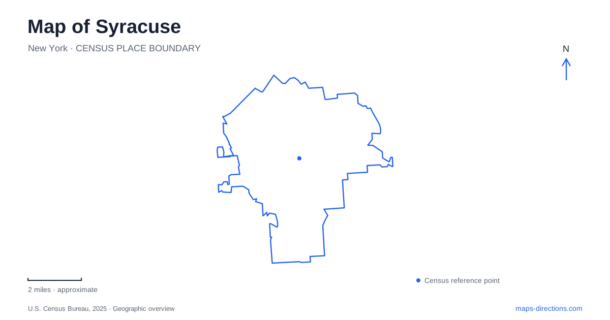
Street tiles load from OpenStreetMap when opened. The blue line shows the 2025 Census boundary.
- State
- New York
- Population · July 2025
- 144,896
- Land area
- 25.1 sq mi
- Water area
- 0.6 sq mi
Syracuse is a city where transportation history remains visible even when the original route has changed form. A canal-era weighlock survives downtown, a creek-side path links neighborhoods to the lake, and a major highway project is reshaping connections across the center. These are different layers of the same map. Looking at them together helps explain why an old building, a modern trail and a construction notice can all be essential to understanding a short journey. Begin with the downtown districts and Onondaga Creek, then distinguish the university hill and the larger lakefront landscape.
The canal left more than a street name
The Erie Canal Museum occupies the 1850 Weighlock Building at 318 Erie Boulevard East. Its original function was practical: loaded canal boats were weighed so officials could calculate cargo tolls. Water drained from the chamber, allowing a boat to settle onto a cradle connected to a scale. The surviving structure therefore records an economic operation as well as an architectural period.
The museum's walking tours follow the nineteenth-century canal route toward Clinton Square. That connection is a useful way to interpret downtown Syracuse because it joins a surviving building to a transportation corridor that no longer appears as it once did. A modern street map alone cannot supply the missing waterway, but the historical route explains why these places belong together. The museum building is a specific destination; the former canal alignment is a broader subject to trace through the surrounding blocks.
Armory Square's substantial landmark
The Museum of Science & Technology occupies the historic state armory at 500 South Franklin Street. The building anchors Armory Square and gives the district a recognizable physical reference. Its current scientific exhibits and its former military purpose are separate layers of use within the same structure.
Arrival details also reveal the shape of the block. The museum identifies the Trolley Lot behind the building and Center Armory Garage across from its east lawn on West Jefferson Street. This is a case where the street-facing address and the vehicle approach describe different sides of one destination. Someone following the Creekwalk encounters the district through another route again. Comparing those approaches makes the area more legible without assuming that every museum visit begins at the same curb. The large armory is the common landmark around which those movements can be organized.
Follow the creek toward the harbor and lake
The Onondaga Creekwalk extends from the Southside through Armory Square and onward toward Onondaga Lake. The city's description identifies a paved path that mostly follows the creek but sometimes leaves its immediate bank. It passes through Franklin Square and the Inner Harbor, giving those districts a shared walking and cycling connection.
Near the northern part of the route, the Creekwalk overlaps the Erie Canalway and Empire State Trail systems. The canalway route turns east at Water Street while the Creekwalk continues south toward Armory Square. That branching point is important: following a regional trail sign and following the creek are not always the same choice.
This corridor provides a longitudinal view of Syracuse, linking several urban settings instead of circling one park. Street crossings remain part of the route, and the city notes occasional flooding around the Wallace Street and Franklin Square segment. The map is therefore best read as a sequence of named sections with real crossing points, rather than an uninterrupted line immune to changing water conditions.
The university hill is a separate orientation point
Crouse College provides a historical reference on the Syracuse University campus. Dedicated in 1889, it was an early campus building associated with the fine arts. Its hilltop setting and the university's own building histories offer another way to understand the city: academic buildings are arranged within a campus landscape that has developed over generations.
For a campus visit, identify the actual building connected with the event, department or performance. A university name covers a much larger setting than a single entrance. The history of Crouse also illustrates why a familiar landmark can serve as an orientation point without being the location of every activity advertised under the institution's name.
Highway maps are changing
The I-81 Viaduct Project addresses the relationship between the elevated highway and the surrounding street network. Its plans include removing a viaduct segment, reconstructing parts of I-690 and introducing the Community Grid. Those proposals explain the scale of the transportation changes under discussion: the project concerns how districts connect, not simply the replacement of a single bridge or interchange.
For someone using a map of Syracuse, this creates a clear distinction between historical infrastructure, construction plans and the road arrangement available for a journey. A project rendering shows an eventual design; it does not establish that every depicted connection is already available. Use current transportation notices for the actual journey, particularly around the central highway corridor, while using this overview to understand the districts and waterways that remain the broader geographical framework.
Map and statistics: U.S. Census Bureau, 2025 Gazetteer, January 2025 generalized place boundaries and Vintage 2025 population estimates. Local references: Erie Canal Museum; Museum of Science & Technology; City of Syracuse; Syracuse University; New York State Department of Transportation. Article prepared by Maps & Directions.