Map of Sumter
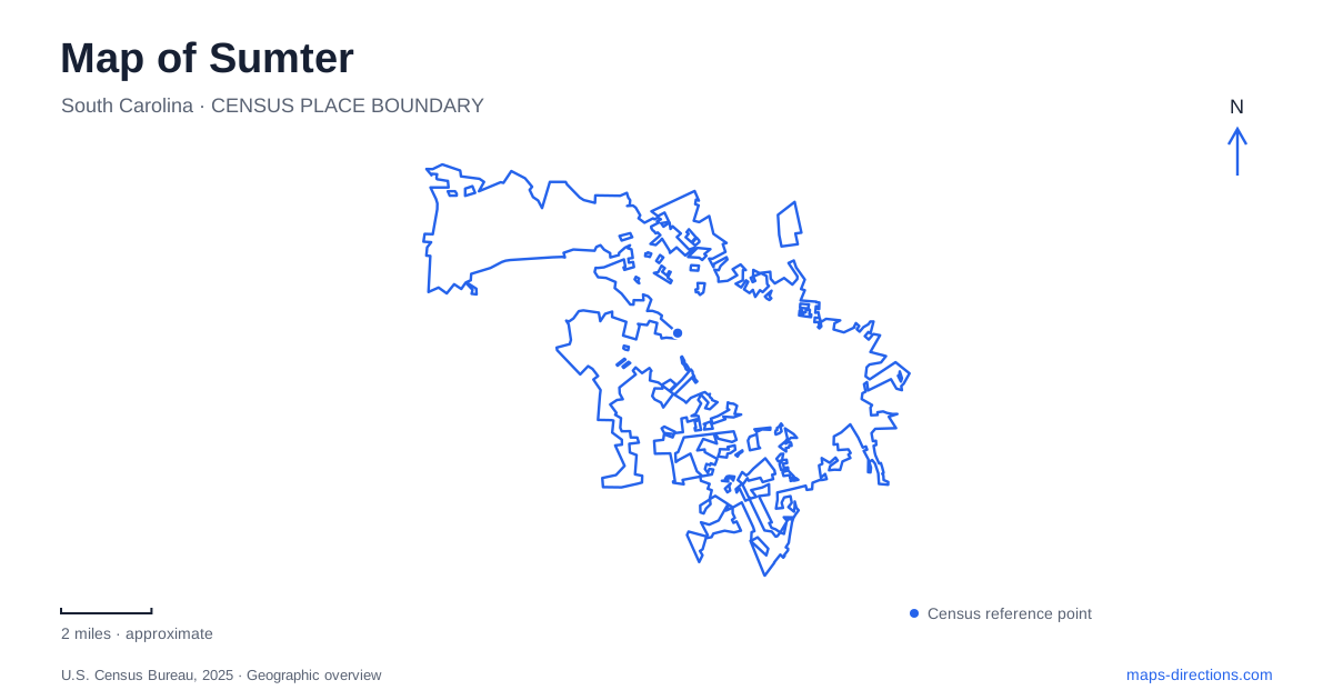
Street tiles load from OpenStreetMap when opened. The blue line shows the 2025 Census boundary.
- State
- South Carolina
- Population · July 2025
- 43,094
- Land area
- 33.2 sq mi
- Water area
- 0.2 sq mi
Sumter has two especially useful systems for reading its map: the streets of the historic commercial center and the green corridor connecting Swan Lake Iris Gardens with Dillon Park. The gardens themselves are divided by West Liberty Street, while the museum occupies more than one downtown location. Understanding those relationships gives familiar attractions a precise setting and reveals how civic buildings, designed landscapes, and a creek corridor fit together.
Swan Lake is a pair of connected gardens
Swan Lake Iris Gardens began as Hamilton Carr Bland's private fishing retreat in 1927. The city's history places his early garden on the north side of West Liberty Street. Additional land from the Heath family expanded the public landscape on the opposite side of the road.
The two areas retain the Bland and Heath names and are joined by the McDuffie Overpass, donated in 1994. This makes the road crossing central to understanding the site. A single garden marker does not show the relationship between two landscapes assembled through separate gifts.
For a map of Sumter, the overpass is a useful reference because it explains continuity across a major street. Visitors can understand the gardens as one public destination while still recognizing that their paths, entrances, and features occupy different sides of the roadway.
The Bland Garden includes a cypress boardwalk extending into the swamp. Other parts of the gardens provide themed plantings, sculptures, and sensory experiences. The boardwalk and cultivated beds offer different ways to encounter the site: one emphasizes a wetland setting, while others reflect deliberate horticultural design.
The greenway follows a branch through the city
The Prisma Health Shot Pouch Greenway links Swan Lake in the south with Dillon Park in the north. The city describes it as a paved, 3.1-mile multipurpose route following Shot Pouch Branch. Its role extends beyond exercise, connecting neighborhoods and public destinations along a natural drainage corridor.
The southern trailhead is at Bland Avenue near West Liberty Street. Broad Street provides an intermediate access point, and the northern trailhead is reached through Dillon Park on Clara Louise Kellogg Drive. These locations give the route a clear structure: two park anchors and a middle connection to the urban street network.
In Sumter, this is an important distinction between a garden walk and a regional-style path. Bicycles and dogs are permitted on the greenway, but the city's information states that they are not allowed on the other garden trails. Sharing an access area does not mean the routes share identical uses.
The branch also provides ecological continuity. Preserved vegetation and water habitat run through an otherwise developed setting, making the greenway both a movement route and a strip of living landscape within the city.
Main Street's clock tower marks a civic building
At 21 North Main Street, the Town Hall–Opera House combines cultural and municipal history. The present building rose after a fire destroyed its predecessor in 1892. It was adapted as a movie theater in 1936, then later restored for renewed civic and performing-arts use.
The clock tower makes it a strong downtown landmark, but its identity is more complex than a theater sign suggests. City offices and council chambers have shared the building with performance space. That combination places administration and public entertainment within one prominent structure on the commercial street.
A downtown walk through Sumter can therefore begin with the building as an orientation point and then follow the surrounding historic blocks. Its repeated changes of use illustrate how a town center can retain a major landmark while adapting the activities inside it.
Museum addresses represent different histories
The Williams Brice House at 122 North Washington Street is the museum's main entrance. Built in 1916, the Edwardian house provides a setting for decorative arts, period rooms, and local-history interpretation. The museum's Carolina Backcountry Homestead represents a different period, using structures and demonstrations to interpret family farm life around 1800.
Those two experiences should not be mistaken for one preserved household from a single date. They bring different periods together within a museum campus, allowing visitors to compare an early-twentieth-century residence with an interpretation of much earlier rural life.
Temple Sinai Jewish History Center occupies a separate site at 11 Church Street. Its exhibits address Jewish community history and the Holocaust, while the synagogue contributes its own architectural setting. The museum's multiple addresses thus reflect distinct collections and places rather than several names for the same entrance.
Together, these locations give Sumter a layered map of public life. The paired gardens show how land gifts created a shared landscape; the greenway connects recreation through a stream corridor; and the opera house and museum sites preserve different forms of civic and cultural history within the street grid.
Map and statistics: U.S. Census Bureau, 2025 Gazetteer, January 2025 generalized place boundaries and Vintage 2025 population estimates. Local references: City of Sumter; Sumter Museum. Article prepared by Maps & Directions.