Map of Summerville
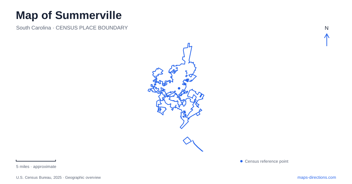
Street tiles load from OpenStreetMap when opened. The blue line shows the 2025 Census boundary.
- State
- South Carolina
- Population · July 2025
- 53,177
- Land area
- 22.6 sq mi
- Water area
- 0.1 sq mi
Summerville has several distinct centers of interest rather than one continuous historic attraction. Hutchinson Square anchors the downtown streets, Azalea Park introduces the landscaped residential district, and the Ashley River supports both modern recreation and the remains of an older colonial town. A useful map keeps these places separate while showing how each contributes to the area's history. Downtown's railway heritage and the river's earlier trading landscape tell different stories at different scales.
Hutchinson Square and the railway
The corner of Main Street and Doty Avenue provides a clear downtown reference at Hutchinson Square. Its pavilion and entrance sign draw inspiration from an earlier railway depot and a historic archway over Main Street. These are contemporary features recalling earlier buildings, an important distinction when reading photographs or walking-tour descriptions of the square.
The old Southern Railroad depot stood at the square's northern end. Designed by Frank Milburn and in service by 1902, it welcomed travelers during the period when the town's inns attracted visitors. Passenger service ended in the 1960s, and the depot was demolished. The railway alignment remains part of the townscape, but the former depot should be understood as a historic location rather than an operating passenger station.
This relationship between the square and the tracks helps explain the position of downtown Summerville. Shops and public gathering space developed beside a major arrival point. Looking toward the railway from the square therefore adds context to the present streetscape: the civic space recalls a transport function that once shaped how visitors first encountered the town.
Azalea Park on both sides of Main Street
Azalea Park lies just beyond the central business district, with Main Street running through it. Paths, ponds, and sculptures occupy both sides of the road. That arrangement is worth noticing before starting a walk, because exploring one portion does not reveal the whole park. The grounds also include recreation facilities such as tennis courts and a children's discovery garden and playground.
The park developed from land donated by a civic organization in the 1920s. During the Depression, Mayor Grange Cuthbert promoted an azalea landscape with the help of local nurseryman George Segelken. Later bronze sculptures added another layer to the planting and ponds. This combination makes the park useful for more than a seasonal flower visit: the paths connect designed landscape, public art, and community recreation within the same setting.
For a map-based visit, use Main Street as the dividing reference and select which part of the grounds to explore first. Azalea Park is a planted town park, while the river parks farther away offer different terrain and activities. Treating both simply as green space would miss the reason to choose one over the other.
The residential streets beyond the park
The historic homes walking tour begins around West 5th South Street and continues through the surrounding residential district. Its stops include cottages and larger houses on Rutherford Street and Sumter Avenue, with buildings dating from different parts of the nineteenth century. The route is useful because it follows actual residential streets rather than presenting the district as a single museum property.
Several examples give the area a more specific shape. Middleton-Minott Cottage is on West 6th South Street, while the Gelzer Brothers House and Brailsford-Browning House are on Sumter Avenue. Their locations show how the historic district extends beyond the downtown storefronts. Walking these streets provides an architectural perspective on Summerville, with the public route passing homes whose grounds and interiors should not be assumed to be open for tours.
An older town beside the Ashley River
Colonial Dorchester State Historic Site preserves a settlement founded in 1697 along the Ashley River. It is a separate archaeological destination, not another block of the present downtown. The remaining bell tower of St. George's Anglican Church, a tabby fort, and traces of a shipping wharf reveal a river-oriented trading community. Tabby is a concrete-like material incorporating oyster shells, making the fort's fabric particularly distinctive.
The wharf remains are visible at low tide, so the landscape itself affects what a visitor can observe. Much of the former town survives below ground or through interpretation rather than as standing buildings. Including this site in a Summerville itinerary adds a period of history earlier than the railway depot and residential walking tour, with the river explaining why the settlement occupied this location.
Recreation at Ashley River Park
Ashley River Park is a different destination at 200 Renken Road, off Bacons Bridge Road. Operated by Dorchester County, it opened in 2022 with riverside trails, a fishing pond, playgrounds, picnic facilities, and kayak access. Its role is contemporary outdoor recreation, whereas Colonial Dorchester emphasizes archaeology and historic remains.
A map of Summerville becomes more useful when this distinction stays visible. Choose the square and residential streets for the town's built history, Azalea Park for gardens and sculpture, and the river destinations according to whether the day centers on recreation or archaeology. Together these places explain how railway travel, residential development, and the Ashley River shaped different parts of the surrounding landscape.
Map and statistics: U.S. Census Bureau, 2025 Gazetteer, January 2025 generalized place boundaries and Vintage 2025 population estimates. Local references: Town of Summerville; Visit Summerville; South Carolina State Parks; Dorchester County. Article prepared by Maps & Directions.