Map of Sugar Land
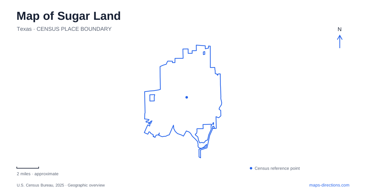
Street tiles load from OpenStreetMap when opened. The blue line shows the 2025 Census boundary.
- State
- Texas
- Population · July 2025
- 107,726
- Land area
- 40.5 sq mi
- Water area
- 2.4 sq mi
Sugar Land's map contains two different ideas of a town center. The Imperial refinery landscape and nearby employee housing explain the community's industrial origins, while Town Square gathers civic and commercial activity around a newer plaza. Highway 6 connects another set of destinations, including large natural areas and a creekside park. The Brazos River adds a separate recreational corridor. Reading these places together reveals a city shaped by industry, planned development, and water management, with each era leaving a different pattern of streets and public spaces.
The refinery and the company-town neighborhood
The company's influence extended well beyond the refinery buildings. After Isaac Kempner and William Eldridge acquired the refinery, town, and surrounding land in 1908, they developed housing, streets, schools, medical facilities, and businesses for the workforce. The municipal history also records levees and canals used for flood control and cooling industrial equipment. These systems help explain why water and industrial land remain closely linked in the older urban landscape.
The Hill neighborhood gives that history a more intimate scale. Its employee houses were associated with the refinery, and the company began selling them to their occupants in 1958. The city's account identifies Lakeview Drive, First through Sixth streets, and Main Street among the locations involved. Because lots were divided according to the houses already built, their widths vary. That is a specific historical reason for irregular residential parcels, rather than simply an oddity in a modern property map.
For Sugar Land, these streets preserve the relationship between work and home within the former company town. The industrial landmark and the residential blocks belong to the same story, even though their present uses differ. Looking at them together is more revealing than locating the refinery alone and overlooking the neighborhood that supported it.
Imperial's changing status and a newer civic center
The city acquired the Imperial Historic District and surrounding property in June 2025, including nearly 40 acres and the prominent Char House. Municipal information describes a process of planning and guiding redevelopment. This is an important distinction for a current map: the historic district is a real place with surviving structures, but a future vision should not be mistaken for a fully completed visitor district with every proposed use already operating.
Town Square represents a different center within Sugar Land. Its location near US 59 and Highway 6 places it in a major modern transportation corridor, and its central plaza is surrounded by restaurants, shops, a hotel, and City Hall. The municipal address is 2700 Town Center Boulevard North. That street reference separates present civic business from the older Imperial landscape.
The contrast between the two centers is useful rather than confusing. One grew from an industrial employer's facilities and housing; the other concentrates contemporary public and commercial activity around a planned plaza. Both contribute to the city's identity, but they answer different questions about its history and daily geography.
Highway 6 and two kinds of water landscape
Cullinan Park at 12414 Highway 6 offers a large nature setting centered partly on White Lake. The city describes 754 acres with walking trails, a boardwalk, an observation tower, and an overlook. These features provide several ways to read the wetland and woodland environment without treating the whole property as a maintained lawn or sports complex. The trails are reserved for pedestrians, so a cycling route should not be extended through them simply because they appear as connected lines on a map.
Oyster Creek Park uses 4033 Highway 6 South and has a different character. Its rock-lined pond, water feature, and bridge over the creek create a designed park setting along a named watercourse. Municipal trail information pairs it with Lost Creek Park, giving the creek corridor a broader recreational context. For Sugar Land, these two Highway 6 addresses illustrate the difference between a large nature preserve and a landscaped creekside destination.
The Brazos River corridor
Brazos River Park is identified by the address 18427 Southwest Freeway. Its paved trail system extends approximately 3.6 miles, while the city's park maps also distinguish mountain-bike trails from the paved routes. That separation matters because the same park name covers different surfaces and recreation types. The freeway address establishes the road approach, but the park's own trail map explains movement within the river landscape.
The Brazos, Oyster Creek, and White Lake are therefore separate geographic anchors rather than interchangeable waterfront labels. Combined with The Hill, Imperial, and Town Square, they show how Sugar Land's present map connects company-town history with modern civic life and several distinct forms of public open space.
Map and statistics: U.S. Census Bureau, 2025 Gazetteer, January 2025 generalized place boundaries and Vintage 2025 population estimates. Local references: City of Sugar Land; Sugar Land Town Square. Article prepared by Maps & Directions.