Map of Stockton
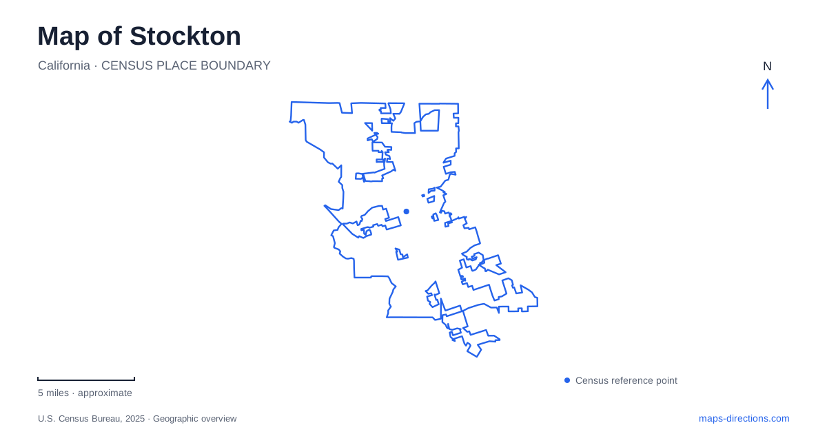
Street tiles load from OpenStreetMap when opened. The blue line shows the 2025 Census boundary.
- State
- California
- Population · July 2025
- 324,597
- Land area
- 63.3 sq mi
- Water area
- 3.1 sq mi
Stockton is an inland city with a maritime working landscape. Waterways connect its downtown and port with the California Delta and ultimately the Pacific Ocean, while another river crosses the university campus farther north. This combination gives the city a distinctive map: channels, industrial islands, a waterfront promenade, historic commercial streets, and a collegiate landscape all appear within the same urban area. The water is therefore an organizing feature of the city's economy and development, not simply a scenic edge.
Why an inland waterfront became a commercial center
During the Gold Rush, the settlement supplied the southern mines. Water transportation made the waterfront a logical location for early businesses, allowing goods to move between boats and the inland routes serving mining communities. The downtown business alliance records that repeated floods and fires encouraged businesses to move toward Main Street by 1851.
That movement helps explain the relationship between the channel and the historic commercial streets. The waterfront was the original economic focus, but the enduring downtown developed through adjustments to environmental hazards as well as changing transportation needs. Buildings and street names preserve the later urban pattern more clearly than the earliest temporary settlement.
The original Chinatown occupied Channel Street between El Dorado and Hunter streets. That specific location adds a community history to what might otherwise appear to be an ordinary downtown block. A map of Stockton becomes more informative when these historical uses accompany the present-day street grid: the same area has served trade, residence, entertainment, and civic life across different periods.
The channel's public waterfront
The downtown marina and waterfront promenade make part of the channel accessible as a recreational setting. The area supports boating, public art, and events, with sports and entertainment venues adding activity around the water. The Bob Hope, formerly Fox, Theatre provides another downtown cultural landmark, extending an outing beyond the shoreline itself.
A promenade walk reveals a particular part of the Delta connection: an urban channel bordered by buildings and public destinations. It does not resemble an open coastal beach or a broad riverfront meadow. That distinction is useful because the city's maritime identity can otherwise suggest a landscape quite different from the one encountered downtown. The visible waterway belongs to a larger navigation network, but its central-city edge has its own compact, built character.
Rough and Ready Island's changing uses
Rough and Ready Island forms the port's West Complex. The port describes its boundaries through the ship channel and Burns Cutoff, placing it within the low-lying Delta landscape. Before its industrial uses, the area passed through wetland and agricultural phases. Dredging, pumping, and the creation of farmland transformed a seasonally inundated environment into a more fixed landscape.
The island later became a naval facility before joining the commercial port. Today warehouses, rail infrastructure, conveyors, and docks express its freight-handling role. Those features explain the large parcels and specialized circulation visible on a detailed map. The port's ocean connection extends more than seventy nautical miles inland, a distance that makes Stockton's seagoing trade especially distinctive.
The public downtown waterfront and the working port therefore share a water system while serving different purposes. Understanding that relationship is more useful than assuming all land along a blue channel line is recreational space. The island's geography reflects the requirements of moving cargo among ships, railways, and road transport.
Art and regional history in Victory Park
The Haggin Museum stands in Victory Park at 1201 North Pershing Avenue. Its collections combine fine art with regional history, making the building a useful cultural counterpart to the working waterfront. The museum expanded over time, including the McKee Room in 1939, another major addition in 1949, and the Benjamin Holt Wing in 1976.
Those additions produced a three-story building with more than 34,000 square feet of exhibition space. The park setting gives the museum a different urban context from the downtown theater and commercial blocks. On a Stockton map, Pershing Avenue and Victory Park provide a clear reference for a destination whose focus is the interpretation of art and local history rather than waterfront activity.
A river through the university landscape
The University of the Pacific campus includes the Calaveras River as a physical feature within its grounds. Calaveras Hall stands north of the river, while bridges connect campus areas on either side. The university's Collegiate Gothic buildings, gardens, and established residential halls contribute an architectural landscape quite unlike the port's warehouse districts.
Southwest Hall dates to 1924, connecting the campus with an earlier period of local development. Pacific Avenue also gives access to the Miracle Mile's restaurants and independent shops, adding a commercial corridor to this northern urban setting. The combination of campus buildings, river crossings, and nearby businesses broadens the picture of Stockton beyond the central channel. Its waterways support different relationships across the city: freight movement at the port, public gathering downtown, and the daily geography of education along the Calaveras.
Map and statistics: U.S. Census Bureau, 2025 Gazetteer, January 2025 generalized place boundaries and Vintage 2025 population estimates. Local references: Downtown Stockton Alliance; Visit Stockton; Port of Stockton; Haggin Museum; University of the Pacific. Article prepared by Maps & Directions.